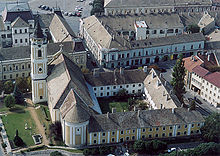
Baja
| Baja | ||||
|
||||
| Basic data | ||||
|---|---|---|---|---|
| State : | Hungary | |||
| Region : | Southern Great Plain | |||
| County : | Bács-Kiskun | |||
| Small area until December 31, 2012 : | Baja | |||
| District since 1.1.2013 : | Baja | |||
| Coordinates : | 46 ° 11 ' N , 18 ° 57' E | |||
| Height : | 95 m | |||
| Area : | 177.61 km² | |||
| Residents : | 37,508 (Jan. 1, 2011) | |||
| Population density : | 211 inhabitants per km² | |||
| Telephone code : | (+36) 79 | |||
| Postal code : | 6500 | |||
| KSH kódja: | 03522 | |||
| Structure and administration (status: 2018) | ||||
| Community type : | city | |||
| Mayor : | Róbert Fercsák (Fidesz-KDNP) | |||
| Postal address : | Szentháromság tér 1 6500 Baja |
|||
| Website : | ||||
| (Source: A Magyar Köztársaság helységnévkönyve 2011. január 1st at Központi statisztikai hivatal ) | ||||
Baja [ ˈbɒjɒ ] (German Franconian town ) is a town with 37,000 inhabitants in southern Hungary on the Danube and its tributary Sugovica. The tourism and fishing play a major role in Baja.
location
Baja is located in County Bács-Kiskun , 156 kilometers south of Budapest and north to the borders of Hungary - Croatia - Serbia . Baja is the administrative seat of the district of the same name . The city lies on the northern edge of the Batschka .
history
Baja was mentioned in a document as early as 1318. In 1712 the first German colonists settled here, the Danube Swabians . In 1946, 2304 inhabitants were Germans, i.e. around 15 percent of the total population.
Attractions
The Baja synagogue , built in the 1840s, is now used as the city library.
The parish church of St. Peter and Paul was built in 1722 and received a baroque high altar in 1765 .
Events
Every year on the second weekend in July there is a folk festival where fish soup is cooked over an open fire in more than 2000 kettles for well over 20,000 people.
sons and daughters of the town
- Karl Isidor Beck (1817–1879), poet
- István Türr (1825–1908), insurgent and politician
- Joseph Perles (1835-1894), rabbi
- Johann von Nostitz-Rieneck (1847–1915), Lieutenant Field Marshal
- Alexander Nehr (1855–1928), fitter and blacksmith
- Juliane Déry (1864–1899), writer
- József Balassa (1864–1945), philologist
- Eduard “Ede” Telcs (1872–1948), sculptor and medalist
- Emmerich Schwemlein (* 1950), politician (SPÖ)
- Viktoria Eschbach-Szabo (* 1956), Japanologist and linguist
- Péter Disztl (* 1960), soccer goalkeeper
- Ferenc Berkes (chess player) (* 1985), chess player
- Renata Koch (* 1985), triathlete
- Ágnes Czingulszki (* 1987), journalist and author
- Gábor Faldum (* 1988), triathlete
- Marcell Pongó (born 1997), basketball player
Town twinning
-
 Argentan in France
-
 Biograd na Moru in Croatia , since 2016
 -
 Hódmezővásárhely in Hungary
 -
 Labin in Croatia
 -
 Sângeorgiu de Pădure in Romania
-
 Sombor in Serbia
-
 Târgu Mureș in Romania
 -
 Thisted in Denmark
-
 Waiblingen in Germany


