Hola Prystan
| Hola Prystan | ||
| Гола Пристань | ||

|
|
|
| Basic data | ||
|---|---|---|
| Oblast : | Kherson Oblast | |
| Rajon : | District-free city | |
| Height : | 3 m | |
| Area : | 9.26 km² | |
| Residents : | 14,658 (2016) | |
| Population density : | 1,583 inhabitants per km² | |
| Postcodes : | 75600 | |
| Area code : | +380 5539 | |
| Geographic location : | 46 ° 31 ′ N , 32 ° 31 ′ E | |
| KOATUU : | 6522310100 | |
| Administrative structure : | 1 city, 1 village | |
| Address: | вул. 1 Травня 14 75600 м. Гола Пристань |
|
| Statistical information | ||
|
|
||
Hola Prystan ( Ukrainian Гола Пристань ; Russian Голая Пристань Golaja Pristan ) is a city in the southern Ukrainian Oblast of Kherson on the Konka , an estuary of the Dnieper with 14,600 inhabitants (2016).
Hola Prystan is the administrative center of the eponymous district of Hola Prystan and is located 43 km southwest of the Oblast capital Kherson . The municipality also includes the village of Bilohrudowe (Ukrainian Білогрудове ) north of the city and the Konka River .
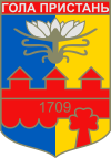
The city was founded by Cossacks in 1709, the old name was Holyj Perewis (Ukrainian Голий Перевіз ). Important as an agricultural center, it was named an urban-type settlement in 1946 and elevated to a town in 1958.
On May 17, 2013, the city and the village of Bilohrudowe were placed under oblast administration and have not been part of the surrounding Rajon since then.
Individual evidence
- ↑ Population figures on pop-stat.mashke.org
- ↑ Верховна Рада України; Постанова від May 17, 2013 № 273-VII Про віднесення міста Гола Пристань Голопристанського району Хелонсьста Хелонсьста Хелонсьста Хелонсьста Хелонсьста Хелонсьста Херсонсьста Херсонсьста Хелонсьста Хелонсьста лерсонсьста Херсонсьста Херсонсьста

