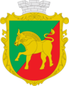
Nyschni Sirohosy
| Nyschni Sirohosy | ||
| Нижні Сірогози | ||

|
|
|
| Basic data | ||
|---|---|---|
| Oblast : | Kherson Oblast | |
| Rajon : | Nyschni Sirohosy district | |
| Height : | 56 m | |
| Area : | 180.91 km² | |
| Residents : | 4,882 (2016) | |
| Population density : | 27 inhabitants per km² | |
| Postcodes : | 74700 | |
| Area code : | +380 5540 | |
| Geographic location : | 46 ° 51 ' N , 34 ° 23' E | |
| KOATUU : | 6523855100 | |
| Administrative structure : | 1 urban-type settlement | |
| Address: | вул. Височина 2 74701 смт. Нижні Сірогози |
|
| Website : | http://www.n-svlada.ks.ua/ | |
| Statistical information | ||
|
|
||
Nyschni Sirohosy ( Ukrainian Нижні Сірогози ; Russian Нижние Серогозы Nizhniy Serogosy ) is an urban-type settlement in the east of the Ukrainian Oblast of Kherson with 4,880 inhabitants (2016).
Founded in 1812, the settlement has been the administrative center of the raion of the same name since 1923 and received urban-type settlement status in 1960.
geography
Nyschni Sirohosy is located on the banks of the 65 km long Velyki Sirohosy ( Великі Сірогози ), 169 km east of the Oblast capital Kherson and 80 km west of Melitopol in the Zaporizhia Oblast . The nearest train station is in the village of Sirohosy ( Сірогози in Ukrainian ), 15 km away .
Population development
| 1886 | 1959 | 1970 | 1979 | 1989 | 2001 | 2016 |
|---|---|---|---|---|---|---|
| 4,285 | 5,494 | 6,088 | 6,607 | 6,747 | 6,021 | 4,882 |
Source:
Rajon
Nyschni Sirohosy is the administrative seat of the raion of the same name, founded on March 7, 1923. Nyschni Sirohosy Raion is located in the east of Kherson Oblast and borders on Zaporizhia Oblast in the east . It has 16,550 inhabitants and an area of 1,208.67 km². The population density is 14 inhabitants per km².
Web links
- Rajon page on the Oblast website (Ukrainian)
Individual evidence
- ↑ a b Demography of Ukrainian cities on pop-stat.mashke.org


