
Vysokopillia
| Vysokopillia | |||
| Високопілля | |||

|
|
||
| Basic data | |||
|---|---|---|---|
| Oblast : | Kherson Oblast | ||
| Rajon : | Vysokopillia district | ||
| Height : | no information | ||
| Area : | 57.26 km² | ||
| Residents : | 4,223 (2017) | ||
| Population density : | 74 inhabitants per km² | ||
| Postcodes : | 74000 | ||
| Area code : | +380 5535 | ||
| Geographic location : | 47 ° 30 ' N , 33 ° 32' E | ||
| KOATUU : | 6521855100 | ||
| Administrative structure : | 1 urban-type settlement , 3 villages | ||
| Address: | вул. Червоноармійська 112 74000 смт. Високопілля |
||
| Website : | http://kronau.in.ua/ | ||
| Statistical information | |||
|
|||


Wyssokopillja ( Ukrainian Високопілля ; Russian Высокополье Wyssokopolje ) is an urban-type with 4200 population (2017) in the north of the Ukrainian oblast Kherson and administrative center of Rayon Wyssokopillja . The place was called Kronau until 1915 .
geography
The place is located 30 km southwest of Apostolowe , 70 km south of Krywyj Rih and 165 km northeast of the oblast capital Kherson .
The settlement council community next Wyssokopillja even the villages are Knjasiwka (Ukrainian Князівка / former German name Fürstenfeld ) with about 390 inhabitants, Potomkyne (Ukrainian Потьомкине / former German name Landau ) with about 490 inhabitants and Topolyne (Ukrainian Тополине / former German name Nikolaital ) with about 180 inhabitants.
history
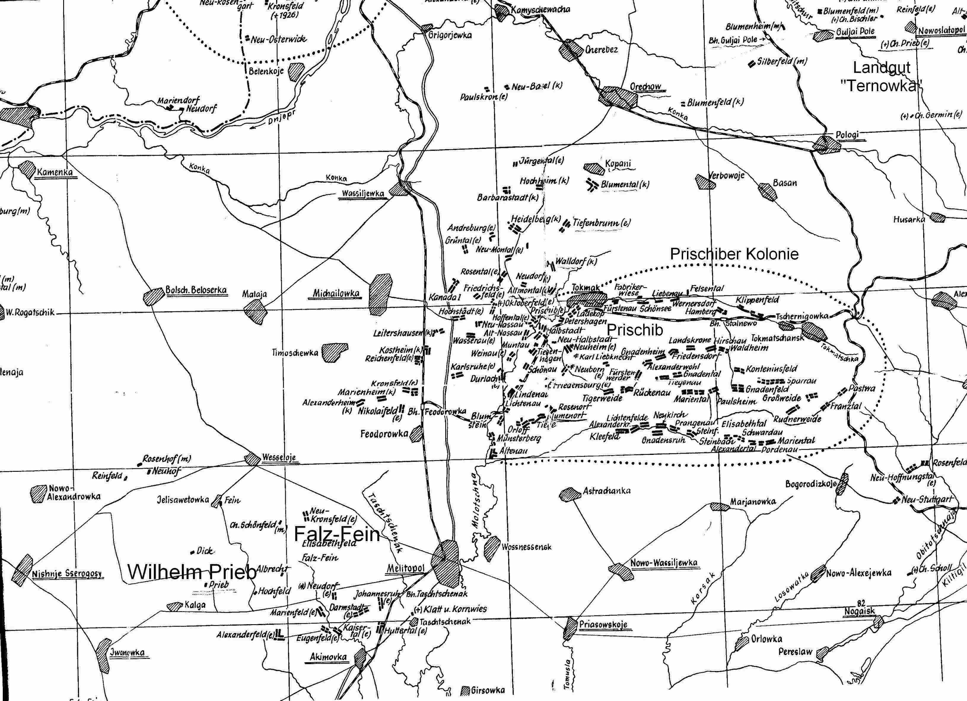
The settlement was founded between 1869 and 1870 by predominantly Evangelical Lutheran Germans from the area of the Taurian governorate and the Prischiber mother colonies and was given the name Kronau .
In 1915 the village was given its current name and in 1957 was given the status of an urban-type settlement.
Population development
| 1904 | 1926 | 1959 | 1970 | 1979 | 1989 | 2001 | 2017 |
|---|---|---|---|---|---|---|---|
| 421 | 998 | 5,350 | 4,292 | 4,642 | 4,986 | 4,717 | 4.223 |
Source:
Web links
- Rajon website on the Oblast website ( memento of April 17, 2014 in the Internet Archive ) (Ukrainian)
- History of Kronau at the Forum for Volga Germans (Russian)
Individual evidence
- ↑ a b Demography of Ukrainian cities on pop-stat.mashke.org
- ↑ http://www.grhs.org/vr/Nikolajew/kronau_nikolajew.htm
- ↑ http://www.stammbaum-familie-prieb.de/PrischiberKolonie.jpg
Beryslaw | Kherson | Henichesk | Hola Prystan | Kachowka | Nowa Kachowka | Oleschky | Skadovsk | Tavriisk
Antonivka urban-type settlements |
Archanhelske |
Askanija-Nowa |
Bila Krynytsya |
Biloserka |
Bryliwka |
Dnipryany |
Hornostayivka |
Ivanivka |
Kalanchak |
Kalynivske |
Karjerne |
Cossack |
Komyshany |
Glaze |
Lyubymivka |
Myrn |
Naddniprjanske |
Nowa Majatschka |
Nowoworonzowka |
Novooleksiyivka |
Novotrojitske |
Nyschni Sirohosy |
Rykowe |
Zelenivka |
Sywaske |
Tschaplynka |
Welyka Lepetycha |
Welyka Oleksandriwka |
Verkhniy Rohachyk |
Vysokopillia