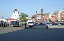
Liski
| city
Liski
Лиски
|
||||||||||||||||||||||||||||||||||||||||||
|
||||||||||||||||||||||||||||||||||||||||||
|
||||||||||||||||||||||||||||||||||||||||||
| List of cities in Russia | ||||||||||||||||||||||||||||||||||||||||||
Liski ( Russian Лиски ) is a Russian city with 55,864 inhabitants (as of October 14, 2010) and the administrative center of the raion of the same name in Voronezh Oblast .
geography
The city is located on the left bank of the Don , around 560 km southeast of Moscow and 98 km south of the regional capital Voronezh . The nearest cities are Ostrogoschsk (34 km west), Bobrov (37 km east) and Novovoronesch (42 km northwest).
Chalk deposits come to the surface around ten kilometers west of Liski. The high solubility of the chalk gives rise to typical forms of erosion. In this region lies the Divnogorje nature reserve .
The climate in Liski is continental temperate with an annual rainfall of about 430 to 560 mm.
history
Liski was established around 1571 as a guard against possible attacks by Crimean Tatars on Tsarist Russia . Initially, the place was known as Novaya Pokrovka ( Новая Покровка ). The later name Liski is based on the river Liska .
The village only gained significant economic importance in the 19th century with the construction of a u. a. The southeastern railway line leading to Voronezh and Rostov-on-Don in the 1870s. Liski thus became a station settlement, which was expanded in 1928 to include an adjacent settlement. At the same time, the new Liski district was founded and Liski was declared its administrative seat. In 1937 the place received city rights.
There was fighting near Liski during both the Russian Civil War and World War II . During the Second World War in July 1942, a troop of the Wehrmacht was stationed on the opposite bank of the Don near Liski. In the post-war period, Liski got its own industry and was expanded as an important center of agriculture.
From 1928 to 1943 Liski Swoboda ( Свобода , literally "freedom") and between 1965 and 1991 Gheorghiu-Dej ( Russian Георгиу-Деж ; after the Romanian politician Gheorghe Gheorghiu-Dej ).
Population development
| year | Residents |
|---|---|
| 1939 | 25,490 |
| 1959 | 37,638 |
| 1970 | 48,682 |
| 1979 | 52,375 |
| 1989 | 54,039 |
| 2002 | 55,893 |
| 2010 | 55,864 |
Note: census data
Economy and Infrastructure
Today Liski is a railway junction (with three lines of the Southeast Railway and a park railway built in 1989 in the city) and an administrative center. Due to the location in the fertile black earth region, food production is the most important branch of the economy.
In addition to the railway connections, Liski has a connection to the M4 trunk road , which passes the city a few kilometers to the east. There is also an inland port on the Don.
sons and daughters of the town
- Ivan Anikeev (1933–1992), Soviet aspirant cosmonaut
See also
Individual evidence
- ↑ a b Itogi Vserossijskoj perepisi naselenija 2010 goda. Tom 1. Čislennostʹ i razmeščenie naselenija (Results of the All-Russian Census 2010. Volume 1. Number and distribution of the population). Tables 5 , pp. 12-209; 11 , pp. 312–979 (download from the website of the Federal Service for State Statistics of the Russian Federation)
Web links
- City Council website (Russian)
- Unofficial Liski website (Russian)
- Liski on mojgorod.ru (Russian)


