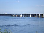
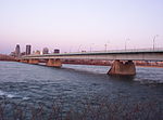
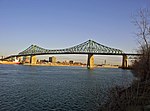
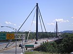
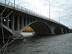
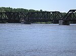
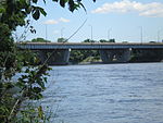
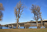
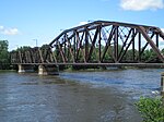
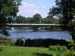
List of bridges and tunnels to the Île de Montréal
The Canadian metropolis of Montreal is located on the Île de Montréal , the largest island in the Hochelaga archipelago . This is surrounded by the St. Lawrence River , the Rivière des Prairies , the Lac des Deux Montagnes , the Lac Saint-Louis and the Ottawa River . Although the city was founded in 1642, the first permanent connection only existed from 1847 when a wooden bridge was built over the Rivière des Prairies to the neighboring island of Île Jésus . The first connection to the mainland followed in 1854 with a railway bridge at Sainte-Anne-de-Bellevue over the Ottawa River. From 1860, the Pont Victoria was the first connection to the south bank of the St. Lawrence River.
This list of bridges and other crossings to the Île de Montréal is ordered counter-clockwise. It begins at Lac Saint-Louis, follows the Saint Lawrence River downstream, then the Rivière des Prairies upstream to Lac des Deux Montagnes and back over the Ottawa River to Lac Saint-Louis. The years of construction of existing buildings are displayed, as well as the years of construction of the original structures, if the existing structure replaced an older one.
| Color key |
|---|
|
|
Via the Sankt-Lawrence-Strom and the Sankt-Lorenz-Seeweg
Across the Rivière des Prairies
Across the Lac des Deux Montagnes and the Ottawa River
| Building | photo | First structure built |
Today's building built |
Connected places |
use | Origin of name | Coordinates |
|---|---|---|---|---|---|---|---|
| Pont de l'Île-aux-Tourtes |

|
- | 1966 | Senneville | Autoroute 40 | Île aux Tourtes (literally: wild pigeon island ) | 45 ° 25 ′ 13 ″ N , 73 ° 59 ′ 2 ″ W. |
| Île Girwood, Île aux Tourtes | |||||||
| Vaudreuil-Dorion | |||||||
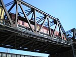
| Canadian-Pacific Railroad Bridge |
|
- | 1893 | Sainte-Anne-de-Bellevue | Canadian Pacific Railway , Agence métropolitaine de transport | no official names | 45 ° 24 ′ 12 " N , 73 ° 57 ′ 25" W. |
| Île Bellevue | |||||||
| Île Perrot | |||||||
| Canadian National Railroad Bridge |

|
- | 1854 | Sainte-Anne-de-Bellevue | Canadian National Railway , VIA Rail | 45 ° 24 ′ 12 ″ N , 73 ° 57 ′ 24 ″ W. | |
| Île Bellevue | |||||||
| Île Perrot | |||||||
| Pont Galipeault |

|
1925 | 1991, 2009 | Sainte-Anne-de-Bellevue | Autoroute 20 , Route Verte 5 | Antonin Galipeault (1879–1971), Quebec politician | 45 ° 24 '12 " N , 73 ° 57' 21" W. |
| Île Bellevue | |||||||
| Île Perrot |
Individual evidence
- ^ Canadian Pacific Railway Bridge, Montreal QC. (No longer available online.) Aboriginal Ironworkers, archived from the original on May 10, 2013 ; accessed on September 9, 2011 . Info: The archive link was inserted automatically and has not yet been checked. Please check the original and archive link according to the instructions and then remove this notice.
- ↑ Le pont Honoré-Mercier. Les Ponts Jacques-Cartier et Champlain Incorporée, December 24, 2010, archived from the original on January 8, 2010 ; Retrieved September 9, 2011 (French).
- ↑ Estacade du pont Champlain. Les Ponts Jacques-Cartier et Champlain Incorporée, December 24, 2010, archived from the original on June 14, 2011 ; Retrieved September 9, 2011 (French).
- ↑ Le pont Champlain et l'autoroute Bonaventure. Les Ponts Jacques-Cartier et Champlain Incorporée, December 24, 2010, archived from the original on June 14, 2011 ; Retrieved September 9, 2011 (French).
- ↑ Le pont Victoria. In: Vieux-Montréal. City of Montreal and Province of Quebec, accessed September 9, 2011 (French).
- ^ Pont de la Concorde. Commission de toponymie Québec, accessed September 9, 2011 (French).
- ↑ a b Chronology de l'entreprise. (No longer available online.) Société de transport de Montréal, archived from the original on September 10, 2011 ; Retrieved September 9, 2011 (French). Info: The archive link was inserted automatically and has not yet been checked. Please check the original and archive link according to the instructions and then remove this notice.
- ↑ Le pont Jacques-Cartier. Les Ponts Jacques-Cartier et Champlain Incorporée, December 24, 2010, archived from the original on June 14, 2011 ; Retrieved September 9, 2011 (French).
- ^ Pont-tunnel Louis-Hippolyte-La Fontaine (40 years). (No longer available online.) Ministère de transport du Québec, archived from the original on July 16, 2011 ; Retrieved September 9, 2011 (French). Info: The archive link was inserted automatically and has not yet been checked. Please check the original and archive link according to the instructions and then remove this notice.
- ↑ a b Comité des fêtes du soixante-quinzième anniversaire de Charlemagne (ed.): Charlemagne et son histoire . Charlemagne 1986, ISBN 2-9800711-1-0 , pp. 134-135 .
- ^ Pont Charles-de-Gaulle. In: Structurae
- ↑ Le pont de l'autoroute 25 est officiellement ouvert. Radio Canada, May 21, 2011, accessed September 9, 2011 (French).
- ↑ Le pont Pie IX. In: Archives de Montréal. City of Montreal, accessed September 9, 2011 (French).
- ↑ La centrale de la Rivière-des-Prairies. Hydro-Québec, accessed September 9, 2011 (French).
- ^ Pont Papineau-Leblanc. Commission de toponymie Québec, accessed September 9, 2011 (French).
- ^ Pont Viau. Commission de toponymie Québec, accessed September 9, 2011 (French).
- ^ Richard Dion, André Bernier, Serge Philibert, Georges Leahy, Sylvie Lalonde: Analyze historique et architecturale sur le patrimoine lavallois . Pluram, 1981, p. 47-51 .
- ^ A b Jean-Claude Fortin, Jacques Saint-Pierre, Normand Perron: Histoire de Laval . Institut national de la recherche scientifique, Québec 2008, ISBN 978-2-7637-8859-3 , p. 210 .
- ^ Pont Lachapelle. Commission de toponymie Québec, accessed September 9, 2011 (French).
- ↑ Fortin et al .: Histoire de Laval. P. 210.
- ↑ Serge Laurin: Histoire des Laurentides . Institut national de la recherche scientifique, Québec 1989, ISBN 978-2-89224-128-0 , p. 303 .
- ↑ Micheline Boulanger: Histoire de l'Île Bizard . Éditions Histoire Québec, Montreal 2008, ISBN 978-2-89586-038-9 , pp. 138 .
- ^ Michel Bélisle: De l'Isle aux Tourtes à Vaudreuil-Dorion . Ed .: Collectif pour l'histoire de Vaudreuil-Dorion. Vaudreuil-Dorion 2007, ISBN 978-2-9810200-0-0 , p. 263 .
- ↑ Île aux Tourtes. Commission de toponymie Québec, accessed September 9, 2011 (French).
- ↑ a b c Paroisse Sainte-Anne-de-Bellevue (ed.): Sainte-Anne-de-Bellevue 1703–2003 . Sainte-Anne-de-Bellevue 2003, ISBN 2-9808057-0-X , p. 125, 130 .
- ↑ Galipeault span to get $ 98-million facelift. (No longer available online.) Canada.com, archived from the original on September 15, 2010 ; accessed on September 9, 2011 . Info: The archive link was inserted automatically and has not yet been checked. Please check the original and archive link according to the instructions and then remove this notice.


