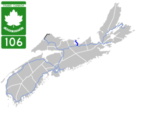
Nova Scotia Highway 106
| Trans-Canada Highway in Canada | |||||||||||||||||||||||||||||||
| Trans-Canada Highway Route Transcanadienne |
|||||||||||||||||||||||||||||||

|
|||||||||||||||||||||||||||||||
| map | |||||||||||||||||||||||||||||||
| Basic data | |||||||||||||||||||||||||||||||
| Operator: | Nova Scotia Department of Transportation and Infrastructure Renewal |
||||||||||||||||||||||||||||||
| Start of the street: |
Westville ( 45 ° 35 ′ N , 62 ° 42 ′ W ) |
||||||||||||||||||||||||||||||
| End of street: |
Caribou ( 45 ° 44 ′ N , 62 ° 41 ′ W ) |
||||||||||||||||||||||||||||||
| Overall length: | 19 km | ||||||||||||||||||||||||||||||
|
County : |
|||||||||||||||||||||||||||||||
| At the Caribou ferry terminal | |||||||||||||||||||||||||||||||
|
Course of the road
|
|||||||||||||||||||||||||||||||
The Highway 106 in the Canadian province of Nova Scotia with a length of 19 km connects Highway 104 with the ferry to Prince Edward Iceland . The route is part of the Trans-Canada Highway system .
Route description
North of Westville , Highway 106 branches off from Highway 104 north and passes New Glasgow west . The road runs over the Middle River of Pictou west of Pictou and reaches the Caribou Ferry Terminal at Caribou . There is a regular ferry connection to Prince Edward Island, to Wood Islands .
Web links
Individual evidence
- ↑ Traffic Volume Book 2001-2010. (PDF; 2.3 MB) Nova Scotia - Transportation and Infrastructure Renewal, accessed on July 17, 2012 (English).

