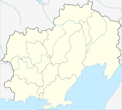
Orotucan
| Urban-type settlement
Orotukan
Оротукан
|
||||||||||||||||||||||||||||||
|
||||||||||||||||||||||||||||||
|
||||||||||||||||||||||||||||||
Orotukan ( Russian Оротука́н ) is an urban-type settlement in the Magadan Oblast ( Russia ) with 1531 inhabitants (as of October 14, 2010).
geography
The settlement is located in the northern part of the Kolyma Mountains about 300 kilometers as the crow flies north of the oblast capital Magadan on the right bank of the Kolyma tributary of the same name , 50 kilometers above the mouth.
The place belongs to the Jagodnoye Rajon and is located a good 100 kilometers southeast of its administrative center Jagodnoye .
history
The history of the place begins in early 1931 when geologists explored the valley of the Kolyma tributary for gold deposits and set up camp on the river. A little later, the preparatory work for the construction of the "Kolyma route" through the area began.
The place was built in its current location in the mid-1930s; it got its name after the river, whose name arose from the Yakut “ortokon” for a “small burned meadow or forest area”. From 1935 the center of the southern section of the Gulag regional administration Dalstroi was in the place .
In the 1940s a factory for repairing and later manufacturing mining equipment was established. In 1953 the place was given urban-type settlement status.
As a result of the economic crisis that went hand in hand with the collapse of the Soviet Union , most mining and other companies were closed or significantly reduced their production in the 1990s, so that more than half of the residents have since left the place.
Population development
| year | Residents |
|---|---|
| 1959 | 4663 |
| 1970 | 4934 |
| 1979 | 5546 |
| 1989 | 5638 |
| 2002 | 2760 |
| 2010 | 1531 |
Note:: census data
Culture and sights
There is a library and a cinema in Orotukan.
Economy and Infrastructure
During the Soviet period, Orotukan was one of the centers of gold exploration and mining in the Kolyma region. A mining equipment factory was located here.
The settlement is located on the Kolyma route, which has been upgraded to the M56 trunk road , which leads from Magadan to the northwestern part of the oblast via Sussuman to the neighboring Republic of Yakutia (Sacha) (to Jakutsk , conditionally passable, as well as a branch to Ust-Nera ). The distance to Magadan by road is about 400 kilometers, to Yakutsk almost 1500 kilometers.
Personalities
- Tina Karol (* 1985 in Orotukan), pop singer
- Matwei Korobow (* 1983 in Orotukan), boxer
Individual evidence
- ↑ a b Itogi Vserossijskoj perepisi naselenija 2010 goda. Tom 1. Čislennostʹ i razmeščenie naselenija (Results of the All-Russian Census 2010. Volume 1. Number and distribution of the population). Tables 5 , pp. 12-209; 11 , pp. 312–979 (download from the website of the Federal Service for State Statistics of the Russian Federation)
- ↑ Local history on a private website about Orotukan (Russian)
- ↑ Jagodnoye Raion on the Oblast Administration website (Russian)
- ↑ Article Orotukan in the Great Soviet Encyclopedia (BSE) , 3rd edition 1969–1978 (Russian)

