Sokol (Magadan)
| Urban-type settlement
Sokol
Сокол
|
||||||||||||||||||||||||||||||||||||
|
||||||||||||||||||||||||||||||||||||
|
||||||||||||||||||||||||||||||||||||
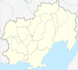
Sokol ( Russian Сокол ) is an urban-type settlement in the Magadan Oblast ( Russia ) with 4685 inhabitants (as of October 14, 2010).
geography
The settlement is located about 40 kilometers as the crow flies north of the Magadan Oblast Administrative Center , separated from the city and the coast of the Sea of Okhotsk by a mountain range a good 1000 m high. It is not far from the right bank of the Uptar, a left tributary of the Chassyn , which in turn flows into the Arman just before the Sea of Okhotsk . To the northeast of Sokol, the Chassyn ridge (Chassynski chrebet), a foothill of the Kolyma Mountains , also rises to over 1000 m .
Like the settlement of Uptar a few kilometers to the east, Sokol belongs to the Magadan district .
history
In connection with the construction of the Magadan airport from 1960, a housing estate was built in its immediate vicinity, which was registered as a location on May 28, 1962. On July 23, 1964, it received urban-type settlement status.
The airport started operations in 1963 and was completed in 1966.
Population development
| year | Residents |
|---|---|
| 1970 | 4126 |
| 1979 | 7642 |
| 1989 | 8011 |
| 2002 | 4715 |
| 2010 | 4685 |
Note: census data
Economy and Infrastructure
Various utilities and authorities are based in Sokol with a connection to the Magadan-Sokol International Airport ( IATA code GDX, ICAO code UHMM ) located immediately to the south-west of the settlement . In addition, the place with its prefabricated buildings is predominantly a residential area.
Sokol is at kilometer 2989 of the M56 trunk road , the former Kolymatrakt , corresponding to kilometer 1777 from Nizhny Bestjach near Jakutsk and kilometer 49 from Magadan . There is a bus connection on this road between the settlement and Sokol Airport and Magadan.
The Magadan - Palatka narrow-gauge railway , which was built in the 1940s and followed the road for long stretches, had already been shut down by the time the Sokol settlement was established (1956). Along the previous route, a local road that branches off from the M56 at Sokol leads to the rural settlements of Molochnaja and Splavnaya downstream on the Uptar.
Individual evidence
- ↑ a b Itogi Vserossijskoj perepisi naselenija 2010 goda. Tom 1. Čislennostʹ i razmeščenie naselenija (Results of the All-Russian Census 2010. Volume 1. Number and distribution of the population). Tables 5 , pp. 12-209; 11 , pp. 312–979 (download from the website of the Federal Service for State Statistics of the Russian Federation)
Web links
- Sokol on the Magadan Municipality website (Russian)

