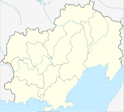
Omsukhan
| Urban-type settlement
Omsukchan
Омсукчан
|
||||||||||||||||||||||||||||||
|
||||||||||||||||||||||||||||||
|
||||||||||||||||||||||||||||||
Omsuktschan ( Russian Омсукча́н ) is an urban-type settlement in the Magadan Oblast ( Russia ) with 4157 inhabitants (as of October 14, 2010).
geography
The settlement is located in the middle of the northern foothills of the Kolyma Mountains , which tower up to about 1500 m , about 420 kilometers as the crow flies northeast of the Magadan Oblast Administrative Center . Omsuktschan is located on the left bank of the Omtschiktschan, which flows about 15 km northeast into the right Kolyma tributary Sugoi .
Omsuktschan is the administrative center of the Omsuktschan Rajon of the same name .
history
The history of the place begins with the discovery of coal deposits in 1937 and tin deposits in the wider area in 1939. The town was founded in 1940. The place name is a modification of the river name Omtschiktschan , an Ewenian name for smaller, swampy, difficult-to-walk locations. In 1941 the first two mines started operating: Industrialny in the mountains not far northwest of the village and Galimy not far from the now abandoned settlement 20 km south.
A road to the mining area was initially built from the direction of Pjostraja Dreswa Bay, 120 km as the crow flies south-east on the Sea of Okhotsk , and completed in 1945. Later, a route from the southwest, starting from Kolyma Street , was laid and opened in 1954. From 1951 to 1956, the Omsuktschan camp department (OmsuktschanLag) of the Dalstroi administration in the Gulag system was located in Omsuktschan with up to 8,200 prisoners who were deployed in mining and road construction.
In 1953 Omsuktschan was given urban-type settlement status. In 1954, the settlement became the administrative center of the Rajon, when the Rajon of the same name was created by outsourcing it from the neighboring Severo-Evensky Rajon .
As early as the end of the 1950s, depletion of the tin ore became apparent; after new discoveries in the 1960s, the last tin shafts closed in the late 1980s. However, mining gained a new boom with the discovery of huge silver ore deposits around 1980, later also of gold .
Population development
| year | Residents |
|---|---|
| 1959 | 2395 |
| 1970 | 4154 |
| 1979 | 7308 |
| 1989 | 9873 |
| 2002 | 4529 |
| 2010 | 4157 |
Note: census data
Economy and Infrastructure
The main economic factor today is the mining of silver and gold , especially in the Dukat settlement a good 20 km northwest . There is an ore enrichment factory in Omsuktschan. In addition, coal is mined for the local energy supply and cattle is farmed in the area for the local supply, as well as reindeer herding in the Rajon by the indigenous population .
A few kilometers southwest of the town there is an airport ( ICAO code UHMF ), which is served by IrAir (IrAero) from Magadan (status 2010). Omsuktschan is connected to the M56 (formerly Kolyma ) road via a mostly unpaved road . There is a rare but regular bus connection over this almost 600 km long route over several mountain passes . A local road connection leads to Dukat. The road that crosses the main ridge of the Kolyma Mountains to the Pjostraja-Dreswa Bay on the Sea of Okhotsk has not been maintained continuously since the 1970s and has not been used in its northern section in recent years after the abandonment of the towns of Galimy and Merenga.
Individual evidence
- ↑ a b Itogi Vserossijskoj perepisi naselenija 2010 goda. Tom 1. Čislennostʹ i razmeščenie naselenija (Results of the All-Russian Census 2010. Volume 1. Number and distribution of the population). Tables 5 , pp. 12-209; 11 , pp. 312–979 (download from the website of the Federal Service for State Statistics of the Russian Federation)
- ↑ Information about place and Rajon on a private website (Russian)
- ↑ Omsuktschan-ITL in the GULAG internet portal of Memorial Deutschland e. V.
- ↑ a b Omsuktschan on the website of the Geographical Institute of the RAN (Russian)


