Uptar
| Urban-type settlement
Uptar
UPтар
|
||||||||||||||||||||||||||||||||
|
||||||||||||||||||||||||||||||||
|
||||||||||||||||||||||||||||||||
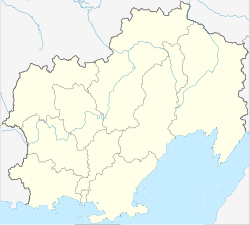
Uptar ( Russian Упта́р ) is an urban-type settlement in the Magadan Oblast ( Russia ) with 1991 inhabitants (as of October 14, 2010).
geography
The settlement is located about 40 kilometers as the crow flies north of the Magadan Oblast Administrative Center , separated from the city and the coast of the Sea of Okhotsk by a mountain range a good 1000 m high. It is located on the right bank of the eponymous Uptar, a left tributary of the Chassyn . To the north of Uptar, the Chassyn ridge (Chassynski chrebet), an extension of the Kolyma Mountains , also rises to over 1000 m .
Like the settlement of Sokol a few kilometers to the west, Uptar belongs to the Magadan district .
history
The settlement arose from 1932, when there in connection with the construction of Kolymatrasse in the gold mining areas in the Kolyma labor camp in the system of the Gulag was born. Due to its location at road km 47 from Magadan after the original, somewhat longer route, the non-independent settlement was simply called 47-j km ("47th kilometer").
From 1970, a cargo handling point was created there for the construction of the Kolyma hydropower plant , and a workers' housing estate was built initially from wooden prefabricated houses and later prefabricated buildings . On April 5, 1973 Uptar was given the status of an urban-type settlement under its current name ( Ewenian origin).
Population development
| year | Residents |
|---|---|
| 1979 | 2993 |
| 1989 | 3983 |
| 2002 | 2311 |
| 2010 | 1991 |
Note: census data
traffic
The R504 Kolyma trunk road passes to the west of Uptar and connects Magadan with Nizhny Bestjach near Jakutsk (previously M56 , number still in use until 2017).
Individual evidence
- ↑ a b Itogi Vserossijskoj perepisi naselenija 2010 goda. Tom 1. Čislennostʹ i razmeščenie naselenija (Results of the All-Russian Census 2010. Volume 1. Number and distribution of the population). Tables 5 , pp. 12-209; 11 , pp. 312–979 (download from the website of the Federal Service for State Statistics of the Russian Federation)

