Piat
| Municipality of Piat | ||
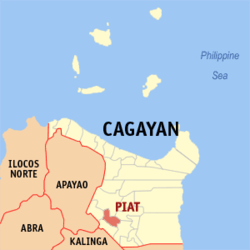
| Location of Piat in the province of Cagayan | ||
|---|---|---|

|
||
| Basic data | ||
| Region : | Cagayan Valley | |
| Province : | Cagayan | |
| Barangays : | 18th | |
| District: | 2. District of Cagayan | |
| PSGC : | 021520000 | |
| Income class : | 4. Income bracket | |
| Households : | 3975 May 1, 2000 census
|
|
| Population : | 23,597 August 1, 2015 census
|
|
| Population density : | 131.9 inhabitants per km² | |
| Area : | 178.9 km² | |
| Coordinates : | 17 ° 47 ′ N , 121 ° 29 ′ E | |
| Postal code : | 3527 | |
| Website: | www.piat-cagayan.gov.ph | |
| Geographical location in the Philippines | ||
|
|
||
Piat is a municipality in the Philippine province of Cagayan . In 2015, 23,597 inhabitants lived in the 178.9 km² area, resulting in a population density of 132 inhabitants per km². The two rivers Chico and Matalag also flow through the hilly Piat. A major educational institution in the community is Cagayan State University . Piat is a religious center in the region; The Basilica of Our Lady of Piat has been a minor basilica since 1997 .
Piat is divided into the following 18 barangays :
|
|
