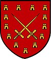
Pembroke (Malta)
| coat of arms | map |
|---|---|

|
|
| Basic data | |
| State : | Malta |
| Gzejjer : | Malta Majjistral (Northwest Malta) |
| Distretti : | Northern Harbor |
| Area : | 2,302,712 km² |
| Residents : | 3842 (December 31, 2018) |
| Population density : | 1668 inhabitants / km² |
| ISO 3166-2 : | MT-40 |
| Postal code : | PBK |
| Website : | www.pembroke.gov.mt |
| politics | |
| Mayor : | Dean Hili ( MLP ) |
Coordinates: 35 ° 56 ' N , 14 ° 29' E
Pembroke , Malta's youngest city, is located on the island's north coast. The coastal and tourist town of St. Julian's with the entertainment mile Paceville is in the east-southeast and the residential areas of Swieqi in the south. The high society village of Madliena can be found to the west from here and Baħar iċ-Ċagħaq some distance to the northwest.
Pembroke was named after Robert Henry, the 12th Earl of Pembroke and British Secretary of War from 1859.
history
The city was founded by the Knights of the Knights of St. John who built a watchtower on this coast to defend the Great Harbor, which is about 6 km east of it. The British , however, only really expanded the fortifications in Pembroke. The first barracks were built between 1859 and 1862 and named after England's patron saint, St. George . Later barracks were built bearing the names of the patron saints of Scotland and Ireland , St. Andrew and St. Patrick . Fort Pembroke was built between 1875 and 1878 to prevent the enemy from approaching the Great Harbor from the sea and to defend the right flank of the Victoria Lines . Today it is an international school offering IGSCE and IB programs. The Pembroke Battery was built between 1897 and 1899 and served the same purpose.
The last British soldiers left Pembroke in 1979. During the Second World War , German prisoners of war were in Fort Pembroke and during their stay they built a small chapel that was used by the British troops . All land claimed by the British was returned to the Republic of Malta when they left.
Recent past
Pembroke was still neglected in the mid-1980s; the barracks were converted into tenement houses and a less successful hotel complex . After the government sold land in 1986, the first new residents settled there. Pembroke developed into a city that is popular with language students, especially in summer.
Web links
Individual evidence
- ↑ StatDB of the National Statistics Office Malta , accessed on August 1, 2020

