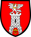
Powiat Czestochowski
| Powiat Czestochowski | |
|---|---|

|

|
| Basic data | |
| State : | Poland |
| Voivodeship : | Silesia |
| County town : | Czestochowa |
| Area : | 1,519.49 km 2 |
| Residents : | 134,637 (June 30, 2019) |
| Population density : | 89 inhabitants / km 2 |
| Telephone code : | (+48) 34 |
| License plate : |
SCZ
|
| Circle structure | |
| Municipalities : | 0 |
| Urban and rural communities : | 2 |
| Rural communities : | 14th |
| Starostei (Stand:) | |
| Starost : | Mieczysław Chudzik |
| Address: | ul.Sobieskiego 9 42-200 Częstochowa |
| Website : | www.czestochowa.powiat.pl |
The powiat Częstochowski is a powiat (district) in the Polish Voivodeship of Silesia with around 134,600 inhabitants.
geography
With an area of 1519 km², the largest powiat in the voivodship, it encompasses the rural area around the district town of Częstochowa , which, however, remains independent, and almost completely surrounds it except for the northwest. Neighboring powers are in the north Pajęczno and Radomsko in the Łódź Voivodeship , in the northeast Włoszczowa in the Świętokrzyskie Voivodeship , in the southeast Zawiercie , in the south Myszków and Lubliniec and in the west Kłobuck .
cities and communes
The powiat Częstochowski comprises 16 municipalities, two of which are urban and rural and 14 rural municipalities.
Urban-and-rural parishes
Rural communities
- Dąbrowa Zielona
- Janów
- Kamienica Polska
- Konopiska
- Kruszyna
- Kłomnice
- Lelów
- Mstów
- Mykanów
- Olsztyn
- Poczesna
- Przyrów
- Rędziny
- Starcza
Partnerships
Partnerships exist with the Lake Constance district in Baden-Württemberg and the Snjatin Raion ( Ivano-Frankivsk Oblast ) in the Ukraine .
Web links
Footnotes
- ↑ population. Size and Structure by Territorial Division. As of June 30, 2019. Główny Urząd Statystyczny (GUS) (PDF files; 0.99 MiB), accessed December 24, 2019 .

