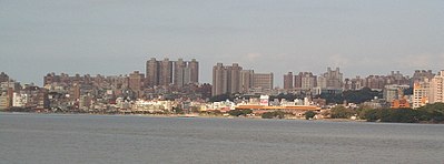
Tamsui
|
Tamsui 淡水 區 |
||
 Location Tamsuis in New Taipei |
||
| State : |
|
|
| Coordinates : | 25 ° 10 ' N , 121 ° 26' E | |
| Height : | 10 m | |
| Area : | 70.6 km² | |
| Residents : | 169,319 (November 2017) | |
| Population density : | 2,398 inhabitants per km² | |
| Time zone : | UTC + 8 (Chungyuan time) | |
| Telephone code : | (+886) (0) 2 | |
| Postal code : | 251 | |
| ISO 3166-2 : | TW-NWT | |
| Community type : | New Taipei City District | |
| Website : | ||
|
|
||
Tamsui ( Chinese 淡水 區 , Pinyin Dànshuǐ Qū , Tongyong Pinyin Danshuei Cyu , Pe̍h-ōe-jī Tām-súi / Tām-chú ), also written Tanshui or Tamshui, is a district of the city of New Taipei in northern Taiwan with a population of around 140,000 . The formerly called Hùweǐ ( Chinese 滬 尾 ) or Hobe ( Taiwanese ) is located northwest of Taipei at the mouth of the Tamsui River ( Chinese 淡水河 ) in the Formosa Strait . The southern part of the borough is part of Yangmingshan National Park .
history
From 1629 to 1641 Tamsui was occupied by the Spanish. Fort Santo Domingo, built by them in 1629, is still one of the city's sights today. The British Consulate resided on the site from 1867 to 1972.
In 1641 the Dutch attacked the fort, which fell on August 3rd. After the expulsion of the Spaniards, the port was under the rule of the Dutch and the Dutch East India Company ( Dutch : Vereenigde Oostindische Compagnie; abbreviated: VOC or VOC) for a few years . The current name of the fort, Hong-Mao-Cheng ( 紅毛 城 , literally: the fort of the redheads) reminds of the rule of the Dutch . However, they left Taiwan in 1661 after losing to Zheng Chenggong (Koxinga).
After the Treaty of Tianjin in 1860, the Chinese government opened the port to foreign trade. From 1862 tariffs were regularly levied. The main exports were tea , camphor wood, sulfur and coal . Trading companies from many western countries settled in Tamsui; the place became the gateway of western culture in Taiwan and experienced an economic boom.
In 1872 the doctor and missionary Dr. George Leslie Mackay moved to Tamsui, where he opened the first western hospital and schools.
In the mid-19th century, Tamsui was Taiwan's most important port, but the importance of the place as a port declined in the 20th century due to severe siltation, and as a result, Keelung assumed the role of the most important port in the north. The population turned back to agriculture and fishing , but due to good infrastructure projects carried out by the Japanese colonial rulers, the place became a local center for administration and culture.
Under the Republic of China, Tamsui was an independent municipality ( 鎮 , Zhèn ) until the place was incorporated as a district into the newly founded city of New Taipei on December 25, 2010 . Tamsui is the northern terminus of the Tamsui Line of the Taipei Metro and a popular destination.
culture and education
Five universities are located in Tamsui, namely Tamkang University ( 淡江 大學 ; founded in 1958) with 814 full-time teachers and 27,711 students and Aletheia University ( 真理 大學 ; founded in 1965) with 256 full-time teachers and 12,630 students ( as of 2004 ), also the St. John's University ( 聖約翰 科技 大學 ), the Taipei University of Marine Technology ( 台北 海洋 科技 sowie ) and the Hwa Hsia University of Technology ( 華夏 科技 大學 Tamsui-Campus).
Aletheia University emerged from the former Oxford College founded by Mackay, the first western school in Taiwan.
climate
| Tamsui | ||||||||||||||||||||||||||||||||||||||||||||||||
|---|---|---|---|---|---|---|---|---|---|---|---|---|---|---|---|---|---|---|---|---|---|---|---|---|---|---|---|---|---|---|---|---|---|---|---|---|---|---|---|---|---|---|---|---|---|---|---|---|
| Climate diagram | ||||||||||||||||||||||||||||||||||||||||||||||||
| ||||||||||||||||||||||||||||||||||||||||||||||||
|
Climate data from Tamsui from 1981–2010
Source: Taiwan Central Weather Bureau
|
||||||||||||||||||||||||||||||||||||||||||||||||||||||||||||||||||||||||||||||||||||||||||||||||||||||||||||||||||||||||||||||||||||||||||||||||||||||
literature
- Weggel, Oskar: The History of Taiwan. From the 17th century until today . Cologne, Weimar, Vienna: Böhlau, 1991, ISBN 3-412-02891-6


