Huanta Province
| Huanta Province | |||
|---|---|---|---|
 Location of the province in the Ayacucho region |
|||
| Symbols | |||
|
|||
| Basic data | |||
| Country | Peru | ||
| region | Ayacucho | ||
| Seat | Huanta | ||
| surface | 3879 km² | ||
| Residents | 89,466 (2017) | ||
| density | 23 inhabitants per km² | ||
| ISO 3166-2 | PE-AYA | ||
| Website | munihuanta.gob.pe/web/ (Spanish) | ||
| politics | |||
| Alcalde Provincial | Renol Silbio Pichardo Ramos (2019-2022) |
||
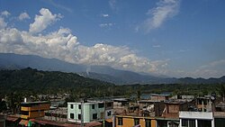
| View over Sivia | |||
Coordinates: 12 ° 56 ′ S , 74 ° 15 ′ W
The Huanta Province is part of the Ayacucho administrative region in south-central Peru . It has an area of 3879 km². The 2017 census counted 89,466 inhabitants in the province. Ten years earlier the population was 93,360. The administrative seat is the city of Huanta .
Geographical location
The province of Huanta is in the north of the Ayacucho region. The province extends over the Peruvian Central Cordillera . The rivers Río Cachi , Río Mantaro , Río Apurímac and Río Piene form the provincial borders in the west, north, east and south-east. The provincial capital Huanta is located in the extreme southwest of the province.
The province of Huanta is bordered by the Huancavelica region in the west, the Junín region in the north, the La Mar province in the east and the Huamanga province in the south .
Administrative division
The Huanta Province consists of 12 districts. The Huanta District is the seat of the provincial government.
| District | Administrative headquarters |
|---|---|
| Ayahuanco | Viracochan |
| Canayre | Canayre |
| Chaca | Chaca |
| Huamanguilla | Huamanguilla |
| Huanta | Huanta |
| Iguaín | Macachacra |
| Llochegua | Llochegua |
| Luricocha | Luricocha |
| Pucacolpa | Huallhua |
| Santillana | San Jose de Secce |
| Sivia | Sivia |
| Uchuraccay | Huaynacancha |
Web links
- Peru: Ayacucho region (provinces and districts) at www.citypopulation.de
- INEI Perú


