Rødøy
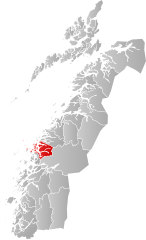
| coat of arms | map | |
|---|---|---|

|
|
|
| Basic data | ||
| Commune number : | 1836 | |
| Province (county) : | North country | |
| Administrative headquarters: | Vågaholmen | |
| Coordinates : | 66 ° 43 ′ N , 13 ° 21 ′ E | |
| Surface: | 711.29 km² | |
| Residents: | 1,213 (Feb 27, 2020) | |
| Population density : | 2 inhabitants per km² | |
| Language form : | neutral | |
| Postal code : | 8186 | |
| Structure: | Vågaholmen, Gladstad, the islands of Nesøya, Gjerøya, Rangsundøya, Rødøya and parts of Hestmona | |
| Website: | ||
| politics | ||
| Mayor : | Inger Dagmar Monsen (Local List) (2019) | |
| Location in the province of Nordland | ||

|
||
Rødøy is a municipality in the Norwegian Fylke Nordland . In the Middle Ages , Rødøy was one of three parishes in Helgeland . Later in the Middle Ages, Helgeland was divided in half: Rødøy and Herøy.
The center is on a peninsula surrounded by the Melfjord and Vælansfjord. The rock formation Rødøyløva, which also gave the coat of arms (“A red lion on a silver background”) the motif, is characteristic. The coat of arms was adopted in 1988. This sphinx-like rock formation has always been an important landmark on the shipping route on the coast.
Web links
Commons : Rødøy - collection of images, videos and audio files
Individual evidence
