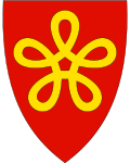
Lødingen
| coat of arms | map | |
|---|---|---|

|
|
|
| Basic data | ||
| Commune number : | 1851 | |
| Province (county) : | North country | |
| Administrative headquarters: | Lødingen | |
| Coordinates : | 68 ° 25 ' N , 16 ° 1' E | |
| Surface: | 527.41 km² | |
| Residents: | 2,034 (Feb 27, 2020) | |
| Population density : | 4 inhabitants per km² | |
| Language form : | Bokmål | |
| Website: | ||
| politics | ||
| Mayor : | Hugo Bongard Jacobsen ( Ap ) (2019) | |
| Location in the province of Nordland | ||

|
||
Lødingen is a municipality in the province ( Fylke ) Nordland in Norway . It is located in the southeast of the island of Hinnøya on the Vesterålen archipelago and borders in the north on the municipalities of Sortland and Kvæfjord , in the east on the municipality Tjeldsund , in the southwest on the municipality Vågan and in the west on the municipality Hadsel . With a community area of 527 square kilometers, it had a total of 2245 inhabitants in 2007. 1753 people live in the main town of the same name (Norwegian: Tettsted ).
Lødingen is connected to the municipality of Bognes by the Tysfjord on European route 6 via a year-round ferry service that operates around the clock . The passage across the Vestfjord takes about an hour. The Lofoten archipelago can also be reached from here in about an hour via the Lofast road connection on European route 10 .
Personalities
- Olaf Kjelsberg (1857–1927), engineer and ski pioneer
- Dagfinn Bakke (1933–2019), painter, caricaturist and illustrator

