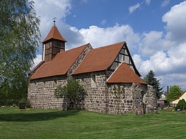
Ragosen (Coswig)
|
Ragosen
City of Coswig (Anhalt)
Coordinates: 51 ° 58 ′ 50 ″ N , 12 ° 17 ′ 55 ″ E
|
||
|---|---|---|
| Height : | 94 m above sea level NN | |
| Area : | 10.35 km² | |
| Residents : | 216 (Dec. 31, 2007) | |
| Population density : | 21 inhabitants / km² | |
| Incorporation : | July 1, 2009 | |
| Postal code : | 06868 | |
| Area code : | 034907 | |
|
Location in Saxony-Anhalt |
||

Ragösen is a district of the town of Coswig (Anhalt) in the district of Wittenberg in Saxony-Anhalt .
geography
Ragösen on the southwestern edge of the Fläming lies in the valley of the upper Nuthe . This small river has its source about five kilometers northeast of the town, flows through Zerbst and flows into the Elbe at Barby . The area is very wooded, the terrain is characterized by rolling hills. The vineyard in the extensive forest area three kilometers north of Ragösen reaches 136 m above sea level. NHN .
The closest cities are Dessau-Roßlau , Coswig (Anhalt) and Zerbst .
history
On July 1, 1950, the previously independent municipality of Krakow was incorporated.
On July 1, 2007, the former municipality of Ragösen was incorporated into the Wittenberg district due to a district reform from the former Anhalt-Zerbst district.
On July 1, 2009, Ragösen was incorporated into Coswig (Anhalt). The last mayor was Hans-Peter Klausnitzer.
Transport links
The state road 121 (formerly federal road 187a ) from Zerbst to Coswig (Anhalt) leads through Ragösen. In the neighboring village of Jeber-Bergfrieden there is a rail connection ( Dessau-Roßlau - Potsdam - Berlin route ) ( Kanonenbahn ). The motorway connections “Köselitz” and “Coswig” on the A 9 (Berlin – Munich) are 16 and 20 km away .
Web links
- Homepage Ragösen, part of the city of Coswig (Anhalt)
- Church portrait of St.Jakobi on www.kirchenstiftung-zerbst.de


