
Bösingen FR
| FR is the abbreviation for the canton of Friborg in Switzerland and is used to avoid confusion with other entries of the name Bösingen . |
| Bösingen | |
|---|---|
 |
|
| State : |
|
| Canton : |
|
| District : | Scythe |
| BFS no. : | 2295 |
| Postal code : | 3178 |
| UN / LOCODE : | CH BSG |
| Coordinates : | 583973 / 193602 |
| Height : | 550 m above sea level M. |
| Height range : | 482–657 m above sea level M. |
| Area : | 14.32 km² |
| Residents: | 3408 (December 31, 2018) |
| Population density : | 238 inhabitants per km² |
| Website: | www.boesingen.ch |
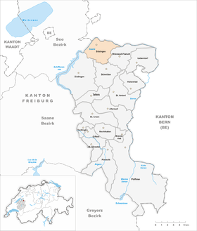
| Location of the municipality | |
  |
|
Bösingen (French outdated Basens and Bésingue ; Friborg Patois ) is a municipality in the Sense district of the canton of Friborg in Switzerland . From 1953 to 1962 the community was officially called Grossbösingen .
geography
Bösingen is 550 m above sea level. M. on the northern edge of the Sense district, 11 km northeast of the canton capital Friborg (as the crow flies). The village extends on a ledge around 60 m above the valley floor of the Saane , near the confluence of the Sense near Laupen , in the northeastern Freiburg Central Plateau .
The area of the 14.3 km² municipal area comprises a section of the molasse hill country east of the Saan valley , which was shaped by the Ice Age Rhone glacier . The municipal boundary of Bösingen is formed by the Saane in the northwest and the Sense in the north. However, the area does not extend to the confluence. Both rivers are channeled and straightened in this section.
To the south of the 0.5 to 1 km wide valley floor joins a slope that is relatively gently sloping in most places and merges into the high plateau of Bösingen. This plateau rises towards the south over the heights of Riederbergholz ( 606 m above sea level ), Oberes Mülibergholz ( 562 m above sea level ) and Litzistorfhubel ( 603 m above sea level ) and reaches the Dornihubel at 656 m ü. M. the highest point in Bösingen. Are cut into the Molasseplateau the little valley of Richterwilbachs and Noflenbachs . In the far south, the municipality extends to the valley basin at Schmitten train station. In 1997, 9% of the municipal area was settled, 15% forest and woodland, 75% agriculture and a little less than 1% was unproductive land.
In addition to the main village, Bösingen has a number of hamlets, farm settlements and individual farms. The most important of these are (from north to south):

- Thürlefeld, 500 m above sea level M. , a residential area in the Sense Valley on the southern edge of Laupen
- Tuftera, 505 m above sea level M. , a former hamlet on the southern edge of the Sense Valley
- Niederbösingen, 507 m above sea level M. , slightly elevated on the southern edge of the Saane valley
- Noflen, 512 m above sea level M. , on the southern edge of the valley of the Sense and on the Noflenbach
- Grenchen, 580 m above sea level M. , on the high plateau south of the Sense Valley
- Fendringen, 583 m above sea level M. , on the high plateau at the edge of the lowland of the Moos
- Uttewil, 625 m above sea level M. , on the high plateau north of the Dornihubels
- Riederberg, 532 m above sea level M. , on the Richterwilbach between the heights of the Upper Mülibergholz and the Riederbergholz
- Vogelshus, 549 m above sea level M. , on the high plateau south of the Saan valley
- Litzistorf, 571 m above sea level M. , west of the valley of the Richterwilbach
- Richterwil, 586 m above sea level M. , in the valley of the Richterwilbach
- Friseneit, 596 m above sea level M. , in the valley basin of the Richterwilbach south of the Dornihubels
Neighboring communities of Bösingen are Wünnewil-Flamatt , Schmitten , Düdingen and Kleinbösingen on Freiburg soil and the communities of Kriechenwil and Neuenegg, which are part of the Bern area, and the small town of Laupen .
According to the 2000 census, the municipality of Bösingen is part of the Bern agglomeration .
population
With 3408 inhabitants (as of December 31, 2018), Bösingen is one of the medium-sized communities in the canton of Friborg. 92.6% of the residents speak German, 1.7% speak Italian and 1.4% speak French (as of 2000). The population of Bösingen was 1124 inhabitants in 1850 and 1438 inhabitants in 1900. In the course of the 20th century the population increased continuously until 1960 (2091 inhabitants), before a decrease to 1729 people was registered in the following decade. Since 1980 (1808 inhabitants) there has been a significant increase in population.
economy
Until the second half of the 20th century, Bösingen was predominantly an agricultural community. A brick factory was operated near Lischera in the 18th and 19th centuries. Even today, dairy farming , animal husbandry , arable farming and fruit growing , especially in the southern part of the municipality, play an important role in the income structure of the population.
Numerous other jobs are available in local small businesses and in the service sector. Bösingen has close economic ties with the neighboring town of Laupen. A larger commercial and industrial area has been developing in the Saane floodplain since the 1970s. Today Bösingen is home to various construction businesses as well as metal processing, precision mechanics, information technology and blind construction companies.
Until 1970 Bösingen was a scattered settlement community consisting of numerous hamlets . Only since then has the actual village of Bösingen developed into a settlement center with the construction of an extensive residential area. New housing estates were also built near Tuftera and in Thürlefeld on the border to Laupen. Many workers are commuters who work mainly in the Bern and Freiburg regions.
traffic
The community is very well developed in terms of traffic. It is located on the connecting road from Düdingen to Laupen . The next connection to the A12 motorway (Bern-Vevey), which crosses the southern municipality, is around 5 km from the town center. Bösingen is connected to the public transport network through the Postbus course , which covers the route from Düdingen to Laupen. The SBB line Bern-Lausanne runs through the extreme south of the area .
history
The municipal area of Bösingen was settled very early, which was proven by the finds of graves from the Hallstatt period. During Roman times there was an important manor on the site of today's village church, which was probably inhabited from the 1st to the 4th century AD. Column fragments and painted ceiling parts represent the most important finds from this period in addition to numerous smaller objects. Grave finds also date from the Burgundian period.
It is possible that the Bösingen hill has been inhabited almost continuously since Roman times. Around 935, Queen Bertha and King Rudolf II of Burgundy founded the Saint Syrus Church, which later became an important place of pilgrimage, but was demolished in 1890 and replaced by a cheese dairy.
The place was first mentioned in a document in 1228 under the French name Basens . Later the names Balsingue lo grant (1264) appeared and in the same year the German version Besingen , which gradually changed to Bösingen over time.
In the Middle Ages , Bösingen belonged to the Counts of Thierstein as a fief. Part of the municipality was owned by the Lords of Fendringen and came to the Magerau monastery and the Freiburg citizen hospital in the 13th century. In 1442 at the latest, the village came under the rule of Freiburg through purchase and was assigned to the Old Landscape (Aupanner).
1476 Murtenschlacht, Bösingen provided a "Reisgesellschaft (Compagnie)" of 23 equipped men,
After the collapse of the Ancien Régime (1798), Bösingen belonged to the Freiburg district during the Helvetic and the following period and to the German district of Freiburg from 1831, before it was incorporated into the newly created Sense district in 1848 with the new cantonal constitution.
There was a significant change of area in 1977, when Bösingen ceded the entire eastern part of its municipal area with an area of 4.65 km² and the hamlets of Staffels, Amtmerswil, Bagiwil, Balsingen and Blumisberg (at that time a total of around 600 inhabitants) to Wünnewil-Flamatt .
coat of arms
description
The upper half of the coat of arms shows a black horse's head on gold. A golden harrow and two scallops are depicted in red on the lower half . The coat of arms has been known since the 19th century, but the harrow and the two scallops were added later. The figures were once found on the banner of the Bösingen military company in the 15th century.
The importance of scallops
The journey to Santiago de Compostela on the pilgrimage routes or the Way of St. James was arduous and took several months. Certain places along the pilgrimage routes looked after the pilgrims and gave them shelter. Bösingen also belonged to these places. Pilgrims often brought back scallops from the pilgrimage, as Santiago is only 20 kilometers from the sea.
Attractions

The parish church of St. Jakob was rebuilt from 1788 to 1795 in the late Baroque style on the site of a previous building from the 13th century. The single-nave church has a rectangular choir, the base of the bell tower with tuff stone blocks dates back to the Middle Ages. The Heiliges Kreuz cemetery chapel was built in 1836 and today houses the former interior of the sanctuary of St. Syrus, which was demolished in 1890.
The old town center of Bösingen is one of the villages of national importance. Here you will find characteristic farmhouses from the 17th to 19th centuries as well as remarkable warehouse buildings from around 1700. The hamlets in the southern municipality are also characterized by stately farmhouses in the Freiburg style. There is a chapel in Richterwil.
Personalities
- Heinrich Schnyder (1897–1974), agricultural scientist and politician
Web links
- Official website of the municipality of Bösingen
- Jean-François Steiert : Bösingen. In: Historical Lexicon of Switzerland .
Individual evidence
- ↑ Permanent and non-permanent resident population by year, canton, district, municipality, population type and gender (permanent resident population). In: bfs. admin.ch . Federal Statistical Office (FSO), August 31, 2019, accessed on December 22, 2019 .
- ^ Municipalities of the agglomeration of Bern. Federal Statistical Office, archived from the original on November 16, 2010 ; Retrieved August 7, 2009 .
- ↑ Description of the coat of arms on www.boesingen.ch
Alterswil | Bösingen | Brünisried | Düdingen | Giffers | Heitenried | Plaffeien | Plasselb | Keep right | Schmitten | St. Antoni | St. New Years Eve | St. Ursen | Tafers | Tentlingen | Ueberstorf | Wünnewil-Flamatt
Former municipality: Neuhaus | Upper shot | Zumholz
Canton of Friborg | Districts of the canton of Friborg | Municipalities of the canton of Friborg