
Roggenburg (Bavaria)
| coat of arms | Germany map | |
|---|---|---|

|
Coordinates: 48 ° 17 ' N , 10 ° 14' E |
|
| Basic data | ||
| State : | Bavaria | |
| Administrative region : | Swabia | |
| County : | New Ulm | |
| Height : | 554 m above sea level NHN | |
| Area : | 27.41 km 2 | |
| Residents: | 2758 (Dec. 31, 2019) | |
| Population density : | 101 inhabitants per km 2 | |
| Postcodes : | 89297, 89290 | |
| Area code : | 07300 | |
| License plate : | NU, ILL | |
| Community key : | 09 7 75 149 | |
| Community structure: | 10 parish parts | |
| Address of the municipal administration: |
Prälatenhof 2 89297 Roggenburg |
|
| Website : | ||
| Mayor : | Mathias Stölzle | |
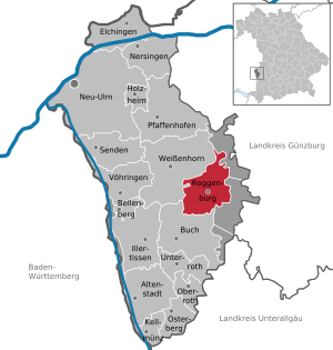
| Location of the community Roggenburg in the district of Neu-Ulm | ||
  |
||


Roggenburg is a municipality in the Bavarian-Swabian district of Neu-Ulm .
Roggenburg is known among other things for the Roggenburg Monastery , which is used again today by the Order of the Premonstratensians . An environmental and cultural center with a supra-regional catchment area is attached to the monastery.
geography
The community is located in the Donau-Iller region in Central Swabia , 30 kilometers southeast of Ulm and 40 kilometers north of Memmingen . The districts of Roggenburg, Biberach and Meßhofen are located on the Biber , which also flows through the 15 hectare Langweiher. Ingstetten, Schießen and Unteregg are located on the Osterbach .
The municipality of Roggenburg has 10 officially named municipal parts : (former municipalities with districts, population in brackets on June 30, 2012)
- Biberach (737) to the Wastes Dirrfelden and Wenenden
- Ingstetten (377)
- Meßhofen (279) with the wasteland Hochbuch (zip code 89290) and Roggenburg (278)
- Shooting (939), Schleebuch (99) and Unteregg (81)
history
Roggenburg was originally apparently the castle of the von Bibereck family, which died out early on .
The Bavarian original cadastre shows Roggenburg in the 1810s as a seat of the Teutonic Order with the monastery, stables, farm buildings, five other hearths and three ponds .
On July 1, 1972, the community of Roggenburg was re-established through the merger of the previously independent communities of Biberach, Ingstetten and Meßhofen. It was named after the monastery. Shooting was added on May 1, 1978.
Population development
Between 1988 and 2019 the municipality grew from 2,288 to 2,758 by 470 inhabitants or 20.5%.
politics
Municipal council
The municipal council has 14 members plus the mayor. The local elections on March 16, 2014 resulted in the following distribution of seats with a turnout of 61.3%:
| ÜWV shooting | FW Meßhofen / Roggenburg | Flat share Biberach | WG Ingstetten | total | |
| 2014 | 5 seats | 3 seats | 4 seats | 2 seats | 14 seats |
| Share of votes | 35.4% | 22.5% | 25.7% | 16.5% |
mayor
In the 2014 local elections, Mathias Stölzle was elected mayor with 98.4% of the valid votes cast (voter turnout: 61.2%); on March 15, 2020, he was elected for a further six years with 96.3% of the vote.
coat of arms
The description of the coat of arms reads: “By a curled red tip, in it three golden ears of rye on a green three-mountain, split; in front in silver a black beaver with red armor turned to the left, holding a silver fish in its mouth, in the back quartered with silver and black. "
Architectural monuments
The Roggenburg Abbey of the Order of the Premonstratensians is an outstanding architectural monument .
Web links
- Entry on the coat of arms of Roggenburg (Bavaria) in the database of the House of Bavarian History
Individual evidence
- ↑ "Data 2" sheet, Statistical Report A1200C 202041 Population of the municipalities, districts and administrative districts 1st quarter 2020 (population based on the 2011 census) ( help ).
- ^ Community Roggenburg in the local database of the Bavarian State Library Online . Bavarian State Library, accessed on August 21, 2019.
- ^ Roggenburg on BayernAtlas Klassik
- ^ Wilhelm Volkert (ed.): Handbook of Bavarian offices, communities and courts 1799–1980 . CH Beck, Munich 1983, ISBN 3-406-09669-7 , p. 540 .
- ^ Federal Statistical Office (ed.): Historical municipality directory for the Federal Republic of Germany. Name, border and key number changes in municipalities, counties and administrative districts from May 27, 1970 to December 31, 1982 . W. Kohlhammer, Stuttgart / Mainz 1983, ISBN 3-17-003263-1 , p. 790 .
- ↑ Population figures in the Neu-Ulm district
- ↑ wahlen.roggenburg.de: Roggenburg municipal council 2014
Biberach | Dirrfelden | Hochbuch | Ingstetten | Meßhofen | Roggenburg | Shooting | Schleebuch | Wenenden | Unteregg

Altenstadt | Bellenberg | Book | Elchingen | Holzheim | Illertissen | Kellmünz on the Iller | Nersingen | Neu-Ulm | Oberroth | Osterberg | Pfaffenhofen an der Roth | Roggenburg | Send | Unterroth | Voehringen | Weissenhorn
Unregulated areas: Auwald | Oberroggenburg Forest | Stoffenrieder Forest | Unterroggenburg Forest