Saint-Sornin-Leulac
| Saint-Sornin-Leulac | ||
|---|---|---|

|
|
|
| region | Nouvelle-Aquitaine | |
| Department | Haute-Vienne | |
| Arrondissement | Limoges | |
| Canton | Châteauponsac | |
| Community association | Gartempe Saint-Pardoux | |
| Coordinates | 46 ° 12 ′ N , 1 ° 18 ′ E | |
| height | 246-365 m | |
| surface | 32.28 km 2 | |
| Residents | 634 (January 1, 2017) | |
| Population density | 20 inhabitants / km 2 | |
| Post Code | 87290 | |
| INSEE code | 87180 | |
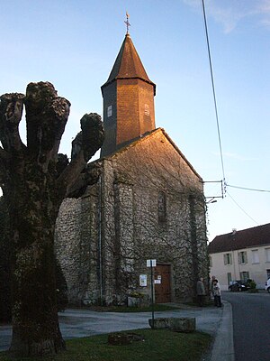
 church |
||
Saint-Sornin-Leulac is a French commune in the region Nouvelle-Aquitaine , in Haute-Vienne , in district Bellac and in Canton Châteauponsac . It borders Dompierre-les-Églises to the west and northwest , Saint-Hilaire-la-Treille to the northeast, Saint-Amand-Magnazeix to the east and Châteauponsac to the south .
The inhabitants call themselves Saint-Sorlaciens. In addition to the main settlement, villages such as Monteil, Chantegrelle, Bussière, Croizet, Puy-Chaumet and Villemacheix are part of the municipality's markings.
The former Route nationale 142 and today's D901 leads via Saint-Sornin-Leulac.
Population development
| year | 1962 | 1968 | 1975 | 1982 | 1990 | 1999 | 2008 | 2013 |
|---|---|---|---|---|---|---|---|---|
| Residents | 840 | 798 | 672 | 675 | 600 | 623 | 647 | 651 |
Attractions
- Saint-Saturnin Church
- Saint-Priest church
Web links
Commons : Saint-Sornin-Leulac - Collection of images, videos and audio files
