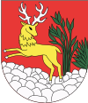
Scalité
| Scalité | ||
|---|---|---|
| coat of arms | map | |

|
|
|
| Basic data | ||
| State : | Slovakia | |
| Kraj : | Žilinský kraj | |
| Okres : | Čadca | |
| Region : | Kysuce | |
| Area : | 33,163 km² | |
| Residents : | 5,243 (Dec 31, 2019) | |
| Population density : | 158 inhabitants per km² | |
| Height : | 524 m nm | |
| Postal code : | 023 14 | |
| Telephone code : | 0 41 | |
| Geographic location : | 49 ° 30 ' N , 18 ° 54' E | |
| License plate : | CA | |
| Kód obce : | 509451 | |
| structure | ||
| Community type : | local community | |
| Administration (as of November 2018) | ||
| Mayor : | Jozef Cech | |
| Address: | Obecný úrad Skalité 598 02314 Skalité |
|
| Website: | www.skalite.sk | |
| Statistics information on statistics.sk | ||
Skalité (Hungarian Sziklaszoros - until 1902 Szkalite ; Polish Skalite ) is a municipality in northern Slovakia with 5243 inhabitants (as of December 31, 2019). It is located near the border triangle with the Czech Republic and Poland in the Beskids . The center of the village is at an altitude of 524 m nm , about 20 km from Čadca .
The place was first mentioned as Podskalitye in 1664 . There is a road and rail border crossing on the Čadca – Zwardoń railway with Poland near the village . A minority of the Gorals live in the village . In 1938, Skalité was occupied by Poland as part of the Munich Agreement , but in 1939 with the beginning of the Second World War , the place came back to the newly formed Slovakia .
Personalities
- Olga Lašová (* 1984), soccer player
See also
- Czechoslovak-Polish border conflicts (Map area No. 1)
Web links
Commons : Skalité - collection of images, videos and audio files
- Entry on e-obce.sk (Slovak)

