Zákopčie
| Zákopčie | ||
|---|---|---|
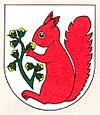
| coat of arms | map | |

|
|
|
| Basic data | ||
| State : | Slovakia | |
| Kraj : | Žilinský kraj | |
| Okres : | Čadca | |
| Region : | Kysuce | |
| Area : | 29.631 km² | |
| Residents : | 1,759 (Dec. 31, 2019) | |
| Population density : | 59 inhabitants per km² | |
| Height : | 572 m nm | |
| Postal code : | 023 11 | |
| Telephone code : | 0 41 | |
| Geographic location : | 49 ° 24 ' N , 18 ° 44' E | |
| License plate : | CA | |
| Kód obce : | 509523 | |
| structure | ||
| Community type : | local community | |
| Administration (as of November 2018) | ||
| Mayor : | Ján Slaninák | |
| Address: | Obecný úrad Zákopčie Stred 824 023 11 Zákopčie |
|
| Website: | www.zakopcie.sk | |
| Statistics information on statistics.sk | ||
Zákopčie (Hungarian Dombelve - until 1907 Zákopcse ) is a municipality in the north-center of Slovakia with 1759 inhabitants (as of December 31, 2019), which belongs to the Okres Čadca , part of the Žilinský kraj .
geography
The community is located in the Javorníky Mountains in the source area of several streams that belong to the catchment area of Kysuca . As a unit, the municipality is made up of around 70 individual settlements (in Slovak, kopanice ) in five valleys in the 29.6 km² municipal area. The terrain is hilly with scattered forests and covered with brown forest floors. The highest mountain is called Jakubovský vrch ( 875 m nm ). The community center is located at an altitude of 572 m nm and is nine kilometers from Čadca and 40 kilometers from Žilina .
Neighboring communities are Podvysoká , Staškov , Raková , Ochodnica , Nesluša , Dlhá nad Kysucou and the city of Čadca .
history
The current municipal area was not permanently settled until the 17th century as a result of the Wallachian colonization of the area in what was then the municipality of Krásno nad Kysucou . The first written record dates from 1662 as Zakopczany in a land register of Strečno . The constant increase in population led to the establishment of a parish in 1749 and a church school shortly thereafter. In 1801 the first church was built.
In 1784 the community had 324 houses and 2019 inhabitants, in 1828 it had 420 houses and 2971 inhabitants. Due to climatic characteristics, agriculture was only fertile to a limited extent; other sources of income were forestry, wire binding and peddling. Nevertheless, there were repeated waves of emigration to Lower Hungary, Silesia or the United States. After the Second World War, industry in the surrounding cities and trade became the main sources of income.
The name Zákopčie means something like "(land) behind the hills".
population
Results after the 2001 census (1752 inhabitants):
|
By ethnicity:
|
By denomination:
|
Buildings
- Roman Catholic church in baroque-classical style from 1801
- several chapels in different individual settlements
- still traditional architecture in some places (log houses)
Web links
- Entry on e-obce.sk (Slovak)

