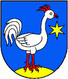
Svrčinovec
| Svrčinovec | ||
|---|---|---|
| coat of arms | map | |

|
|
|
| Basic data | ||
| State : | Slovakia | |
| Kraj : | Žilinský kraj | |
| Okres : | Čadca | |
| Region : | Kysuce | |
| Area : | 15.737 km² | |
| Residents : | 3,487 (Dec 31, 2019) | |
| Population density : | 222 inhabitants per km² | |
| Height : | 432 m nm | |
| Postal code : | 023 12 | |
| Telephone code : | 0 41 | |
| Geographic location : | 49 ° 29 ' N , 18 ° 48' E | |
| License plate : | CA | |
| Kód obce : | 509493 | |
| structure | ||
| Community type : | local community | |
| Administration (as of November 2018) | ||
| Mayor : | Renáta Majchráková | |
| Address: | Obecný úrad Svrčinovec 858 02312 Svrčinovec |
|
| Website: | www.svrcinovec.sk | |
| Statistics information on statistics.sk | ||
Svrčinovec (Hungarian Fenyvesszoros - until 1899 Szvrcsinovecz , Polish Świerczynowiec ) is a municipality in Slovakia .
location
The municipality is located in northern Slovakia, southwest of the border triangle Slovakia, Czech Republic and Poland under the Jablunka Pass on the banks of the Čierňanka River in the Kysuce region . The neighboring towns are the district town of Čadca in the south, Čierne in the east and Mosty u Jablunkova in the north in the Czech Republic .
Although the municipality is administratively not divided, there are many individual farms / small settlements (Slovakian kopanice ) around the actual place.
population
According to the 2001 census, the place had 3382 inhabitants. Of which were:
The predominant religion is the Roman Catholic with 97.37%, around 0.98% are without confession.
history
The first written mention was made in 1658 as a Wallachian settlement. In 1871 the line of the Kaschau-Oderberger Bahn was built and the place got a rail connection. Until 1918 it belonged to the Kingdom of Hungary in Trenčín County and later to the newly formed Czechoslovakia . In 1938 Poland annexed the village together with the Olsa area , but from 1939 it was again part of Slovakia .
(see Czechoslovak-Polish border conflicts , map area no. 1).
Population development
- 1784: 951 inhabitants in 136 houses
- 1828: 1558 inhabitants in 165 houses
- 1910: 1700 inhabitants
partnership
- Mosty u Jablunkova ( Mosty in Beskydy Mountains ), Czech Republic
Economy and Transport
The place lies in the Euroregion Beskydy and forms together with Čierne and Skalité the Mikroregión Kysucký triangle (Kischützer triangle).
Svrčinovec is a railway junction, as the railway line Žilina – Bohumín leads through the village to the Czech Republic and the line branches off via Skalité to Bielsko-Biała in Poland. The municipality is also a road junction. The main road I / 11 leads towards the Czech Republic and the main road I / 12 ( E 75 ) towards Poland.
Individual evidence
- ↑ a b municipal statistics . Statistical Office of the Slovak Republic. Archived from the original on August 11, 2011. Info: The archive link was inserted automatically and has not yet been checked. Please check the original and archive link according to the instructions and then remove this notice. Retrieved November 24, 2010.
