Oščadnica
| Oščadnica | ||
|---|---|---|
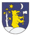
| coat of arms | map | |

|
|
|
| Basic data | ||
| State : | Slovakia | |
| Kraj : | Žilinský kraj | |
| Okres : | Čadca | |
| Region : | Kysuce | |
| Area : | 58.364 km² | |
| Residents : | 5,720 (Dec. 31, 2019) | |
| Population density : | 98 inhabitants per km² | |
| Height : | 474 m nm | |
| Postal code : | 023 01 | |
| Telephone code : | 0 41 | |
| Geographic location : | 49 ° 26 ' N , 18 ° 53' E | |
| License plate : | CA | |
| Kód obce : | 509345 | |
| structure | ||
| Community type : | local community | |
| Administration (as of November 2018) | ||
| Mayor : | Marián Plevko | |
| Address: | Obecný úrad Oščadnica Námestie Martina Bernáta 745 023 01 Oščadnica |
|
| Website: | www.oscadnica.sk | |
| Statistics information on statistics.sk | ||
Oščadnica ( Hungarian Ócsad - until 1902 Oscsadnica ) is a municipality in northern Slovakia .
geography
It is located in the Kysucké Beskydy Mountains in the valley of the Oščadnica stream below the Veľká Rača mountain , 9 km east of Čadca and about 30 km north of Žilina . There is a morally speaking minority in the village .
history
The place was first mentioned in writing in 1579, it arose from a Wallachian settlement .
In 1720 three mills and 45 households in the settlement were taxed. In 1784 391 families with 1929 inhabitants lived in 254 houses. In 1828 there were 306 houses and 2987 residents who were engaged in livestock farming and wood processing.
Economy and Transport
Today the place is a summer and winter tourist center. The Oščadnica railway station is on the Žilina – Bohumín railway line . Road 11 runs through the village as E 75 .

