Sualafeldgau
The Sualafeld or Sualafeldgau was after the Frankish conquest of Bavaria furnished in the 8th century Gau in the area around Lech Gemünd .
Origin of name
The Sualafeldgau was named after the Schwalb river , a tributary of the Wörnitz , which is why the corresponding Danube area was initially called "Schwalbfeld". However, the Franks pronounced the "swallow" as "Swala", which is why the name "Swalafeld" became naturalized.
location

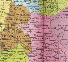
The borders to the Bavarian Nordgau to the east ran from Stepperg on the Danube via Wellheim , Dollnstein , Nennslingen and Roth to Schwabach . In the north, the Schwabach river formed the border with Rangau . Later, however, the Gau only included the southern part with areas south of the Danube. The center was probably a Franconian royal court in Gosheim .
The Radenzgau joins the Nordgau in the south with the Regnitz , the Franconian Schwabach and the Pegnitz . The Franconian Schwabach is also the border to the Suala field. An old path leads from Feuchtwangen over the Schleifenberg and further over St. Ulrich , Metzlesberg , the Obere Lottermühle , Schwaighausen , Langfurth and Ammelbruch to the Limestor near Dühren . Part of this old path coincides with the border of the former Graisbach district court against the county of Öttingen , which, according to the border descriptions of 1315, 1419 and 1594, extends to the west gable of the Feuchtwang collegiate church as a fixed point. This path separates the Franconian districts of Sualafeld and Riesgau , from which the counties Graisbach and Oettingen emerged , and must therefore be pre-Franconian.
history
For the first time in writing, the Gau, which may have arisen in the Alemannic period, was mentioned in a document from 793 in which Count Hermoin donated an area around the town of Gosheim to the Bishop of Freising . Possibly there was a Count Ortleip before this time. Only one Erlvin has been proven as Count des Gaus for the year 802. The boundaries of the Sualafeldgau cannot be precisely determined, since it was only mentioned 34 times between the years 751/52 and 1188. Only five mentions come from the 8th century.
In the year 798, after the dissolution of the Diocese of Neuburg , Gerhoh von Eichstätt managed to win the Sualafeldgau (with Heidenheim and Solnhofen ) for the Diocese of Eichstätt . The "Salafeld" was separated from the diocese of Augsburg .
When the empire was divided in 839, the Sualafeldgau was no longer part of Bavaria. Around 854 a Count Ernst I from Nordgau is mentioned, perhaps also Count in the Suala field. He fell against the Hungarians in 908 . He was followed by Ernst II, who in turn was followed by Ernst III, Ernst IV, Ernst V, Hartwig Graf in the Suala field and Guntpold Graf in the Suala field. In a document from the year 996, an Adelhard is named as a Gaugraf. What Ernst II. 1007 relates to the later Counts of Hirschberg is, in addition to the same name, the fact that he owned the Dollnstein estate in Sualafeldgau, a property that was in the hands of the Hirschbergs in the 12th century.
For a long time the Gau was owned by the Counts of Lechsgemünd . Under Heinrich II. , A certain Liutgar von Lechsgemünd was mentioned as Gaugraf in 1035 : He founded the St. Walburg Monastery in Eichstätt . In 1053, Emperor Heinrich III. the episcopal church in Eichstätt the forest and wild bans in Sualafeldgau. On May 17, 1053, he also gave Bishop Gebhard von Eichstätt some places that were all in the Sualafeldgau of Count Chuno.
In 1135, Count Heinrich von Lechsgemünd founded the Kaisheim monastery . His successor, Count Volchrad, has been handed down from 1135 to around 1145. His son Diepold was a count from 1149 to 1187, followed by the even more long-lived Berchtold I (1193–1253).
After the Counts of Lechsgemünd died out, the Sualafeldgau fell to the Wittelsbach family in 1342 .
literature
- Gerhard Köbler : Historical lexicon of the German countries. The German territories from the Middle Ages to the present. 7th, completely revised edition. CH Beck, Munich 2007, ISBN 978-3-406-54986-1 , p. 694.
Remarks
- ↑ The Sualafeld Gau (PDF; 388 kB)
- ^ Gerhard Köbler: Historical Lexicon of the German Lands. Beck, 2007, ISBN 3406549861 , pp. 66 and 264.
- ↑ http://www.historisches-lexikon-bayerns.de/artikel/artikel_45953
- ↑ http://www.geschichte-feuchtwangen.de/Funk/Funk041.htm
- ↑ This and the following according to: Yearbook of the Association for Augsburg Diocesan History 40 (2006), p. 51 ff.
- ↑ Bruno W. Häuptli: GERHOH von Eichstätt. In: Biographisch-Bibliographisches Kirchenlexikon (BBKL). Volume 26, Bautz, Nordhausen 2006, ISBN 3-88309-354-8 , Sp. 463-466.
- ↑ Christofer Zwanzig: Founding Myths of Franconian Monasteries in the Early and High Middle Ages , Steiner, 2010, p. 127, Amm. 586.
- ^ Andreas Kraus : History of Franconia up to the end of the 18th century , Vol. 1, Beck, Munich 1997, p. 225.
- ↑ Dr. W. Wegener: Genealogical tables for Central European history ; Göttingen 1962; Page 205
- ^ Karl Heinrich von Lang: Regesta sive Rerum Boicarum Autographa ad annum usque MCCC: e Regni Scriniis, Volume 1, 1822, p. 47
- ↑ Journal for Bavarian State History 28 (1965), p. 94.
- ↑ Annual report of the historical association in the Rezat district, Volume 6, p. 29
- ^ Studies on Bavarian Constitutional and Social History (1975), p. 44.
- ^ Andreas Thiele: Narrative Genealogical Family Tables. Fischer, 1991, ISBN 3894064609 , p. 22.
Web links
- Literature on Sualafeld in the Opac of the Regesta Imperii
- River Swallow (Map)
- Information on the history of the municipality on gemeinde-marxheim.de