
Huisheim
| coat of arms | Germany map | |
|---|---|---|

|
Coordinates: 48 ° 49 ' N , 10 ° 42' E |
|
| Basic data | ||
| State : | Bavaria | |
| Administrative region : | Swabia | |
| County : | Danube Ries | |
| Management Community : | Wemding | |
| Height : | 455 m above sea level NHN | |
| Area : | 22.79 km 2 | |
| Residents: | 1640 (Dec. 31, 2019) | |
| Population density : | 72 inhabitants per km 2 | |
| Postal code : | 86685 | |
| Area code : | 09080 | |
| License plate : | DON, Lower Austria | |
| Community key : | 09 7 79 167 | |
| LOCODE : | DE HUI | |
| Community structure: | 16 parts of the community | |
| Address of the municipal administration: |
Main street 10 86685 Huisheim |
|
| Website : | ||
| Mayor : | Harald Müller ( SPD ) | |
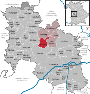
| Location of the municipality of Huisheim in the Donau-Ries district | ||
  |
||

Huisheim is a municipality in the Swabian district of Donau-Ries . The place of the same name is both the capital and the seat of the municipal administration.
geography
The Angergraben, a tributary of the Wörnitz, flows past north of the village . Nearby cities are Wemding , 6 km away, Donauwörth (13 km) and Nördlingen (16 km).
There are 16 officially named municipal parts (the type of settlement is given in brackets ):
|
|
|
There are the districts of Huisheim, Gosheim and Lommersheim.
history
Until the church is planted
In the 15./16. In the 19th century the place was under the Oberamt Alerheim of the Counts of Oettingen .
Before 1800, Huisheim was a nursing office and belonged to the Kaisheim Imperial Foundation . Since the Reichsdeputationshauptschluss of 1803 the place belongs to Bavaria. The community of Ronheim belonged to Huisheim until 1826 , after which it became independent.
Incorporations
On May 1, 1978, the previously independent municipality of Gosheim and its parts of the parish, Frühlingsmühle, Herbermühle, Kriegsstatthof, Lommersheim, Mathesmühle, Mittelmühle, Pflegeermühle, Schwalbmühle, Stadelmühle and Stoffelmühle were incorporated.
Population development
- 1961: 1274 inhabitants
- 1970: 1348 inhabitants
- 1987: 1448 inhabitants
- 1991: 1555 inhabitants
- 1995: 1625 inhabitants
- 2000: 1636 inhabitants
- 2005: 1659 inhabitants
- 2010: 1618 inhabitants
- 2015: 1570 inhabitants
Between 1988 and 2018 the community grew from 1,483 to 1,640 by 157 inhabitants or 10.6%.
politics
The community is a member of the Wemding administrative community .
mayor
Harald Müller (SPD) has been the first mayor since May 1, 2014; he is the successor to Hermann Rupprecht (SPD) and was re-elected on March 15, 2020 with 96.7%.
Municipal council
The municipal council for the 2020–2026 term of office includes three representatives each from the CSU and the Independent Voters Gosheim-Huisheim as well as two representatives each from the SPD, the party-free voter group and the young voter community.
coat of arms
|
|
Blazon : "In gold over a left-turned Moor's head with a red collar, red earring and red crown, a blue, blue-crowned capital letter K, which is accompanied by a red crescent moon and a red heraldic lily." |
Architectural monuments
Economy and Infrastructure
Economy including agriculture and forestry
In 2017, the municipal tax revenue was € 1,424,000, of which € 287,000 (net) was trade tax revenue. The largest income item was income tax participation at € 978,000.
According to official statistics, there were 84 employees subject to social insurance contributions in the municipality in 2017. Of the resident population, 678 people were in employment subject to compulsory insurance. This means that the number of out-commuters was 594 more than the number of in-commuters. 14 residents were unemployed.
In 2016 there were 40 farms. 1,373 hectares of the communal corridor were used for agriculture, of which 1,059 hectares were arable land and 314 hectares were permanent green.
education
In 2018 the following facility existed:
- Daycare center with 65 places, all of which were occupied.
Personalities
- Honorary citizen
- Walter Barsig (1932–2012), teacher and councilor
- Werner Schiedermair (* 1942 in Huisheim), ministerial official
Web links
Individual evidence
- ↑ "Data 2" sheet, Statistical Report A1200C 202041 Population of the municipalities, districts and administrative districts 1st quarter 2020 (population based on the 2011 census) ( help ).
- ^ Greetings from the 1st Mayor of Huisheim. Huisheim municipality, accessed on 23 August 2020 .
- ^ Community Huisheim in the local database of the Bavarian State Library Online . Bayerische Staatsbibliothek, accessed on September 2, 2019.
- ↑ Genealogy network
- ↑ a b c Federal Statistical Office (ed.): Historical municipality directory for the Federal Republic of Germany. Name, border and key number changes in municipalities, counties and administrative districts from May 27, 1970 to December 31, 1982 . W. Kohlhammer, Stuttgart / Mainz 1983, ISBN 3-17-003263-1 , p. 794 .
- ^ Entry on the coat of arms of Huisheim in the database of the House of Bavarian History
Gosheim with the spring mill, Herbermühle, Kriegsstatthof, Mathesmühle, Mittelmühle, Pflegeermühle, Schwalbmühle, Stadelmühle and Stoffelmühle | Huisheim with Angermühle, Haunzenmühle, Markhof and Ziegelhof | Lommersheim

Alerheim | Amerdingen | Asbach-Bäumenheim | Auhausen | Buchdorf | Daiting | Deiningen | Donauwörth | Ederheim | Ehingen am Ries | Forheim | Fremdingen | Fünfstetten | Genderkingen | Hainsfarth | Harburg (Swabia) | Hohenaltheim | Holzheim | Huisheim | Kaisheim | Maihingen | Marktoffingen | Marxheim | Megesheim | Mertingen | Mönchsdeggingen | Monheim | Möttingen | Munningen | Munster | Niederschönenfeld | Nordlingen | Oberndorf am Lech | Oettingen in Bavaria | Otting | Rain | Reimlingen | Rögling | Tagmersheim | Tapfheim | Wallerstein | Wechingen | Wemding | Wolferstadt
Unregulated areas: Dornstadt-Linkersbaindt | Ester wood