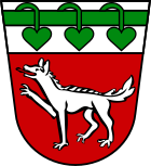
Wolferstadt
| coat of arms | Germany map | |
|---|---|---|

|
Coordinates: 48 ° 54 ' N , 10 ° 47' E |
|
| Basic data | ||
| State : | Bavaria | |
| Administrative region : | Swabia | |
| County : | Danube Ries | |
| Management Community : | Wemding | |
| Height : | 495 m above sea level NHN | |
| Area : | 30.71 km 2 | |
| Residents: | 1098 (Dec. 31, 2019) | |
| Population density : | 36 inhabitants per km 2 | |
| Postal code : | 86709 | |
| Area code : | 09092 | |
| License plate : | DON, Lower Austria | |
| Community key : | 09 7 79 231 | |
| Community structure: | 10 parish parts | |
| Address of the municipal administration: |
Doeckinger Str. 1 86709 Wolferstadt |
|
| Website : | ||
| Mayor : | Philipp Schlapak (Christian voter community) | |
| Location of the community Wolferstadt in the district of Donau-Ries | ||
Wolferstadt is a municipality in the Swabian district of Donau-Ries and a member of the Wemding administrative community .
geography
Wolferstadt lies on the edge of the Hahnenkamm in the Augsburg planning region .
The municipality has 10 officially named parts of the municipality (the type of settlement is given in brackets ):
|
|
There are the districts Hagau, Wolferstadt and Zwerchstrasse.
history
Until the church is planted
The place, once part of the Franconian Sualafeldgau , was part of the Graisbach County , then fell to the Duchy of Bavaria-Landshut , became part of the Principality of Palatinate-Neuburg in 1505 and finally became part of the Kingdom of Bavaria in 1808 . It formed a closed Hofmark under the rule of the cathedral chapter of Eichstätt, which ended in 1803 with the secularization . In the course of the political reorganization of Bavaria under Count Montgelas , today's community was created with the community edict of 1818 .
Incorporations
On January 1, 1974, the previously independent community of Zwerchstrasse was incorporated. Hagau was added on May 1, 1978.
Population development
Between 1988 and 2018 the municipality grew from 1,017 to 1,075 by 58 inhabitants or 5.7%.
- 1961: 944 inhabitants
- 1970: 968 inhabitants
- 1987: 995 inhabitants
- 1991: 1030 inhabitants
- 1995: 1074 inhabitants
- 2000: 1103 inhabitants
- 2005: 1132 inhabitants
- 2010: 1101 inhabitants
- 2015: 1080 inhabitants
politics
Philipp Schlapak (Christian Voters' Association) has been mayor since May 1, 2014; he was confirmed in office on March 15, 2020 with 91% for a further six years. His predecessor Xaver Schnierle ( CSU ) was 36 years old, from 1978 to 2014. The municipal council for the 2020–2026 term of office includes seven members of the CSU and JU and five members of the Wolferstadt Christian Voters' Association. The municipal tax revenue in 2017 was € 759,000, of which € 128,000 (net) was trade tax revenue.
Architectural monuments
Economy and Infrastructure
Economy including agriculture and forestry
In 2017, according to official statistics, there were 75 employees subject to social security contributions at the place of work. There were a total of 461 employees at the place of residence subject to social insurance contributions. This means that the number of out-commuters was 386 greater than that of in-commuters. Seven residents were unemployed. In 2016 there were 48 farms; In 1999 there were still 72. 1585 hectares of the community area were used for agriculture, of which 1146 hectares were arable land and 438 hectares were permanent green space.
education
In 2018 there were the following institutions:
- Johannes Kraus day care center with 62 places and 42 children, four of them under three years of age
- Primary school with four teachers, four classes and 76 students
Sons and daughters of the church
- Richard Auer (* 1965), crime writer and journalist
Web links
- Website of the community of Wolferstadt
- Entry on the coat of arms of Wolferstadt in the database of the House of Bavarian History
Individual evidence
- ↑ "Data 2" sheet, Statistical Report A1200C 202041 Population of the municipalities, districts and administrative districts 1st quarter 2020 (population based on the 2011 census) ( help ).
- ^ Community Wolferstadt in the local database of the Bayerische Landesbibliothek Online . Bayerische Staatsbibliothek, accessed on September 1, 2019.
- ↑ a b c Federal Statistical Office (ed.): Historical municipality directory for the Federal Republic of Germany. Name, border and key number changes in municipalities, counties and administrative districts from May 27, 1970 to December 31, 1982 . W. Kohlhammer, Stuttgart / Mainz 1983, ISBN 3-17-003263-1 , p. 792 and 794 .


