
Dead life
| coat of arms | Germany map | |
|---|---|---|

|
Coordinates: 51 ° 10 ′ N , 10 ° 45 ′ E |
|
| Basic data | ||
| State : | Thuringia | |
| County : | Unstrut-Hainich district | |
| Height : | 211 m above sea level NHN | |
| Area : | 5.07 km 2 | |
| Residents: | 134 (Dec 31, 2019) | |
| Population density : | 26 inhabitants per km 2 | |
| Postal code : | 99947 | |
| Area code : | 036043 | |
| License plate : | UH, LSZ, MHL | |
| Community key : | 16 0 64 062 | |
| Address of the municipal administration: |
Hauptstrasse 47 99947 Tottleben |
|
| Website : | ||
| Mayor : | Steffen Mörstedt ( FW ) | |
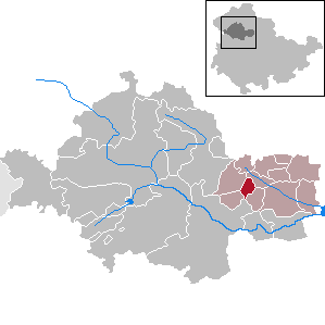
| Location of the community of Tottleben in the Unstrut-Hainich district | ||
  |
||

Tottleben is a municipality in the Unstrut-Hainich district in Thuringia . It belongs to the Bad Tennstedt administrative community based in the city of Bad Tennstedt .
geography
The community of Tottleben is 7.11 km by road from the western edge of Bad Tennstedt at an altitude of 210-315 meters. The L 2127 runs through the village, which connects it with the neighboring village of Großurleben in the southeast and with Kirchheilingen in the northwest. The Dorfbach winds coming from Kirchheilingen, southeast by the local situation and leads to 500 m from the left in the Singer stream that flows Großurleben.
history
The community was first mentioned in a document in 988 . The place belonged to the Electoral Saxon Office Langensalza until 1815 and after its cession to Prussia from 1816 to 1944 to the district of Langensalza in the province of Saxony .
In 1913 the private Langensalzaer Kleinbahn was built by house summer residents to Langensalza via Tottleben. This was completely dismantled in 1967 from Haussummer to Kirchheilingen and in 1969. An old diesel locomotive is a reminder of this railway line.
The Saxon-Thuringian barons of Tottleben , whose most famous son General Gottlob Curt Heinrich von Tottleben (1715–1773) served in Saxon and Russian services, came from this place.
politics
Municipal council
The municipal council of Tottleben consists of six council members, all of whom belong to the “FWG fire brigade” (status: local election on May 26, 2019 ).
mayor
The honorary mayor Steffen Mörstedt was re-elected on June 5, 2016.
Culture and sights

The most striking sight of the place is the village church of St. Anna . The parish belongs to the parish church of Heilingen in the evangelical church district of Mühlhausen.
Personalities
Gottlob Curt Heinrich von Tottleben (1715–1773)
Individual evidence
- ^ Population of the municipalities from the Thuringian State Office for Statistics ( help on this ).
- ↑ Langensalzaer Kleinbahn Part 2: From Thamsbrück to Haussommern , accessed on May 29, 2020
- ↑ City council election 2019 in Thuringia. Thuringian State Office for Statistics, accessed on July 7, 2019 .
- ↑ Mayoral elections in Thuringia. Thuringian State Office for Statistics, accessed on July 7, 2019 .
Web links
Anrode | Bad Langensalza | Bad Tennstedt | Ballhausen | Blankenburg | Bruchstedt | Dünwald | Greater Vargula | House summer | Autumn life | Hornsummer | Kammerforst | Kirchheilingen | Grains | Kutzleben | Marolterode | Menteroda | Midsummer | Mühlhausen / Thuringia | Nottertal-Heilinger Heights | Oppershausen | Rodeberg | Schönstedt | Südeichsfeld | Sundhausen | Dead life | Unstrut-Hainich | Unstruttal | Primeval life | Bailiwick