
Nottertal-Heilinger Heights
| coat of arms | Germany map | |
|---|---|---|
 Help on coat of arms |
Coordinates: 51 ° 14 ' N , 10 ° 39' E |
|
| Basic data | ||
| State : | Thuringia | |
| County : | Unstrut-Hainich district | |
| Fulfilling municipality : | for grains for Marolterode |
|
| Height : | 243 m above sea level NHN | |
| Area : | 75.95 km 2 | |
| Residents: | 5760 (Dec. 31, 2019) | |
| Population density : | 76 inhabitants per km 2 | |
| Postal code : | 99994 | |
| Primaries : | 036021, 036043 | |
| License plate : | UH, LSZ, MHL | |
| Community key : | 16 0 64 077 | |
| City structure: | 6 districts | |
City administration address : |
Markt 1 99994 Nottertal-Heilinger Heights |
|
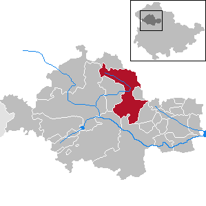
| Location of the city of Nottertal-Heilinger Heights in the Unstrut-Hainich district | ||
  |
||

The town of Nottertal-Heilinger Höhen is a rural community in the Thuringian Unstrut-Hainich district , which was created on December 31, 2019 through the merger of the town of Schlotheim and the communities of Bothenheilingen , Issersheilingen , Kleinwelsbach , Neunheilingen and Obermehler . The city is a fulfilling community for Körner and Marolterode .
geography

Nottertal-Heilinger Heights is located in the middle of Germany and in the northwest of the Thuringian Basin . The Schlotheimer Graben , a rift valley running from northwest to southeast ( Hercynian ) determines the topography of the city. In its northern part the Notter , a tributary of the Unstrut, flows from the foothills of the Dün , in the southern part the Marolteroder Bach, which is framed by the Heilinger Heights and flows into the Notter in Schlotheim.
The lowest point is in the south of the city west of Kleinwelsbach in the valley of the Welsbach at 190 meters, the highest at the northern tip of the urban area on state road 2096 near Menteroda at 436 meters.
The town of Nottertal-Heilinger Höhen consists of six districts that correspond to the original communities. Schlotheim's districts of Mehrstedt and Hohenbergen lost their district status, but can regain it from 2024.
Nottertal-Heiliger Höhen borders, starting in the north and in a clockwise direction, with the following cities and communities: Menteroda , Holzsussra , Ebeleben , Marolterode , Kirchheilingen , Bad Langensalza , Unstrut-Hainich , Körner and Mühlhausen / Thuringia .
history
The member communities of the Schlotheim administrative community had debts of around 45 million euros at the end of 2017, so that investments were only possible to a limited extent. The possibility of forming a rural community relieves the communities of a large part of their debts, for example the city of Schlotheim by almost 90%, thanks to debt relief under the Thuringian Community Reorganization Financial Aid Act (ThürGNGFG).
The municipalities of Körner and Marolterode decided against joining the rural municipality in 2018, even if this did not take their debt burden off.
The name of the new city is a compromise of the merging communities, in which as many of them as possible should be able to recognize each other. There was "at all citizens' meetings [...] incomprehension about the chosen name of the new rural community to be founded". An application to use the name “Schlotheim” instead did not find the necessary unanimous support from the communities.
According to the Thuringian law on the voluntary reorganization of municipalities belonging to the district in 2019, the new municipalities came into force on December 31, 2019. The law was adopted by the state parliament on September 12, 2019.
traffic
Nottertal-Heilinger Höhen is on the federal highway 249 ( Mühlhausen / Thuringia - Ebeleben - Sondershausen ). The federal road 84 (Ebeleben - Bad Langensalza ) forms part of the eastern municipal boundary. Further state and district roads complete the road network.
The nearest train stations are in Mühlhausen / Thuringia and Bad Langensalza on the Gotha – Leinefelde and Erfurt – Bad Langensalza lines .
The Obermehler-Schlotheim airfield in the north of the municipality can only be approached by visual flight .
Web links
proof
- ^ Population of the municipalities from the Thuringian State Office for Statistics ( help on this ).
- ↑ Thuringian law on the voluntary reorganization of municipalities belonging to the district in 2019 and on the adjustment of organizational regulations in the Thuringian law and regulation gazette No. 11/2019 of October 18, 2019, p. 385 ff., Accessed on October 22, 2019
- ↑ a b c Schlotheimer Kurier - Official Journal of the Schlotheim Administrative Community , Volume 25, Number 14 , Page 6, from July 11, 2019, accessed on October 16, 2019
- ↑ a b Verwaltungsgemeinschaft Schlotheim: Formation of a rural community - current development at www.vg-schlotheim.de, accessed on October 16, 2019
- ↑ Martin Lindner: Neue Landgemeinde ohne Körner and Marolterode on www.tlz.de from November 17, 2018, accessed on October 16, 2019
Anrode | Bad Langensalza | Bad Tennstedt | Ballhausen | Blankenburg | Bruchstedt | Dünwald | Greater Vargula | House summer | Autumn life | Hornsummer | Kammerforst | Kirchheilingen | Grains | Kutzleben | Marolterode | Menteroda | Midsummer | Mühlhausen / Thuringia | Nottertal-Heilinger Heights | Oppershausen | Rodeberg | Schönstedt | Südeichsfeld | Sundhausen | Dead life | Unstrut-Hainich | Unstruttal | Primeval life | Bailiwick