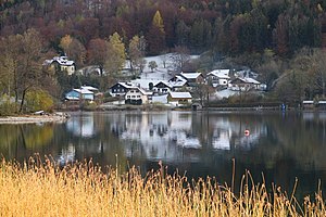
Wiesenau (municipality of Sankt Gilgen)
| Wiesenau ( Rotte ) | ||
|---|---|---|
|
|
||
| Basic data | ||
| Pole. District , state | Salzburg area (SL), Salzburg | |
| Judicial district | Thalgau | |
| Pole. local community | Sankt Gilgen ( KG Oberburgau ) | |
| Locality | Oberburgau | |
| Coordinates | 47 ° 48 '10 " N , 13 ° 26' 57" E | |
| height | 482 m above sea level A. | |
| Building status | 22 (addresses 2017 ) | |
| Post Code | 4866 Unterach | |
| Statistical identification | ||
| Counting district / district | Unterburgau - Oberburgau (50 330 002) | |
 Wiesenau at the southeast end of the Mondsee |
||
| Source: STAT : index of places ; BEV : GEONAM ; SAGIS | ||
Wiesenau is a locality in Mondseeland in the Salzburg part of the Salzkammergut and belongs to the municipality of Sankt Gilgen in the Salzburg-Umgebung district .
geography
Wiesenau is located 30 kilometers east of the city of Salzburg . It is located about 9 kilometers southeast of the Mondsee market and 3 kilometers west of Unterach am Attersee at the southeast end of the Mondsee ( 481 m above sea level ) and on the Seeache , the stream from the Mondsee to the Attersee . The location includes the shoreline below Weinkogel ( 1181 m above sea level ) and Ackerschneid ( 1119 m above sea level ), two foothills at the northern foot of the Schafberg of the Salzkammergut mountains . The Schafberg massif breaks steeply into the lake in the walls of the Kienberg ( 947 m above sea level ) to Ackerschneid. Opposite rises the high plateau of the Mondsee Flysch Mountains .
The small locality right on the Upper Austrian border includes around 20 addresses. The Kienbergwandstraße (L217) leads through the village and joins the B151 Attersee Straße at the village of See . In terms of traffic geography, the place is isolated from its municipal capital Sankt Gilgen , 7 kilometers southeast, by the Scharflinger Höhe and the Kienbergwand.
|
Marienau Mondsee |
lake (all according to Unterach a. A. ,
|
Au |
| Cross stone |

|
Latvian rennet cutter |
| Eisenaueralm |
History, infrastructure and sights
Wiesenau is one of the Salzburg possessions on the Mondsee and Attersee lakes, while Burgau is part of the Hüttenstein rulership , which had been disputed with the Mondsee Monastery and then with Austria since the Middle Ages and was only finally clarified with a state treaty in 1689. Postal and parish, however , the place belongs to the Upper Austrian Unterach.
Until the 19th century, the place was hardly accessible from the Salzburg side due to the impassable Kienbergwand, and the whole of Unterach was also very isolated. The main route of transport was by boat , to Hüttenstein only the high path behind the Kienberg (Holzingeralm - Plankenmoos) led. Here by the lake there were only a few farms that lived primarily from fishing ( Grauvitz now gone, Muthlehen, Förster ). The prince- Forsthaus Oberburgau in Wiesenau was built in 1761, it is now a protected monument ( list entry ). Kienbergwand-Strasse with its tunnels was not built until 1896 , and it was not until 2004 that it was brought up to date with a new tunnel.
Today the headquarters of an international drug manufacturer (EVER Neuro Pharma) is located here. Tourism plays a relatively minor role compared to the other lake resorts, but there are little-visited public bathing areas that are an insider tip despite the shade. A hiking trail starts in the village and leads over the Eisenaueralm and the Himmelspfortsteig to the Schafberg.
Web links
- 50330 - Sankt Gilgen. Community data, Statistics Austria .
Individual evidence
- ^ A b Alfred Mück: Unterach am Attersee. History of a Salzkammergut summer retreat. In: Yearbook of the municipal museum in Wels 1936, Wels 1936. Chapter Die Salzburgische Burgau. P. 56–60 (full article p. 29–155; first part (PDF) in the forum OoeGeschichte.at; there p. 31 ff.)
- ↑ Carl Schuch: Mondsee with Drachenwand, seen from Wiesenau. Oil painting, around 1869 ( zeno.org ).


