Witzelroda
|
Witzelroda
Community Moorgrund
Coordinates: 50 ° 49 ′ 28 ″ N , 10 ° 17 ′ 14 ″ E
|
|
|---|---|
| Height : | 272 m |
| Residents : | 527 (December 31, 2017) |
| Incorporation : | March 25, 1994 |
| Postal code : | 36433 |
| Area code : | 03695 |
|
Witzelroda with Neuendorf
|
|
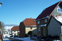
Witzelroda is part of the municipality of Moorgrund in the Wartburg district in Thuringia, which was formed in 1994 as part of an administrative reform . Until 1950 the western district of Neuendorf was an independent municipality. In 2008, Witzelroda celebrated the site's 850th anniversary. 527 residents currently live in Witzelroda and the associated village of Neuendorf (as of December 31, 2017).
geography
Geographical location
The municipality of Witzelroda is located in the moorland , a natural depression between the western Thuringian Forest and the Werra valley near Bad Salzungen .
Neighboring municipalities and towns
Witzelroda has belonged to the municipality of Moorgrund since the regional reform of October 7, 1994. It borders in the southeast on Barchfeld , in the southwest on the city of Bad Salzungen, followed by the Moorgrund communities of Graefen-Nitzendorf , Möhra and Gumpelstadt in the west, north and east . To the east, Witzelroda also borders the Profisch district of the Schweina community .
mountains
The landscape around Witzelroda is determined in the northeast by the ridge line of the Thuringian Forest with the Rennsteig and the striking Windsberg and in the south by the Pleßberg .
The highest point in the community is the Hohleberg ( 366.6 m above sea level ). Also noteworthy are the mountains and hills Frankenstein ( 342.7 m above sea level ), Klosterberg ( 316.3 m above sea level ), Fischberg ( 295.4 m above sea level ), Mäuseberg ( 290.1 m above sea level ) and the iceberg ( 289.8 m above sea level ).
Rivers
The place names Möhra and Moorgrund were once derived from an extensive wetland area that emerged as a moor after the last ice age and which was largely drained only in the 1970s. The Moorbach is a main tributary of the Fischa , which was given the name Fischgraben after the canalisation and which flows into the Werra as a right tributary at Barchfeld . The approximately 2 hectare Michelsteich is located south-east of the Witzelroda location. It is used as a fish pond .
history
The municipality of Witzelroda is very closely linked to the history of the neighboring town of Bad Salzungen. The place was originally owned by the Lords of Frankenstein , came to the Counts of Henneberg in 1330 and from them to the House of Wettin in 1353 . After the Thirty Years' War , the town and the Salzungen office came to the Duchy of Saxony-Meiningen in 1680 , and the district of Meiningen was created during the administrative reform in 1868 . After the abdication of Duke Bernhard III. on November 10, 1918, the Duchy of Meiningen became the Free State of Saxony-Meiningen , which continued until 1920. In 1950 the place Witzelroda was included in the newly created Bad Salzungen district .
First mention
After a chapel already existed in the local area of Witzelroda around 1158 (the reason for the 850th anniversary), the first documented mention of the place in the spelling Wezilnroda took place on July 18, 1259. This document is the neighboring Breitungen monastery obliged by the lord of the castle Ludwig von Frankenstein as the owner to donate part of the income from the use of the Fischa brook to the church in Wezilnroda . The street name Kapelle reminds of this first church or chapel .
The western district of Neuendorf , which was only incorporated into Witzelroda in 1950 , was first mentioned in a document in 1330 with the neighboring villages of Gräfendorf and Nitzendorf .
Witzelroda in the Middle Ages
These places and also Witzelroda belonged in the Middle Ages to the castle district of the high medieval Frankenstein Castle - ancestral seat of a branch of the Henneberg counts . The nunnery Allendorf, richly wealthy in the Bad Salzungen region, was built below the castle from 1272 onwards . Most of the surrounding villages passed into the possession of the monastery in the 14th century after the violent destruction of Frankenstein Castle. The field names Frankenstein and Klosterberg are reminiscent of this time.
The landscape around Witzelroda was bounded by an extensive moor in the north and west for centuries. The trade was therefore directed in a wide arc around the places. The church that now exists in Witzelroda has been built since 1506 and a pastor was mentioned for the first time. The Salzunger Forste and the forests of the neighboring towns had to deliver firewood and later also thorn bushes for the operation of the Salzunger Saline until the 19th century . The woods near Neuendorf, which are mostly used as Hauwald , were given the descriptive name Heckenwald , as the trees that grew back usually did not grow larger than hedges before they were felled again.
Modern times
The Protestant theologian, philosopher and philologist Johann Faccius was born in Witzelroda in 1698.
The important connection to the trunk road network took place for the first time in 1840 with the construction of a road from Eisenach via Gumpelstadt and Barchfeld to Breitungen, Wasungen and Meiningen . This road became the forerunner of today's Bundesstraße 19 .
After 1820, the Gumpelstädter head forester Trautwein, a pupil of the Oberforstrat Heinrich Cotta , ensured that the farmers in the communities bordering the moorland received new cultivation areas and meadows through amelioration and soil fertilization. He had a dense network of drainage ditches built, dirt roads expanded and promoted the establishment of orchards and beekeeping. In 1841 a state treaty between the states of Saxe-Weimar-Eisenach , Saxe-Coburg and Gotha as well as Saxe-Meiningen for the construction of a railway line from Eisenach to Coburg was concluded and construction plans for the layout of the so-called Werra Railway were examined. The route variant via Immelborn was finally implemented in the Bad Salzungen area.
From 1875 the residents in Witzelroda were able to move into a newly built schoolhouse, in the same year the parish lost the parish, which was transferred to Gumpelstadt. In a major fire on September 19, 1888, nine farms were cremated and 68 residents were temporarily homeless. At the instigation of Duke Georg II, Duke of Meiningen, the art ruin Burg Frankenstein was built on the summit of the Frankenstein in 1891 as an important excursion destination with a small observation tower .
In 1914 the first houses in Witzelroda received an electricity connection, the first water pipeline was laid in 1930, which made the numerous pump wells superfluous. In the 1930s Witzelroda had about 400 inhabitants.
During the last days of the Second World War in April 1945, the place was surrendered without a fight and so remained without major damage. On June 5, 1945 there was a tragic accident involving found ammunition, in which five children from the village who were playing with a grenade were killed.
The neighboring town of Neuendorf to the west was incorporated on July 1, 1950, and the Bad Salzungen district was formed. In 1955 there were 582 inhabitants. In 1979 and 1985, two farmhouses from Witzelroda were converted into today's Henneberg open-air museum, Kloster Veßra , as examples of the Henneberg framework .
On March 25, 1994 the communities of Gumpelstadt, Waldfisch and Witzelroda were dissolved and merged to form the new community of Moorgrund.
Culture and sights
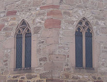
In 2008, the municipality of Witzelroda celebrated its 850th anniversary with a large parade. Sights in the community include the Frankenstein Castle ruins and the St. Andreas Church .
traffic
Road traffic
The B 19 runs through the village in the Eisenach– Breitungen / Werra – Meiningen section. The L 1121 Bad Salzungen - Neuendorf - Witzelroda also runs through the village .
Rail transport
The nearest train stations are on the Werra Railway in the district town of Bad Salzungen and in Oberrohn, seven kilometers away . Passenger traffic is carried out by the Süd-Thüringen-Bahn .
Bus transport
The following bus lines run by the Verkehrsgesellschaft Wartburgkreis mbH run to Witzelroda
| line | Driving distance |
|---|---|
| L-104 | Bad Salzungen - Immelborn - Barchfeld - Witzelroda - Gumpelstadt - Möhra |
| L-105 | Bad Liebenstein - Schweina - Barchfeld - Witzelroda - Gumpelstadt - Möhra |
| L-135 | Bad Salzungen - Immelborn - Barchfeld - Witzelroda - Gumpelstadt - Etterzüge - Eisenach |
economy
The inhabitants of the municipality of Witzelroda mainly work in the companies in the neighboring district town of Bad Salzungen and in the surrounding municipalities. In the village there is a location of the agricultural cooperative Moorgrund , which operates agriculture and animal husbandry according to ecological aspects.
Web links
Individual evidence
- ↑ http://www.moorgrund.de/scripts/angebote/3676?ortsfilter=39010&main_aktiv=main_aktiv2&sub_aktiv=sub_aktiv8
- ^ Thuringian Land Surveying Office: Wartburg district and district-free city of Eisenach. Erfurt 2002, ISBN 3-86140-250-5 .
- ↑ a b Thuringian Land Survey Office TK25 - sheet 5127 Bad Salzungen. Erfurt 1997, ISBN 3-86140-063-4 .
- ↑ Ludwig Bechstein , Georg Brückner (Ed.): Hennebergisches Urkundenbuch. Part II: The documents from ... 1330 to 1365. Meiningen 1847.
- ↑ Otto Hartmann: Local history from the Moorgrunddorf Witzelroda. In: Altensteiner Blätter. Yearbook 1993, pp. 145f.
- ↑ a b c Luck: Witzelroda farming village on the edge of the moorland. In: Altensteiner Blätter. Yearbook 1992, p. 95 ff.
- ^ Frankensteinverein (ed.): Salzungen - Historical foray through the Salzunger Land. Bad Salzungen 1992, p. 29f.
- ^ Otto Hartmann: Graefen-Nietzendorf - a moorland idyll. In: Altensteiner Blätter. Yearbook 1999/2000, p. 78.
- ↑ Schilling zu Dreyzigeracker: Agricultural remarks on the Meininger Unterland- In: Contributions to the teutschen Landwürthschaft and their auxiliary sciences. Bonn 1824, p. 63ff.
- ^ Frankensteinverein (ed.): Salzungen - Historical foray through the Salzunger Land. Bad Salzungen 1992, p. 39.
- ^ Michael Rademacher: German administrative history from the unification of the empire in 1871 to the reunification in 1990. Population figures. (Online material for the dissertation, Osnabrück 2006).
- ^ Paul Luther: Materials for local history lessons - Bad Salzungen district, Suhl district . Ed .: Council of the Bad Salzungen District, Department of Public Education. Bad Salzungen 1959, structure of the district of Suhl (overview of the places and population of the districts), p. 5-11 .
- ↑ Hennebergisches Freilichtmuseum Kloster Veßra with converted half-timbered houses from Witzelroda ( Memento of the original from February 29, 2016 in the Internet Archive ) Info: The archive link was inserted automatically and has not yet been checked. Please check the original and archive link according to the instructions and then remove this notice.
- ^ Thuringian ordinance on the dissolution and amalgamation of the communities Gumpelstadt, Waldfisch and Witzelroda of February 25, 1994
- ↑ Timetable of the Verkehrsgesellschaft Wartburgkreis mbH


