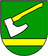
Závada (Humenné)
| Závada Завада |
||
|---|---|---|
| coat of arms | map | |

|
|
|
| Basic data | ||
| State : | Slovakia | |
| Kraj : | Prešovský kraj | |
| Okres : | Humenné | |
| Region : | Horný Zemplín | |
| Area : | 9.03 km² | |
| Residents : | 64 (Dec. 31, 2019) | |
| Population density : | 7 inhabitants per km² | |
| Height : | 330 m nm | |
| Postal code : | 094 08 ( Ruská Poruba Post Office ) | |
| Telephone code : | 0 57 | |
| Geographic location : | 49 ° 10 ' N , 21 ° 47' E | |
| License plate : | HE | |
| Kód obce : | 529273 | |
| structure | ||
| Community type : | local community | |
| Administration (as of November 2018) | ||
| Mayor : | Miluška Hlavatá | |
| Address: | Obecný úrad Závada 62 09408 Ruská Poruba |
|
| Statistics information on statistics.sk | ||
Závada ( Russian Завада / Zawada ; Hungarian Hegyzávod - until 1902 Zavada ) is a municipality in eastern Slovakia .
It is located in the Ondavská vrchovina mountains on the upper reaches of the Sitnička and was first mentioned in writing in 1454.
The place was created by a locator who settled Wallachian settlers here between 1430 and 1454. The settlement then belonged to the rule of Stropkov , in 1600 there were ten houses and one mayor , in 1715 only six houses and five years later only five. However, there was a recovery in population, in 1828 there were again 30 houses with 230 residents.
Until 1918 the municipality in Semplin County was part of the Kingdom of Hungary , after which it came to the newly formed Czechoslovakia and has been part of what is now Slovakia since 1993.
During the fighting around the Duklapass in the Second World War , the place suffered badly.
Worth seeing in the place are the Orthodox church from the 17th century as well as the Greek-Catholic church, which was built at the beginning of the 20th century.
