Autoroute A 52
| Autoroute A52 in France | |||||||||||||||||||||||||

|
|||||||||||||||||||||||||
| map | |||||||||||||||||||||||||
| Basic data | |||||||||||||||||||||||||
| Operator: | Escota | ||||||||||||||||||||||||
| Overall length: | 26 km | ||||||||||||||||||||||||
|
Regions : |
|||||||||||||||||||||||||
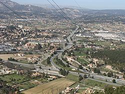
| The A 52 near Aubagne | |||||||||||||||||||||||||
|
Course of the road
|
|||||||||||||||||||||||||
The Autoroute A 52 is a French motorway beginning in Aix-en-Provence and ending in Aubagne . It has a total length of 26 km.
history
- August 29, 1974: La Bouillardisse - Pont-de-l'Etoile opens (exit 33 - A 501)
- December 16, 1975: Opening of Pont-de-l'Etoile - Aubagne-sud-est (A 501 - A 50)
- March 21, 1978: opening of Châteauneuf-le-Rouge - La Bouillardisse (A 8 - exit 33)
Big cities on the highway
Web links
- Autoroute A 52 in German and French version of the SARATLAS
- Autoroute A 52 on WikiSara (French)


