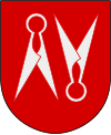
Borås (municipality)
| Borås municipality | |||||
|---|---|---|---|---|---|
|
|||||
| State : | Sweden | ||||
| Province (län): | Västra Götalands län | ||||
| Historical Province (landskap): | Västergötland | ||||
| Main place: | Borås | ||||
| SCB code: | 1490 | ||||
| Residents : | 113,179 (December 31, 2019) | ||||
| Area : | 967.5 km² (January 1, 2016) | ||||
| Population density : | 117 inhabitants / km² | ||||
| Postal code : | 501 10 - 508 99 | ||||
| Website : | www.boras.se | ||||
| List of municipalities in Sweden | |||||
Coordinates: 57 ° 43 ' N , 12 ° 57' E
Borås is a municipality ( Swedish kommun ) in the Swedish province of Västra Götalands län and the historic province of Västergötland . The main town of the municipality is Borås .
history
Borås Municipality was formed in 1971 through the amalgamation of Borås City and Brämhult Rural Municipality. In 1974 more parishes from the area were added, with the parish of Bollebygd being spun off again in 1995 .
Before the merging of Älvsborgs län , Skaraborgs län and Göteborgs och Bohus län to Västra Götalands län , Borås belonged to the province of Älvsborg.
places
The following localities ( tatorter ) have at least 200 inhabitants (in brackets, as of December 31, 2017):
|
|
Twin cities
-
 Germany : Espelkamp , since 1995
 -
 Norway : Molde , since 1944
 -
 Finland : Mikkeli , since 1940
 -
 Denmark : Vejle , since 1947
Web links
Commons : Borås Municipality - collection of images, videos and audio files
Individual evidence
- ↑ Folkmängd i riket, län och kommuner December 31, 2019 at Statistiska centralbyrån
- ↑ Kommunarealer January 1, 2016 at Statistiska centralbyrån (including all inland waters)
- ↑ Borås website - Invånare i tatorter 2017 ( Swedish ), accessed on December 5, 2018


