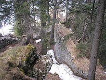
Hohenwaldeck Castle
| Hohenwaldeck Castle | ||
|---|---|---|
|
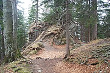
The northern part of the ruin from the lookout point |
||
| Creation time : | Late 13th century | |
| Castle type : | Höhenburg, spur location | |
| Conservation status: | ruin | |
| Standing position : | Ministeriale | |
| Construction: | Humpback cuboid | |
| Place: | Schliersee - Neuhaus | |
| Geographical location | 47 ° 42 '55.4 " N , 11 ° 52' 35.4" E | |
| Height: | 986 m above sea level NHN | |
|
|
||
The Hohenwaldeck castle ruin is the ruin of a hilltop castle 470 meters east of the southern part of the Schliersee , near the village of Neuhaus , at 986 m above sea level. NHN . It rises 209 meters above the lake level. The castle ruins can be reached from the high-altitude hiking trail between Schliersee and Neuhaus.
The fortress was built towards the end of the 13th century by the Lords of Waldeck . The Waldecker were originally servants of the Diocese of Freising , but were able to build a largely independent rule after the new construction of the Spornburg .
In the 16th century, after the death of the last Waldecker, the possessions came into the hands of the Lords of Maxlrain . At that time, however, the castle was already in ruins. In particular, a rock fall in 1480 had destroyed the buildings.
history
The Lords of Waldeck are first documented in the middle of the 11th century as servants of the Diocese of Freising. The eponymous residence of this Servientes Ecclesia Frisingensis has been preserved as the Burgstall south of Bad Aibling (Burgstall Altenwaldeck ). In the 13th century, the Waldeckers were considered the most influential vassals of the Freising Cathedral monastery. The family was given the highest secular offices in the diocese. Despite this appreciation, the family began to build up their own, independent domain around the Schliersee with the rule of Waldeck . Towards the end of the 13th century, the construction of the large Hohenwaldeck castle complex over the lake began.
As a result, there was already an open confrontation with the diocese at the beginning of the 14th century. In 1312 Arnold von Waldeck destroyed the episcopal castle in Miesbach. During the subsequent peace negotiations, Freising had to give up sovereignty over the Waldecker's property.
The now largely independent rule of Waldeck was fragmented over the next two centuries by divisions within the family. Under Georg von Waldeck, imperial immediacy was nevertheless achieved in 1454 , so the last ties to the diocese could also be broken. The Habsburgs probably wanted to prevent the occupation of the area by the Wittelsbachers by upgrading the rule to an imperial fief. The Schliersee is only a few kilometers from the beginning of the Habsburg possessions in Tyrol .
As early as 1483, the Count of Waldeck family died out. The Bavarian dukes then began a decade-long legal dispute with the heirs in order to take over the rule of Waldeck. Significantly, the imperial court supported the heirs against Duke Albrecht the Wise.
Hohenwaldeck Castle above the Schliersee had not been used for a long time. Georg von Waldeck (died 1380) was probably the last knightly resident of the castle. After his death the official seat of the rulership was moved to Schliersee. With the death of the noble family by Wolfgang von Waldeck (d. 1483), the abandoned castle passed to his daughter Ehrentraut and her husband Hieronymus von Seyboltsdorf to the lords of Seiboldsdorf in 1497 . Around this time, a massive rock fall must have made the fortress finally uninhabitable.
In 1516 Wolfgang von Maxlrain finally acquired the shares of his co-heirs. His son Wolf Dietrich von Maxlrain openly admitted that he was a supporter of Martin Luther . The Maxlrainers were considered one of the richest aristocratic houses in Upper Bavaria. The Hohenwaldeck estate was administered from the Maxlrain family residences near Aibling and Wallenburg an der Schlierach .
In 1568 Philipp Apian was only able to report on the " ruins of an ancient castle called Waldegk ". " Giant trees have grown up within its walls " (Topographia Bavariae). Wiguläus Hundt even suspected a pre-medieval origin of the ruin in 1585: " a very old Haidnisch Gemäur, high on Pergen, in such a way that in several hundred years there would have been no apartment " (Bayrisch Stammen Buch).
In 1734, after the Maxlrainers died out, the rule was handed over to the Electorate of Bavaria . The county was dissolved in 1803 and converted into a district court .
description
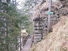
The castle is located high above the Schliersee on a rocky mountain spur in front of the western flank of the Leitnerberg. In the east, a shallow depression protects the Burgplatz. Behind the grave similar incision, the radicals have one to a rock Stock the keep or residential tower obtained. Passing the well-preserved south side of the tower, a wooden walkway leads into the interior of the castle.
The large humpback cubes on the edges of the front tower indicate that it was built in the late 13th or early 14th century. An exact dating would only be possible through an elaborate building survey, as humpback cubes were still used in defense construction in the late Middle Ages and the early modern period.
From the early 19th century onwards, all of the large humpback ashlar towers were incorrectly dated to Roman times . This misinterpretation persists in part to the present day. The information board on the front tower of the ruin reports that the remains of the wall were supposed to have Roman origins.
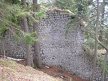
The tower is about six meters high in the south and east. According to Weithmann , traces of a high entrance should be preserved on the south side . The north and west walls are completely missing.
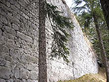
In addition to the tower ruins, large parts of the surrounding wall made of limestone blocks of different sizes and rubble stones have been preserved around the castle plateau . The ruins are still up to eight meters high. The walls are not broken by any window or light openings. Whether it is a curtain wall or the outer walls of buildings cannot be clearly decided. The walls form an irregular square that tapers to the north at an acute angle. The high rock rib inside the castle probably goes back in part to the late medieval landslide.
The western part of the castle has long since slipped into the valley. According to a site plan by Adolph von Schaden (1832), the edges of the slopes are said to have been secured by additional wall sections. At the time of the recording, however, the area had already crashed. The narrow northern spur that has been preserved today serves as a popular vantage point over the Schliersee.
No major renovation measures have been carried out on the castle ruins since the late Middle Ages . The preserved walls are still not in acute danger. The outer shell of the surrounding wall is handcrafted very carefully with limestone blocks in layers.
The castle was probably accessed via the approximately three kilometer long path from Schliersee, which is now used as a hiking trail. Supplying the fortress must have been difficult. The Burgweg climbs up to an altitude of 1000 meters. In winter the snow is sometimes meters high here. The direct descents are steep and could only be mastered by pack animals that were only lightly packed . However, the "normal route" was also not passable. Another problem was the water supply. Here one should have managed with cisterns and meltwater. In addition to the difficult supply situation, the residents are constantly endangered by falling rocks and landslides .
The Bavarian State Office for Monument Preservation lists the complex as a castle ruin with late Gothic finds under the monument number D-1-8237-0003.
Defense building or symbol of power
Since the end of the 20th century, some castle researchers have interpreted medieval castle complexes more as symbols of power and status than as actual fortifications. The spectacular location of Hohenwaldeck Castle, 200 meters above the Schliersee, was interpreted as a demonstration of power by the Waldecker against the Archdiocese of Freising and the Duchy of Bavaria (Michael Weithmann). M. Weithmann even described Hohenwaldeck as a "failed hilltop castle".
Other historians , on the other hand, focus on the function of the complex as a refuge in the emerging conflict with the diocese. An efficient siege of the fortress would have been difficult. The enemy troops could only have blocked and starved the castle.
Just as difficult was an offensive defense by the castle crew, who in the event of an attack could only rely on the relief of allied associations and the teams of the other Waldeck castles. Effective monitoring of the road to Bayrischzell was also difficult because of the altitude. The difficult living conditions on Hohenwaldeck probably meant that the Veste was not inhabited all year round. In winter, the family's residence in Miesbach and the Wallenburg north of the village were used.
Hohenwaldeck Castle was already very well secured by its location on the spur, which sloped steeply on three sides. In addition, there was the considerable height of the surrounding wall and the strong front tower with its representative humpback panel.
Like most medieval castles, the complex is to be interpreted as a defensive structure as well as a representative building and a symbol of power. In the meantime, the theses developed in connection with Joachim Zeune's power symbol theory are increasingly being critically questioned by research.
literature
- Werner Meyer : Castles in Upper Bavaria - A manual . Verlag Weidlich, Würzburg 1986, ISBN 3-8035-1279-4 , p. 154-157 .
- Michael W. Weithmann: Inventory of the castles of Upper Bavaria . 3rd revised and expanded edition. Published by the District of Upper Bavaria, Munich 1995, pp. 200–202.
- Michael Weithmann: Knights and Castles in Upper Bavaria - Forays into the medieval country between the Alps, Danube, Lech and Salzach . Dachau 1999, ISBN 3-89251-276-0 .
- I. Joseph von Obernberg : The castles Hohenwaldeck on Schliersee and Altenwaldeck near Au. Contribution to the history of the same . In: Upper Bavarian Archive for Patriotic History (published by the historical association of and for Upper Bavaria). Volume 3, Munich 1841, pp. 110-115.
Web links
- Entry on Hohenwaldeck in the private database "Alle Burgen".
- Hohenwaldeck castle ruins at "burgseite.de"
Individual evidence
- ^ Manfred Hiebl: Burgenverzeichnis AK , accessed on March 2, 2016
- ↑ Bavarian State Office for Monument Preservation: Entry ( Memento of the original from December 20, 2016 in the Internet Archive ) Info: The archive link was inserted automatically and has not yet been checked. Please check the original and archive link according to the instructions and then remove this notice.


