Buschdorf (Bonn)
|
Buschdorf
Federal city of Bonn
Coordinates: 50 ° 45 '14 " N , 7 ° 3' 25" E
|
|
|---|---|
| Height : | 58 m above sea level NHN |
| Residents : | 4517 (December 31, 2018) |
| Incorporation : | 1st August 1969 |
| Postal code : | 53117 |
| Area code : | 0228 |
|
Location of the district of Buschdorf in the Bonn district
|
|
Buschdorf is a district on the northern outskirts of the federal city of Bonn with around 4500 inhabitants. It belongs to the city district of Bonn .
history
From the second century on, the Romans practiced agriculture in Buschdorf. Later a castle was built to protect the trade route between Bonn and Aachen . The place is first mentioned in a document in 1217. As a result, a small, agricultural village grew, which at the beginning of the 19th century still had less than 100 inhabitants. Since 1816 the municipality of Buschdorf has belonged to the mayor's office Oedekoven (dissolved in 1937 and merged with the Duisdorf office ) in the Bonn district .
With the construction of the Rheinuferbahn in 1906, Buschdorf became an attractive place to live for commuters to Bonn and Cologne . By 1960 the population tripled to around 650. In the 1960s and 1970s, several settlements and an industrial area emerged that allowed Buschdorf to merge with Bonn. On August 1, 1969, the municipality of Buschdorf, which until then belonged to the Duisdorf district in the Bonn district , was incorporated into Bonn and has been part of the Bonn district ever since. The Buschdorf district within the boundaries of the former municipality still exists today.
Attractions

|
Geographical center, corner of Buschdorfer Strasse and Otto-Hahn-Strasse. The brick house was a farm (despite the stone cross and the statue of Joseph, it was never the rectory), it used to belong to the long-established Bursch family. The stone cross (left half of the picture) was dismantled for restoration in autumn 2007. It was erected again in spring 2009. |

|
House and tower stump of the former castle (Buschdorfer Straße 1), a knight's seat, the beginnings of which date back to the 10th century (to protect the military and trade route from Bonn to Aachen). Today owned by the Frings-Watterott family. |

|
Neo-Gothic Aegidius Chapel at the western end of Friedlandstrasse, built in 1869, architect Vincenz Statz (1819–1898). |

|
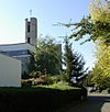
Aegidiuskirche (a copy of a matron stone on the hedge on the lower right ), planning Johannes Krahn (1908–1974), his son (also Johannes) designed the plans together with the architects Lorenz and Sauer (Krahn-Lorenz-Sauer, Frankfurt am Main) in Realized between 1978 and 1980, consecration in 1980. The altar plate contains a relic of Engelbert I. |

|
Copy of a matron stone near the Aegidius Church. The original (discovered in 1964 under Buschdorfer Straße) is in the Rheinisches Landesmuseum. The inscription reads: "Gabinis sacrum ex imperio ipsarum L. Fonteivs Firmvs VSLM". The abbreviation at the end stands for Votum Solvit Libens Merito, a common phrase on consecration stones ([he or she] liked to fulfill the vow according to merit). The translation as a whole: Dedicated to the Gabinish matrons at their behest, L. Fonteius Firmus was happy to fulfill [his] vows according to his merit. |

|
Roman sarcophagus, since 1987 in the Buschdorfer cemetery on Otto-Hahn-Straße. A sign explains: "Roman sarcophagus, end of the 2nd century, found on Dellweg July 1984". The stone box (including a 30 cm thick lid) is about 1.20 m high and about twice as long. |

|
Prussian milestone ("Adlerstein") on the corner of Kölnstrasse / Engländerweg (a previous time from the French era marked the border between the Department de Rhin-et-Moselle in the south and the Department de la Roer ). On the side facing away from the road it says “Coeln 3 miles”. The all-mile obelisk with base is about 2.50 m high. 3 km further in the direction of Cologne on Elbestraße in Bornheim- Uedorf there is another milestone (with the inscription 2M). |

|
The cast iron frame at the corner of Kölnstrasse and Friedlandstrasse marks point A of the Bonn base , the geodetic baseline from 1847 for the Rhenish triangular network. The wayside shrine dates from 1860. |
Personalities
- Joachim Hartung (1948–2014), German mathematician and professor, lived temporarily in Buschdorf.
- Adolf Heuser (1907–1988), German boxer
literature
- F. Grünkorn, J. Haffke, F. Becker, M. Dietrich: Bonn's northwest: Stations in the development of Auerberg, Buschdorf, Graurheindorf and Tannenbusch. Bonn 1988.
- A. Hausen: Bonn-Buschdorf St. Aegidius. Schnell und Steiner publishing house, Munich 1990.
- Catholic Parish Office St. Aegidius, Bonn-Buschdorf (ed.): Festschrift St. Aegidius, Bonn-Buschdorf, March 30, 1980.
- Local festival committee Buschdorf (Ed.): Festschrift 760 years Bonn-Buschdorf. 1977.
- D. Reindl: Buschdorf story (s). A village through the ages 1217–2017. Published by the Buschdorf Community Foundation, Bonn 2016.
- D. Reindl, H. Klein, I. Schoenen: Buschdorf 800. People - encounters - festivals. Edited by the Buschdorf Foundation, Bonn 2018.
See also
Web links
Individual evidence
- ↑ Population in Bonn by districts (according to the main statute) on December 31 , 2018 , Federal City of Bonn - Statistics Office, February 2019
- ↑ Martin Bünermann: The communities of the first reorganization program in North Rhine-Westphalia . Deutscher Gemeindeverlag, Cologne 1970, p. 82 .
- ↑ State Surveying Office North Rhine-Westphalia: Directory of landmarks ( Memento from April 17, 2012 in the Internet Archive ) (as of 2005; PDF, 243 kB)
- ↑ Course: Acherstrasse ("Aachener Strasse") in Bonn-Mitte, Hohe Strasse in Bonn-Tannenbusch, Buschdorfer Strasse, Heerweg in Bornheim on the foothills, Swisterberg, Bliesheim, Lechenich, Düren, Aachen
- ↑ According to information from the parish office
- ↑ To him is the poem by Annette von Droste-Hülshoff : The death of Archbishop Engelbert von Cöln in the Gutenberg-DE project ( archive version )
- ↑ One Prussian mile is 7,532.5 m


