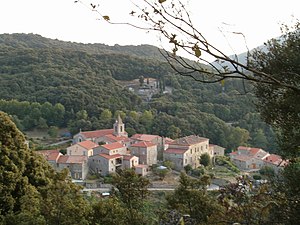
Casalabriva
| Casalabriva | ||
|---|---|---|
|
|
||
| region | Corsica | |
| Department | Corse-du-Sud | |
| Arrondissement | Sartène | |
| Canton | Taravo-Ornano | |
| Community association | Sartenais Valinco | |
| Coordinates | 41 ° 45 ′ N , 8 ° 56 ′ E | |
| height | 16-1,115 m | |
| surface | 15.92 km 2 | |
| Residents | 213 (January 1, 2017) | |
| Population density | 13 inhabitants / km 2 | |
| Post Code | 20140 | |
| INSEE code | 2A071 | |
 Casalabriva |
||
Casalabriva is a municipality on the French Mediterranean island of Corsica . It belongs to the Corse-du-Sud department , the Sartène arrondissement and the Taravo-Ornano canton . The residents call themselves Casalabrivais .
Geography and infrastructure
Casalabriva is about 600 meters above sea level and is affected by Route nationale 196 . Neighboring municipalities are Pila-Canale in the north-west, Guargualé in the north, Petreto-Bicchisano in the north-east, Olmeto in the south-east and Sollacaro in the south-west.
economy
In Casalabriva there are approved vineyards of the Ajaccio wine-growing region .
Attractions
- Saint-Michel church, built 1873–83
- Pont de Calzola ´, a bridge over the Taravo . The river forms the border with Pila-Canale there.

Bridge Pont de Calzola over the Taravo
Population development
| year | 1962 | 1968 | 1975 | 1982 | 1990 | 1999 | 2008 | 2012 |
|---|---|---|---|---|---|---|---|---|
| Residents | 174 | 162 | 139 | 136 | 150 | 181 | 180 | 185 |
Web links
Commons : Casalabriva - collection of images, videos and audio files
