Därligen
| Därligen | |
|---|---|
| State : |
|
| Canton : |
|
| Administrative district : | Interlaken-Oberhasli |
| BFS no. : | 0575 |
| Postal code : | 3707 |
| Coordinates : | 628 347 / 167 707 |
| Height : | 567 m above sea level M. |
| Height range : | 557–1929 m above sea level M. |
| Area : | 6.93 km² |
| Residents: | 435 (December 31, 2018) |
| Population density : | 57 inhabitants per km² |
| Website: | www.daerligen.ch |
|
Därligen by steamship Blümlisalp seen from |
|
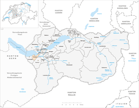
| Location of the municipality | |
Därligen is a municipality in the Interlaken-Oberhasli administrative district in the canton of Bern in Switzerland .
In addition to the residents' community, there is also and a civic community of the same name.
geography
Därligen is located in the temperate zone in the Bernese Oberland on the south bank of Lake Thun . The hamlet of Tracht in the west of the municipality on the banks of the lake and various individual farms and alps on the slope of the Därligrats belong to the municipality. The neighboring communities starting from the north in a clockwise direction are: Unterseen, Interlaken , Matten bei Interlaken , Wilderswil , Saxeten and Leissigen .
The village is located on the lakeshore, while the community extends to the Därliggrat.
politics
The community president is Hans Wolf (as of 2013).
population
| Population development | ||||||||
|---|---|---|---|---|---|---|---|---|
| year | 1850 | 1880 | 1900 | 1930 | 1950 | 1980 | 1990 | 2000 |
| Residents | 2 | 370 | 375 | 1 | 361 | 295 | 0 | 359 |
traffic
Därligen has a train station on the BLS line Bern - Thun - Interlaken. There is an hourly ride to Interlaken or Spiez. The village has access to the A8 motorway .
See also
Web links
- Official website of the municipality of Därligen
- Anne-Marie Dubler : Därligen. In: Historical Lexicon of Switzerland .
Individual evidence
- ↑ Permanent resident population from STAT-TAB of the BfS , municipalities see also regional portraits 2020 on bfs.admin.ch, accessed on May 29, 2020


