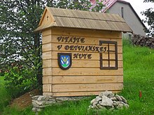
Detvianska Huta
| Detvianska Huta | ||
|---|---|---|
| coat of arms | map | |

|
|
|
| Basic data | ||
| State : | Slovakia | |
| Kraj : | Banskobystrický kraj | |
| Okres : | Detva | |
| Region : | Pohrony | |
| Area : | 14.313 km² | |
| Residents : | 677 (Dec. 31, 2019) | |
| Population density : | 47 inhabitants per km² | |
| Height : | 821 m nm | |
| Postal code : | 962 06 | |
| Telephone code : | 0 45 | |
| Geographic location : | 48 ° 34 ' N , 19 ° 35' E | |
| License plate : | DT | |
| Kód obce : | 518271 | |
| structure | ||
| Community type : | local community | |
| Structure of the municipality: | 5 parts of the community | |
| Administration (as of November 2018) | ||
| Mayor : | Pavel Šulek | |
| Address: | Obecný úrad Detvianska Huta č. 102 962 06 Detvianska Huta |
|
| Website: | www.detvianskahuta.sk | |
| Statistics information on statistics.sk | ||
Detvianska Huta (Slovak in the 19th century "Mikulášová"; Hungarian Zólyommiklós - until 1907 Miklósfalu , sometimes also Dettvahuta ) is a municipality in the middle of Slovakia with 677 inhabitants (December 31, 2019), which in Okres Detva , part of Banskobystrický kraj , lies.
geography
The municipality is located in the Veporské vrchy Mountains , part of the Slovak Ore Mountains . The municipality is drained by tributaries of the Ipeľ and Slatina . The center of the village lies at an altitude of 821 m nm and is six kilometers from Hriňová and 16 kilometers from Detva .
Administratively, the municipality has five parts: Bratkovica, Detvianska Huta, Komárno, Vrchdobroč and Žabica.
Neighboring municipalities are Hriňová in the west and north, Látky in the east, Kotmanová in the south and Dobroč and Podkriváň in the southwest.
history
The community emerged in the second half of the 18th century from the individual farms Bratkovica and Komárno and from a settlement near a glassworks, which was founded on the occasion of the Vígľaš estate after the necessary forests at Vígľašská Huta had already been felled. The first inhabitants (14 families) came from Moravia in 1763 , more precisely from the Brumov and Vsetín area . After 1775, the hut and the settlement were named after Nikolaus Esterházy ( Mikloss Huta ), but the hut closed its operation in 1801. In 1828 there were 142 houses and 1,185 inhabitants who were employed in agriculture.
Until 1918 the place in Sohl County belonged to the Kingdom of Hungary and then came to Czechoslovakia or today Slovakia. Immediately after the Slovak National Uprising , 28 residents were deported to German Buchenwald and Mauthausen concentration camps.
population
According to the 2011 census, Detvianska Huta had 722 inhabitants, 696 of whom were Slovaks, two Czechs and one Magyar; four residents were of a different ethnic group. 19 residents did not answer. 675 residents belonged to the Roman Catholic Church and four residents to the Evangelical Church AB. 12 residents were non-denominational and the denomination of 31 residents was not determined.
Results after the 2001 census (779 inhabitants):
|
By ethnicity:
|
By denomination:
|
Buildings
- Roman Catholic church in neo-Romanesque style from the years 1842–1843
Individual evidence
- ↑ 2011 census by ethnicity (English)
- ↑ Census 2011 after confession (English) ( Memento of 12 November 2013, Internet Archive )
Web links
- Entry on e-obce.sk (Slovak)


