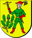
Gmina Świętajno (Powiat Szczycieński)
| Gmina Świętajno | ||
|---|---|---|

|
|
|
| Basic data | ||
| State : | Poland | |
| Voivodeship : | Warmia-Masuria | |
| Powiat : | Szczycieński | |
| Geographic location : | 53 ° 33 ' N , 21 ° 13' E | |
| Residents : | see Gmina | |
| Postal code : | 12-140 | |
| Telephone code : | (+48) 89 | |
| License plate : | NSZ | |
| Economy and Transport | ||
| Rail route : | Olsztyn – Pisz | |
| Gmina | ||
| Gminatype: | Rural community | |
| Gmina structure: | 15 school offices | |
| Surface: | 279.78 km² | |
| Residents: | 5835 (Jun. 30, 2019) |
|
| Population density : | 21 inhabitants / km² | |
| Community number ( GUS ): | 2817072 | |
| Administration (as of 2014) | ||
| Wójt : | Alicja Kołakowska | |
| Address: | ul.Grunwaldzka 15 12-140 Świętajno |
|
| Website : | www.swietajno.ug.gov.pl | |
The Gmina Świętajno is a rural municipality in the powiat Szczycieński of the Warmian-Masurian Voivodeship in Poland . Your seat is the village of the same name ( German Schwentainen ) with about 1600 inhabitants.
geography
The municipality is located in the south of the voivodeship. The border with the Masovian Voivodeship is about five kilometers away, the triangle with the Podlaskie Voivodeship is about twelve kilometers away. The district town of Szczytno is eight kilometers to the west. Neighboring municipalities are the municipality of Dźwierzuty in the northwest, Piecki in the north, Ruciane-Nida in the east and Rozogi in the south and the rural municipality of Szczytno in the west.
history
The rural community under Polish law was founded in 1945 and divided into Gromadas in 1954 . It was re-established in 1973. The municipality was part of the Olsztyn Voivodeship from 1946 to 1998 , which changed its layout in 1950 and 1975. In 1999 the municipality came to the newly founded Warmian-Masurian Voivodeship.
structure
The rural community (gmina wiejska) Świętajno has 15 school offices:
| Polish name | German name (until 1945) |
|---|---|
| Biały Grunt | Bialygrund 1934-45 Weißengrund |
| Chochół | Friedrichsfelde |
| Długi Borek | Dlugiborrek 1829–1945 Langenwalde |
| Jerominy | Jeromin |
| Yerutki | Klein Jerutten |
| Jeruty | Great Jerutten |
| Koczek | Kotzek 1905–45 Waldersee |
| Colonia | Grünwalde |
| Konrady | Conrades |
|
Nowe Czajki with C sharp |
New Czayken 1933–45 New Kiwitten with Friedrichsthal |
| Piasutno | Piassutten 1938–45 lake forest |
| Spychowo | Dolls |
| Starlings Czajki | Alt Czayken 1933–45 Alt Kiwitten |
| Świętajno | Schwentainen 1938–45 Altkirchen |
| Zielone | Zielonen 1938–45 green corridor |
Smaller places are: Bystrz (1938–45 Brücknersmühl), Chajdyce (Neu Jerutten), Kierwik (Kurwig, 1938–45 Kurwick), Kobiel (Kobiel, 1938–1945 lake view), Łąck Mały , Łąck Wielki (Lontzig), Myszadło (Storchwiese ), Niedźwiedzi Kąt (Bärenwinkel), Połom (Polommen), Powałczyn (Powalczin, 1938–45 Schönhöhe), Racibórz (Ratzeburg), Spychowski Piec , Spychówko (small dolls) and Szklarnia (Adam's disgust).
literature
- Paprotta: News about the place Schwentainen near Ortelsburg, which was completely destroyed by the Russians, and its reconstruction. German Armed Forces, Berlin-Friedenau 1915.
Web links
Individual evidence
- ↑ population. Size and Structure by Territorial Division. As of June 30, 2019. Główny Urząd Statystyczny (GUS) (PDF files; 0.99 MiB), accessed December 24, 2019 .
- ^ Website of the municipality (BIP), Wójt - Dane , accessed on February 17, 2015
