Henarsee
| Henarsee | ||
|---|---|---|

|
||
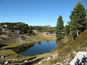
| Henarsee (1691 m) against Kl. Woising (1879 m) | ||
| Geographical location | Dead Mountains , Styria | |
| Drain | underground via the karst system | |
| Location close to the shore | Grundlsee | |
| Data | ||
| Coordinates | 47 ° 41 '42 " N , 13 ° 52' 53" E | |
|
|
||
| Altitude above sea level | 1691 m above sea level A. | |
| surface | 2700 m² | |
|
particularities |
Karst lake |
|
The Henarsee is a mountain lake in the Dead Mountains in Styria , Austria .
geography
The lake is 1691 m above sea level. A. below the Redenden Stone ( 1900 m ) and 900 meters east of the Albert Appel House of the Austrian Tourist Association . The lake is located in a shallow basin within the plateau of the Dead Mountains, is fed by underground tributaries and has a length of about 80 meters in north-south direction with a maximum width of about 45 meters. The area is approximately 0.3 hectares (2700 m²).
The closest bodies of water are the Wildensee , about 2.8 km to the north-west, and the Dreibrüdersee, about 3.5 km to the south-east . Only about 4 km away from the lake are the closest rivers, namely the Zimitzbach flowing to the Grundlsee in the south, the Kolmkarbach in the northeast and the Nesseltalbach in the north, both of which drain towards the Almsee , as well as the Rinnerbach flowing to the Offensee . The Henarsee is a (superficially) drainless karst lake and, like the Dreibrüdersee or the Elmsee, drains underground into the branched karst system of the Dead Mountains.
ways
The Henarsee can be reached via a one-hour circular walk from the Albert-Appel-Haus. From the Austrian long-distance hiking trail (No. 201) (also corresponds to the purple path of the Via Alpina and the European long-distance hiking trail E4 Alpin ), the upper lake trail leads north to the lake. You can return to the Appelhaus via the lower Seeweg .
Literature & Maps
- Ludwig Krenmayr, Gernot Rabeder, Gisbert Rabeder: Alpine Club Leader Totes Gebirge (= Alpine Club Leader. Series: Northern Limestone Alps ). RZ 60-63 and 155-157. 3rd, revised edition. Bergverlag Rudolf Rother, Munich 1982, ISBN 3-7633-1244-7 .
- Wolfgang Heitzmann: Salzkammergut with the Totem Mountains and Dachstein: high-altitude trails, summit tours, via ferratas . Tour No. 46, pp. 182-185. New edition Bruckmann Verlag, Munich 2002, ISBN 3-7654-3336-5 .
- ÖK 50, sheet 97 (Bad Mitterndorf).
- Alpine Club Map Bl. 15/1 (Totes Gebirge - West), 1: 25,000; Austrian Alpine Club 2014; ISBN 978-3-928777-29-2 .
Web links
Individual evidence
- ↑ Measured on the body of water, Digital Atlas Styria → Topic bodies of water & water information → Water → Body of water ; Background orthophoto

