
Inta
| city
Inta
Инта
|
||||||||||||||||||||||||||||||||||||||||||
|
||||||||||||||||||||||||||||||||||||||||||
|
||||||||||||||||||||||||||||||||||||||||||
| List of cities in Russia | ||||||||||||||||||||||||||||||||||||||||||

_(1982).svg)
.svg)

Inta ( Russian Инта ) is a city in the northwestern Russian republic of Komi with 32,080 inhabitants (as of October 14, 2010).
geography
The city is located in the foreland of the Polarural about 600 km northeast of the republic capital Syktyvkar on the Bolshaya Inta , a right tributary of the Kosju in the Pechora river system .
Inta is administratively directly subordinate to the republic. A total of 30,100 km², largely sparsely populated, belongs to the city.
The city is located about 10 km west of the Pechora railway Konoscha - Kotlas - Vorkuta (station Inta-1 , distance kilometers 1999 from Moscow , at the urban-type settlement Verkhnyaya Inta ). A branch line to the city ( Inta-2 station ) is only used for freight traffic.
history
Inta was established in 1940 as the base and housing estate for a geological expedition to explore coal deposits and plan mines. The name is derived from the Nenets word for water-rich place . In 1954, the place, which was always overshadowed by the more northerly Vorkuta in terms of coal mining, was given city rights.
Between 1948 and 1957, the Gulag special camp No. 1, MinLag, was located near the municipality .
Population development
| year | Residents |
|---|---|
| 1959 | 45.136 |
| 1970 | 50.178 |
| 1979 | 50,862 |
| 1989 | 60,220 |
| 2002 | 41,217 |
| 2010 | 32,080 |
Note: census data
Culture and sights
There is a local museum in Inta and a historical and ethnographic museum in the town of Petrun .
economy
The cityscape is determined by the hard coal mining. However, only one of the previous six coal pits survived the economic crisis after the collapse of the Soviet Union and the late 1990s ( Intinskaya owned by Intaugol ), which explains the city's significant population decline . There are also companies in the construction and timber industry.
Buildings
One of the largest transmitters of the Chaika radio navigation system (CHAYKA) is located near Inta, near the Verkhnyaya Inta settlement . At 460 meters, the mast of the system is the second highest structure in Europe after the Ostankino television tower in Moscow .
sons and daughters of the town
- Aleksandras Abišala (* 1955), Lithuanian entrepreneur and politician
- Viktor Schluktow (* 1954), Russian ice hockey player
- Uladsimir Zyplakou (1969-2019), Russian-Belarusian ice hockey player

Lenin Square

Komsomolskaya Square
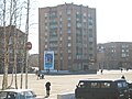
House in Inta


Individual evidence
- ↑ a b Itogi Vserossijskoj perepisi naselenija 2010 goda. Tom 1. Čislennostʹ i razmeščenie naselenija (Results of the All-Russian Census 2010. Volume 1. Number and distribution of the population). Tables 5 , pp. 12-209; 11 , pp. 312–979 (download from the website of the Federal Service for State Statistics of the Russian Federation)
- ↑ OAO NTZ Internavigazija ( Memento of the original from August 16, 2011 in the Internet Archive ) Info: The archive link was automatically inserted and not yet checked. Please check the original and archive link according to the instructions and then remove this notice. (Russian)
Web links
- City administration website (Russian)
- Inta on mojgorod.ru (Russian)
City districts : Inta | Syktyvkar | Ukhta | Ussinsk | Vorkuta
Rajons : Ishemsky | Knjaschpogostski | Koigorodski | Kortkerosski | Pechora | Prilussky | Sosnogorsk | Syktyvdinsky | Syssolski | Troitsko-Pechorsky | Udorski | Ust-Kulomski | Ust-Wymski | Ust-Zilemski | Wuktyl
| Cities |
Inta S | Jemwa R | Mikun | Pechora R | Sosnogorsk R | Syktyvkar S | Uchta S | Ussinsk S | Vorkuta S | Wuktyl R |
|
| Urban-type settlements |
Blagojewo | Borovoi | Isjaju | Jarega | Yeletsky | Komsomolski | Koshwa | Koschym | Krasnosatonsky | Meshduretchensk | Mulda | Nizhny Odes | Oktyabrsky | Parma | Promyschlenny | Putejez | Sapolyarny | Scheschart | Shudajag | Sedkyrkeschch | Sewerny | Sindor | Troitsko-Pechorsk R | Usogorsk | Verkhnyaya Inta | Verkhnyaya Maksakovka | Vodny | Voivosh | Worgaschor |
|
| Other Rajon centers |
Aikino | Ischemia | Koigorodok | Kortkeros | Koslan | Objachevo | Ust-Kulom | Ust-Zilma | Wisinga | Wylgort |