
Jossa (sense)
| Jossa | ||
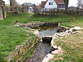
 The Jossa at the barracks courtyards |
||
| Data | ||
| Water code | DE : 24484 | |
| location |
Hessian-Franconian mountainous region
|
|
| River system | Rhine | |
| Drain over | Sinn → Franconian Saale → Main → Rhine → North Sea | |
| source | in Jossgrund , district Lettgenbrunn 50 ° 10 ′ 3 ″ N , 9 ° 25 ′ 3 ″ E |
|
| Source height | approx. 420 m above sea level NHN | |
| muzzle | near Sinntal - Jossa from the right into the Sinn coordinates: 50 ° 14 '12 " N , 9 ° 36' 1" E 50 ° 14 '12 " N , 9 ° 36' 1" E |
|
| Mouth height | approx. 220 m above sea level NHN | |
| Height difference | approx. 200 m | |
| Bottom slope | approx. 6.2 ‰ | |
| length | 32.3 km | |
| Catchment area | 146.7 km² | |
| Discharge at the Jossa gauge (99.5% of the catchment area) |
MNQ MQ MHQ |
290 l / s 1.52 m³ / s 11.7 m³ / s |
| Left tributaries | Breitenbach , Distelbach , Rohrbach | |
| Right tributaries | Villbach , Hungerbach , Kalbach , Mohrenbach , Steinbach | |
The Jossa is a 32 km long river in the Spessart , in the Hessian Main-Kinzig district . It rises in the Jossgrund district of Lettgenbrunn and flows into the Sinn from the right at the Jossa district of the Sinntal community .
geography
Jossa spring

The Jossa spring is located in the middle of Lettgenbrunn. It is a small enclosed spring into which the Villbach flows , which is often viewed as the upper course and arises about two kilometers further northwest near Villbach . However, this often does not have any water in summer, so that the real watercourse then begins at the source of the Jossa. The spring was used to supply Lettgenbrunn with drinking water until 1951. On September 16, 2007, the redesign of the Jossa spring was completed and a natural sandstone was placed with a reference to the spring.
course
The young Jossa flows from Lettgenbrunn to the southeast through a narrow valley, where it is crossed by the Eselsweg . After a few kilometers, however, it turns its direction of flow to the north, where the edges of the forest partially reach the bed of the stream.

Part of the Jossa water seeps away there and reappears in front of Pfaffenhausen . In a northerly direction, it then crosses a wide valley floor in a moderate loop, above which there are forests to the right and left. The Jossa then flows through Oberndorf , Burgjoss and Mernes .
Then it slowly turns to the southeast. Almost at the northernmost point of its arc is Marjoss , a district of Steinau an der Straße , behind which its largest tributary, the Rohrbach , flows from the left. The valley floor of the lower reaches is now very narrow, at the end of which it reaches Jossa .
There the Jossa passes under the viaduct of the Flieden – Gemünden railway line and flows into the Sinnwiesen nature reserve of Altengronau at an altitude of 220 m above sea level. NHN from the right into the mind .
Its 32.3 km long run ends about 200 meters below its source, so it has an average bed gradient of 6.2 ‰.
- Jossa picture gallery

Natural sandstone at the source of the Jossa

The Jossa spring in 2012 before the redesign

The Jossa shortly after its source in Lettgenbrunn

The Jossa with water plants in Pfaffenhausen

The Jossa in Marjoss

The Jossa at Jossa

The mouth of the Jossa

The Jossa (front right) flows into the Sinn (from front left to back)


Catchment area
The 146.7 km² catchment area of the Jossa lies in the sandstone Spessart and is drained to the North Sea via the Sinn, the Franconian Saale , the Main and the Rhine .
It borders
- in the northeast to that of the Gronaubach , which flows into the Sinn
- in the east to the sense itself
- in the southeast to that of the aura of the influx of sense
- in the south to that of the Main tributary Lohr and to that of its tributary Flörsbach
- in the southwest of the Bieber , which drains over the Kinzig into the Main
- in the west to that of the Kinzig tributaries Orb and Klingbach
- in the northwest to that of the Hellgraben , also a tributary of the Kinzig
- and in the north to that of the Erlenbach , which flows into the Kinzig over the Ahlersbach .
The highest point is 540 m above sea level. NHN high Horst in the south of the catchment area.
Tributaries
- Mouths of the tributaries into the Jossa
Mouth of the Villbach ,

of the Hungerbach ,

of the calf ,

of the Breitenbach ,

of the Mohrenbach ,

of the Diestelbach ,

of the Rohrbach ,

and the Steinbach .


1.JPG)
.JPG)
The tributaries are listed in the order from source to estuary:
- Villbach (right, often viewed as the upper course), 2.1 km
- Hungerbach (right, temporarily dry), 0.5 km
- Kalbach (right), 1.9 km
- Breitenbach (left), 1.4 km
- (Bach from the) Ober Grund ( Orber-Grund ) (left)
- Spirgelbach (left, temporarily dry)
- Auragrund (right, temporarily dry)
- Mohrenbach (right), 3.7 km
- Distelbach (left), 2.3 km
- Rohrbach (left), 7.6 km
- Steinbach (right), 4.7 km
River system sense
Places on the Jossa

The upper Jossatal near Lettgenbrunn

The lower Jossatal near Marjoss


The places from the source to the mouth, the residents are marked in italics
Rieselwiesen in the Jossatal
Up until the 20th century, meadows were laid out on the Jossa as Rieselwiesen (also known as ridge meadows ). Earth was piled up in rows about 30-50 cm high and about 4-6 m wide on Rieselwiesen. At the top of the rows ("backs"), the dammed water, which was diverted through inlet channels, was allowed to run along the Jossa, then "trickle" over the edges of the "backs" into drainage ditches and back into the Jossa. This intensive irrigation resulted in an additional hay harvest per year. Since the undulating cultivated meadows cannot be worked with machines, the Rieselwiesen disappeared from the Jossatal at the end of the 20th century.
Relics of the weirs and canals are preserved between Jossa and Marjoss in a section now designated as a nature reserve between a wooden footbridge and a bridge (NSG Speckesteg-Müsbrücke) and explained by an explanation board on the bike and hiking trail. Then the last Rieselwiese of Marjoss was laid out by a Schultheis family in 1919.
Mills
In the southern area of Marjoss was the upper mill (closed in 1968), on the north-eastern edge the lower mill (closed in 1958). Both water mills were supplied by an operating ditch derived from the Jossa.
history
The Jossa was not always a purely Hessian river. After the reorganization of the borders in this area, as a result of the Congress of Vienna , it flowed partly on Bavarian soil from 1814 to 1868. From its source to northeast of Mernes the Jossa ran on what was then Bavarian territory. During this time she left the Kingdom of Bavaria ( District Office Gemünden am Main ) and reached the Electorate of Hesse . After the military defeat in the German War , Bavaria had to surrender the administrative area of the old Orb district court to Hessen-Nassau .
See also
Web links
- Water level at Jossa, HND Bavaria
- Course of the Jossa on the topographic map
- Hessian Spessart beaver habitat (Jossa and Sinn) Natura 2000 Hessen
- Retention cadastre river basin Jossa river basin code number: 24484 (PDF file; 1.12 MB)
- Jossa profile ( memento from October 25, 2014 in the Internet Archive )
Individual evidence
- ↑ Topographic map 1: 25,000
- ↑ Water map service of the Hessian Ministry for the Environment, Climate Protection, Agriculture and Consumer Protection ( information )
- ↑ Flood Action Plan Main
- ^ Flood news service Bavaria
- ↑ Information panel "Long Reason"
- ↑ Map of the area at the "Hungerbach" nature park hiking car park
- ↑ from street name Kalbachstraße
- ↑ from street name Spirgelbachstraße
- ↑ Topographical Atlas of the Kingdom of Bavaria on this side of the Rhine Sheet: 10 (1860)
- ↑ Topographical Atlas of the Kingdom of Baiern this side of the Rhine Sheet: 10. Orb