Kätzelmühle
|
Kätzelmühle
Thalmässing market
Coordinates: 49 ° 4 ′ 48 ″ N , 11 ° 14 ′ 52 ″ E
|
|
|---|---|
| Height : | 415 m |
| Residents : | 0 (Jan. 2, 2018) |
| Postal code : | 91177 |
| Area code : | 09173 |
|
Kätzelmühle
|
|
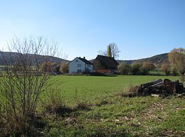
Kätzelmühle is a district of the market Thalmässing in the district of Roth in the administrative region of Middle Franconia in Bavaria .
location
The Kätzelmühle is located at around 415 meters above sea level on the right of the Thalach in the southern Franconian Jura, to the south- east of Thalmässing not far from Hagenich .
Place name interpretation
There are three attempts at interpretation: On the one hand, the mill name of "castellum" is said to be derived from the former tower hill castle of Hagenich, on the other hand, a miller's family is said to have been called Kätzl. Karl Kugler provides the third interpretation : "Kätzelmühle near Aue is completely disfigured from Getzelmühle, ie, the speedy mill, from gezal, fast, speedy."
history
In 1345 a document reports that Heinrich the oldest Kaurlacher von Haydeck sells the Hagnach estate near the mill; presumably it is about Hagenich and the later so-called Katzel- or Käzlmühl / Kätzelmühle. The Mühlbach was fed by a water source near Waizenhofen . The mill belonged to the cathedral chapter of Eichstätt from an undetermined point in time until the end of the Old Kingdom . It was subject to the high court of the Brandenburg-Ansbach Oberamt Stauf-Landeck, while the village and community rulership together with that of Göllersreuth was exercised by the Domkapitel's judicial office, as the recess of 1736, concluded between the Hochstift Eichstätt and the Principality of Ansbach , had once again confirmed. Ecclesiastically, the mill initially belonged to the Catholic parish Großhöbing, after the Reformation carried out by the Principality of Ansbach to the Lutheran parish of St. Michael in Thalmässing.
In the new Kingdom of Bavaria (1806) the "oversized" Kätzelmühle became part of the Waizenhofen tax district . On August 17, 1818, the rural community of Landersdorf was formed, to which, in addition to the two church villages Landersdorf and Göllersreuth, the wastes Feinschluck , Hundszell and Kätzelmühle belonged. From October 1, 1809, this community was assigned to the Raitenbuch regional court , and from 1812 to the Greding regional court .
In 1875 the miller of the Kätzelmühle kept two horses and ten cattle on large cattle. The children went to school in Landersdorf.
On July 1, 1971, the municipality of Landersdorf and thus the Kätzelmühle was incorporated into the Thalmässing market.
On November 29, 2010, the historic mill building fell into flames at night.
Population development
- 1818: 6 (1 "fireplace" = housekeeping, 1 family)
- 1823: 5 (1 property)
- 1846: 6 (1 house, 1 family)
- 1871: 8 (7 buildings)
- 1900: 9 (1 residential building)
- 1937: 7 Protestants, no Catholics
- 1950: 13 (1 property)
- 1961: 6 (1 residential building)
- 1970: 5
- 2015: 2
traffic
The mill can be reached via a road that branches off to the west from the district road RH 33.
literature
- Wolfgang Wiessner: Historical Atlas of Bavaria. Part Franconia, series I, issue 24: Hilpoltstein. Munich 1978
- Gerhard Hirschmann: Historical Atlas of Bavaria. Part of Franconia. Row I, Issue 6. Eichstätt. Beilngries-Eichstätt-Greding. Munich 1959
Web links
- Kätzelmühle on the Thalmässing website
- Photo of the Müller house in Jura construction from the 1st half of the 19th century
Individual evidence
- ↑ Thalmässing
- ↑ Wiessner, p. 32
- ^ Karl Kugler: Explanation of a thousand place names of the Altmühlalp and its surroundings. One try. Eichstätt 1873: Verlag der Krüll'schen Buchhandlung, p. 122 (No. 351)
- ↑ Wiessner, p. 128
- ↑ Hirschmann, p. 116; Recess Between The Prince. Hohen Stifft Eystätt And The Hoch-Fürstl. Hauß Brandenburg-Onolzbach, from now on August 22nd and 23rd, Anno 1736, p. 24
- ^ Johann Kaspar Bundschuh : Geographical Statistical-Topographical Lexicon of Franconia , III. Vol., Ulm 1801, column 46
- ↑ a b c Hirschmann, p. 228
- ↑ a b Kgl. Statistical Bureau in Munich (edit.): Complete list of localities of the Kingdom of Bavaria , Munich 1876, column 1163
- ^ [1] Website of the Thalmässing market
- ↑ [2] nordbayern.de of November 30, 2010
- ↑ Alphabetical list of all the localities contained in the Rezatkreise ... , Ansbach 1818, p. 45
- ^ Eduard Vetter: Statistical handbook and address book of Middle Franconia in the Kingdom of Bavaria . Ansbach 1846, p. 121
- ^ Locations directory of the Kingdom of Bavaria with an alphabetical register of locations , Munich 1904, column 1224
- ^ Franz Xaver Buchner: The diocese of Eichstätt. Volume I: Eichstätt 1937, p. 415
- ^ Official register of places for Bavaria. Territorial status on October 1, 1964 with statistical information from the 1961 census , Munich 1964, column 796
- ↑ Official directory for Bavaria , vol. 1978 = 380, Munich 1978, p. 167
- ^ [3] Website of the Thalmässing market

