Valtenberg
| Valtenberg | ||
|---|---|---|
|
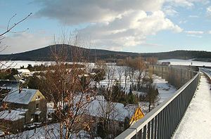
Valtenberg of Putzkau seen |
||
| height | 586.6 m above sea level NHN | |
| location | Saxony ( Germany ) | |
| Mountains | Lusatian highlands | |
| Dominance | 12.3 km → Tanečnice | |
| Coordinates | 51 ° 4 '27 " N , 14 ° 16' 40" E | |
|
|
||
| rock | Two-mica granodiorite , granodiorite | |
| particularities | King Johann Tower ( AT ) | |
The Valtenberg ( Upper Sorbian Sokolnik ) is 586.6 m above sea level. NHN the highest point in the Lusatian Mountains in the Free State of Saxony .
Origin of the name
The name Falckenberg or Falkenberg was common until the 19th century , from which the name Valtenberg, which is valid today, arose. The Upper Sorbian name Sokolnik ( sokol = "falcon") also refers to the root word falcon .
Geographical location

The Valtenberg is located about 2.5 km southwest of the municipality of Neukirch , 3.5 km southeast of the municipality of Schmölln-Putzkau and 5 km north of Neustadt in Saxony . The boundaries of the three communities meet at the summit. The southern slope of the mountain is called Hohwald . The Hohwald Clinic is located there directly on the border with the Czech Republic . The source of the Wesenitz , which flows into the Elbe near Pirna, is located in an old mining tunnel on the southern slope of the mountain . The summit and northwest side of the mountain is made of two-mica granodiorite , while granodiorite can be found at the base .
history
1752–1762 was on the southern slope of the Valentin Erbstolln on the Falckenberge , where a quartz vein was the subject of a mining attempt. The rolled-up tunnel mouth hole is now the source of the Wesenitz .
On July 1, 1857, the stone observation tower, which still exists today, was inaugurated, which was built in a construction period of 150 days according to a design by the Zittau architect Carl August Schramm . The tower was named after King John of Saxony . In 1859 the wooden mountain inn was destroyed by arson and then replaced by a solid stone building.
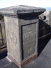
As station no. 6 Valtenberg , the summit was a first-order station of the Royal Saxon Triangulation from 1864 . For this reason, a surveying column was built on the observation tower, which still exists today. King John's first visit took place in 1865.
The water supply was sought in 1938 by drilling a well. The mountain inn burned down again in 1951, but was rebuilt. The current restaurant "Bergbaude Valtenberg" was opened in 1977. Every year there is an Ascension and Whitsun festival on the Valtenberg . In 2007 the 150th anniversary of the König-Johann-Tower was celebrated.
view
From the 22 m high König-Johann-Turm the view extends over the Upper Lusatian Mountains to the Zittau Mountains and into the Elbe Sandstone Mountains and the ridge of the Ore Mountains . The ridge of the Jizera and Giant Mountains can be seen from a distance .

Paths to the summit
A variety of hiking trails lead over the mountain. The hiking area can be reached from all directions by public transport.
- The Oberlausitzer Bergweg begins here, reaches Steinigtwolmsdorf next and crosses all the major Lausitz mountains to the east.
- The shortest and steepest ascent begins at Neukirch West train station . From there, a route marked with a green line leads to the summit.
- From Putzkau train station, the summit can be reached on the path marked with a yellow dot via the Milchhübel vantage point.
- The Hohwaldschänke (with bus stop line 267) on the Neustadt - Steinigtwolmsdorf state road is also a good starting point for climbing the mountain. From there you follow a path marked with a blue line .
literature
- Gustav Hermann Schulze : The Valtenberg . Ed .: Mountain Association "Upper Spreethal-Neusalza". Commission publisher by Hermann Oeser, Neusalza i. P. 1886 ( digitized version )
Web links
- Valtenberg Website of the Bergbaude


