| Surname
|
City district
(location)
|
Size (ha)
|
Year of
creation
|
annotation
|
image
|
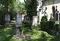
| Allach cemetery |
Allach-Untermenzing
( 48 ° 12 ′ 1 ″ N, 11 ° 27 ′ 26 ″ E ) |
0.5 |
|
St. Peter and Paul (Allach) |

|
| Aubing cemetery |
Aubing-Lochhausen-Langwied
( 48 ° 9 ′ 16 ″ N, 11 ° 24 ′ 35 ″ E ) |
4.5 |
1911 |
|
|
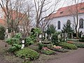
| Baumkirchen cemetery |
Berg am Laim
( 48 ° 7 ′ 52 ″ N, 11 ° 37 ′ 54 ″ E ) |
0.2 |
|
The cemetery is a listed building |
more pictures
|
| Bogenhausen cemetery |
Bogenhausen
( 48 ° 8 ′ 52 ″ N, 11 ° 36 ′ 5 ″ E ) |
0.22 |
|
The cemetery is a listed building |
more pictures
|
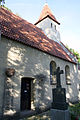
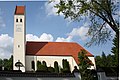
| Daglfing cemetery |
Bogenhausen
( 48 ° 9 ′ 8 ″ N, 11 ° 39 ′ 25 ″ E ) |
0.45 |
1300 |
St. Philipp and Jakob (Munich) |

more pictures
|
| Englschalking cemetery |
Bogenhausen
( 48 ° 9 ′ 29 ″ N, 11 ° 38 ′ 36 ″ E ) |
|
|
St. Nikolaus (Englschalking) |
more pictures
|
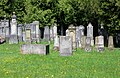
| Feldmoching cemetery |
Feldmoching-Hasenbergl
( 48 ° 12 ′ 59 ″ N, 11 ° 31 ′ 34 ″ E ) |
3.6 |
1929 |
|

more pictures
|
| Forstenried cemetery |
Thalkirchen-Obersendling-Forstenried-Fürstenried-Solln
( 48 ° 5 ′ 8 ″ N, 11 ° 29 ′ 39 ″ E ) |
0.1 |
|
Holy Cross (Forstenried) |

|
| Freimann cemetery |
Schwabing-Freimann
( 48 ° 11 ′ 34 ″ N, 11 ° 36 ′ 59 ″ E ) |
0.1 |
|
St. Nicholas (Freimann) |

|
| Haidhausen cemetery |
Au-Haidhausen
( 48 ° 8 ′ 4 ″ N, 11 ° 36 ′ 16 ″ E ) |
2.4 |
|
Old parish church St. Johann Baptist (Haidhausen)
cemetery is a listed building |

more pictures
|
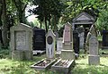
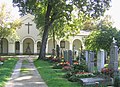
| Old Israelite cemetery |
Thalkirchen-Obersendling-Forstenried-Fürstenried-Solln
( 48 ° 6 ′ 35 ″ N, 11 ° 32 ′ 45 ″ E ) |
2.5 |
1816 |
The cemetery is a listed building |
more pictures
|
| New Israelite cemetery |
Schwabing-Freimann
( 48 ° 10 ′ 57 ″ N, 11 ° 36 ′ 10 ″ E ) |
5.7 |
1908 |
The cemetery is a listed building |
more pictures
|
| Johanneskirchen cemetery |
Bogenhausen
( 48 ° 10 ′ 11 ″ N, 11 ° 39 ′ 2 ″ E ) |
0.1 |
|
St. Johann Baptist (Johanneskirchen) |

|
| Carmelite monastery cemetery |
Schwabing-West
( 48 ° 10 ′ 36 ″ N, 11 ° 34 ′ 9 ″ E ) |
|
Abandoned in 2013 |
|
|
| St. Anton monastery cemetery |
Ludwigsvorstadt-Isarvorstadt
( 48 ° 7 ′ 29 ″ N, 11 ° 33 ′ 44 ″ E ) |
|
|
|
|
| Munich war cemetery |
Thalkirchen-Obersendling-Forstenried-Fürstenried-Solln
( 48 ° 5 ′ 55 ″ N, 11 ° 28 ′ 40 ″ E ) |
1 |
|
|

more pictures
|
| Laim cemetery |
Laim
( 48 ° 8 ′ 24 ″ N, 11 ° 29 ′ 59 ″ E ) |
0.1 |
|
St. Ulrich (Laim)
cemetery is a listed building |

|
| Lochhausen cemetery |
Aubing-Lochhausen-Langwied
( 48 ° 11 ′ 3 ″ N, 11 ° 24 ′ 24 ″ E ) |
1.3 |
|
|
|
| Moosach cemetery |
Moosach
( 48 ° 10 ′ 53 ″ N, 11 ° 30 ′ 59 ″ E ) |
0.25 |
|
Old parish church St. Martin (Moosach) |

|
Neuhausen cemetery
or Winthir cemetery
|
Neuhausen-Nymphenburg
( 48 ° 9 ′ 18 ″ N, 11 ° 31 ′ 48 ″ E ) |
0.3 |
|
|

more pictures
|
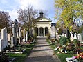
| Old North Cemetery |
Maxvorstadt
( 48 ° 9 ′ 13 ″ N, 11 ° 34 ′ 13 ″ E ) |
3.5 |
1866 |
Monument protection, protected landscape component |

more pictures
|
| North Cemetery |
Schwabing-Freimann
( 48 ° 10 ′ 31 ″ N, 11 ° 36 ′ 12 ″ E ) |
31 |
1884 |
The cemetery is a listed building |

more pictures
|
| Nymphenburg cemetery |
Neuhausen-Nymphenburg
( 48 ° 9 ′ 44 ″ N, 11 ° 30 ′ 25 ″ E ) |
0.32 |
1875 |
|
more pictures
|
| Oberföhring cemetery |
Bogenhausen
( 48 ° 10 ′ 15 ″ N, 11 ° 37 ′ 26 ″ E ) |
0.4 |
|
St. Lorenz (Munich) |
|
| Forest cemetery Obermenzing |
Pasing-Obermenzing
( 48 ° 9 ′ 55 ″ N, 11 ° 26 ′ 48 ″ E ) |
8th |
1913 |
The cemetery is a listed building |

more pictures
|
| East cemetery |
Obergiesing pheasant garden
( 48 ° 7 ′ 11 ″ N, 11 ° 35 ′ 27 ″ E ) |
26th |
1821 |
Cemetery is a listed
biotope (M-0187-001) |

more pictures
|
| Untermenzing park cemetery |
Allach-Untermenzing
( 48 ° 10 ′ 39 ″ N, 11 ° 27 ′ 29 ″ E ) |
7.6 |
1499,
1952 |
St. Martin (Untermenzing) |

|
| Pasing Cemetery |
Pasing-Obermenzing
( 48 ° 8 ′ 10 ″ N, 11 ° 27 ′ 35 ″ E ) |
7.5 |
1903 |
|

more pictures
|
| Perlach cemetery |
Ramersdorf-Perlach
( 48 ° 5 ′ 55 ″ N, 11 ° 38 ′ 29 ″ E ) |
0.26 |
1902 |
The cemetery is a listed building |
more pictures
|
| Cemetery at the Perlacher Forest |
Obergiesing Pheasant Garden
( 48 ° 5 ′ 56 ″ N, 11 ° 35 ′ 51 ″ E ) |
28 |
1931 |
mapped biotope (M-0290-001) |

more pictures
|
| Pipping cemetery |
Pasing-Obermenzing
( 48 ° 9 ′ 23 ″ N, 11 ° 27 ′ 27 ″ E ) |
0.03 |
|
St. Wolfgang (Pipping) |

|
| Riem cemetery |
Trudering-Riem
( 48 ° 7 ′ 57 ″ N, 11 ° 40 ′ 45 ″ E ) |
7.6 |
1913 |
|

|
| Sendling cemetery |
Sendling
( 48 ° 6 ′ 56 ″ N, 11 ° 32 ′ 13 ″ E ) |
2.1 |
1872 |
The cemetery is a listed building |

more pictures
|
| Solln cemetery |
Thalkirchen-Obersendling-Forstenried-Fürstenried-Solln
( 48 ° 4 ′ 43 ″ N, 11 ° 31 ′ 4 ″ E ) |
0.4 |
1883 |
|

more pictures
|
| Old south cemetery |
Ludwigsvorstadt-Isarvorstadt
( 48 ° 7 ′ 38 ″ N, 11 ° 33 ′ 54 ″ E ) |
10 |
1563 |
Monument protection, protected landscape component, mapped biotope (M-0182-001) |

more pictures
|
| New south cemetery |
Ramersdorf-Perlach
( 48 ° 5 ′ 58 ″ N, 11 ° 37 ′ 12 ″ E ) |
36 |
1977 |
|

more pictures
|
| Thalkirchen cemetery |
Thalkirchen-Obersendling-Forstenried-Fürstenried-Solln
( 48 ° 6 ′ 0 ″ N, 11 ° 32 ′ 43 ″ E ) |
0.03 |
|
Monument protection, St. Maria (Thalkirchen)
|

more pictures
|
| Forest cemetery |
Rags
( 48 ° 6 ′ 10 ″ N, 11 ° 29 ′ 37 ″ E ) |
161 |
1907
1966 expanded |
|

more pictures
|
| Solln forest cemetery |
Thalkirchen-Obersendling-Forstenried-Fürstenried-Solln
( 48 ° 4 ′ 7 ″ N, 11 ° 30 ′ 50 ″ E ) |
7.3 |
1937 |
|

more pictures
|
| West Cemetery |
Moosach
( 48 ° 10 ′ 16 ″ N, 11 ° 31 ′ 21 ″ E ) |
50 |
1902 |
|

more pictures
|


