List of protected caves in Styria
This list contains all caves as well as surface and underground karst phenomena in the federal state of Styria , which have been placed under special protection according to the Natural Caves Act .
| photo | Surname | Cadastral no. | Location | description | date |
|---|---|---|---|---|---|
| Feistringgrabenhöhle | 1745/10 |
Aflenz KG: Jauring location |
09/05/1939 | ||
| Tonion cavity | 1762/1 |
Mariazell KG: Aschbach location |
09/30/1991 | ||

|
Rettenwandhöhle | 1731/1 |
Kapfenberg KG: Einöd location |
The Rettenwand Cave is located in the Jura limestone and has a total length of around 300 m. It is run as a show cave. | 09/05/1930 |

|
Dead woman | 1851/10 |
Neuberg an der Mürz KG: Mürzsteg location |
Note: also protected as a natural monument. |
11/06/1970 |

|
Brunnwaller cascade fall and Bärenloch | 2839/2 |
Pernegg an der Mur KG: Mixnitz location |
09/22/1931 | |

|
Dragon cave | 2839/1 |
Pernegg an der Mur KG: Mixnitz location |
01/19/1949 | |
|
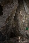
Mathildengrotto | 2839/3 |
Pernegg an der Mur KG: Mixnitz location |
06/27/1974 | |
| Langstein stalactite cave | 1742 / 1c |
Tragöß-Sankt Katharein KG: Schattenberg location |
04/21/1969 | ||

|
Repolust Cave | 2837/1 |
Frohnleiten KG: Mauritzen location |
Discovered in 1910 by the miner Repolust, this cave later turned out to be the location of over 2000 Paleolithic stone tools. Bones of cave bears, lions, marten, deer, large hamsters, bison, marmots, ibexes, wolves and wild boar were also found. The total length of the cave is only 35 m. Note: Coordinates in GIS inaccurate. |
08/12/1948 |

|
Repolust cave protected area | 2837/1 |
Frohnleiten KG: Mauritzen location |
03/21/1962 | |
| Angerleitenschwinde | 2836/5 |
Peggau KG: Peggau location |
06/17/1929 | ||

|
Badlhöhle | 2836/17 |
Peggau KG: Peggau location |
The Badlhöhle is located on the north side of the Tanneben at 495 m above sea level. A. and has a length of around 500 meters. More than 400 bones were recovered from the cave, including two polished bone needles. | 06/15/1929 |

|
Protected area above the course of the Große Badlhöhle |
Peggau KG: Peggau location |
The aragonite cave (cadastral number 2836/14), the small Badl cave (cadastral number 2836/16) and a rock arch are located in the protected area above the Großer Badlhöhle. | 03/23/1962 | |

|
Buck den | 2836/163 |
Peggau location |
The Bockhöhle is a 100 m long horizontal cave in the upper northern part of the Peggauer Wall. The entrance to the Perco cave is only 17 m away from the entrance to the Bock cave. | 04/09/1971 |

|
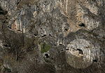
Great Peggauer Wall Cave | 2836/39 |
Peggau KG: Peggau location |
The Great Peggauer Wall Cave can be reached through three entrances (entrances IV; V; VI). The total length of the cave is about 200 m. The cave sediments were largely dismantled in the course of a fertilizer procurement campaign during the First World War. Cave bear bones and finds from the La Tene period, the Roman period and the early and high Middle Ages were brought to light. Note: Coordinates in GIS inaccurate. |
04/09/1971 |
|
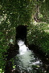
Guano Cave | 2836/96 |
Peggau KG: Peggau location |
The total length of the cave is about 400 m. The sediments and large amounts of bat guano are still preserved. | 04/09/1971 |
|
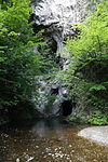
Hammerbachquelle | 2836/34 |
Peggau KG: Peggau location |
06/04/1929 | |
|
Lurgrotte near Peggau | 2836 / 1b |
Peggau KG: Peggau location |
06/17/1926 | |

|
Lurhöhle Peggau I. Protected area | - |
Peggau KG: Peggau location |
The protected area includes plots 403/4 and 401/2. It is threatened by quarries from both sides. | 06/15/1929 |

|
Peggauerwand Cave 1 | 2836/35 |
Peggau KG: Peggau location |
Note: Coordinates in GIS inaccurate. |
04/09/1971 |

|
Peggauerwand cave 2 | 2836/37 |
Peggau KG: Peggau location |
Note: Coordinates in GIS inaccurate. |
04/09/1971 |

|
Peggauerwand Cave 3 (Small Peggauer Wall Cave) | 2836/38 |
Peggau KG: Peggau location |
04/09/1971 | |

|
Perco cave | 2836/164 |
Peggau KG: Peggau location |
04/09/1971 | |

|
Protected area Ober der Lurhöhle Peggau | - |
Peggau KG: Peggau location |
02/12/1960 | |

|
Capricorn cave | 2836/23 |
Peggau KG: Peggau location |
A cave with two entrances above the Badlgalerie. According to the finds, it was already settled in the Magdalenian period. Note: Coordinates in GIS inaccurate. |
06/27/1974 |

|
Tunnel hole | 2836/71 |
Peggau KG: Peggau location |
Note: Coordinates in GIS inaccurate. |
04/09/1971 |
|
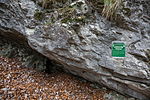
Dew grotto | 2836/82 |
Peggau KG: Peggau location |
Note: Coordinates in GIS inaccurate. |
04/09/1971 |

|
Doline above the large cathedral of the Lur cave | 2836/1 |
Semriach KG: Markterviertel location |
06/15/1929 | |

|
Sinkhole above the Hall of the Trapped | 2836/1 |
Semriach KG: Markterviertel location |
06/15/1929 | |

|
Lur cave near Semriach | 2836 / 1a |
Semriach KG: Markterviertel location |
06/17/1929 | |

|
Tanneben reserve | - |
Semriach KG: Markterviertel location |
Dolinenreicher Green Karst floor in the Graz Bergland. Protected due to the abundance of caves (over 300) and other karst features. | 06/16/1969 |

|
Langstein- Frauenmauerhöhle | 1742/1 |
Eisenerz (Styria) KG: Trofeng location |
09/23/1931 | |
| Loser cave near Aussee | 1623/8 |
Altaussee KG: Altaussee location |
01/23/1934 | ||
| Nail bridge cavity | 1626/5 |
Altaussee KG: Altaussee location |
06/09/1905 | ||
| Smoking car cave | 1626/55 |
Altaussee KG: Altaussee location |
05/20/1905 | ||
| Schwarzmooskogeleishöhle | 1623/40 |
Altaussee KG: Altaussee location |
08/26/1970 | ||
| Beilstein Ice Cave | 1741/2 |
Landl KG: Gams location |
07/14/1971 | ||
| Miner's hole | 1441/3 |
Landl KG: Gams location |
01/29/1970 | ||

|
Kraushöhle | 1741/1 |
Landl KG: Gams location |
09/05/1930 | |
| Mausbendlloch | 1548/2 |
Gröbming KG: Gröbming location |
12/30/1969 | ||

|
Almberg cave | 1624/18 |
Grundlsee KG: Grundlsee location |
11/14/1962 | |
| Bärenhöhle-Schoberwiesl | - |
Grundlsee KG: Grundlsee location |
10/10/1949 | ||
| Board stone bear cave | 1625/33 |
Grundlsee KG: Grundlsee location |
|||

|
Elm cave system | 1624/38 |
Grundlsee KG: Grundlsee location |
05/15/1973 | |
| Salt oven cave | 1624/31 |
Grundlsee KG: Grundlsee location |
10/10/1949 | ||
| Bear Cave-Hartelgraben | 1714/1 |
Admont KG: Johnsbach location |
08/23/1948 | ||
| Jahrling wall cave | 1713/7 |
Admont KG: Johnsbach location |
10/13/1971 | ||
| Odelstein Cave | 1722/1 |
Admont KG: Johnsbach location |
06/30/1931 | ||
| Rumble shaft | 1634/33 |
Liezen KG: Liezen location |
10/17/1974 | ||
| Sutan ice cave | 1636/24 |
Liezen KG: Liezen location |
05/30/1905 | ||

|
Brieglersberg Cave (Bear Cave) | 1625/24 |
Bad Mitterndorf KG: Tauplitz location |
04/28/1953 | |
| Bear Cave Krahstein | 1622/13 |
Bad Mitterndorf KG: Klachau location |
March 31, 1971 | ||
| Liglloch | 1622/1 |
Bad Mitterndorf KG: Klachau location |
08/10/1948 | ||
| Sheepstone Cave | 1625/100 |
Bad Mitterndorf KG: Tauplitz location |
06/02/1905 | ||

|
Arzberg Cave | 1741/4 |
Wildalpen KG: Wildalpen location |
05/07/1948 | |
|
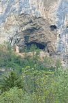
Puxerloch | 2745/1 |
Teufenbach-Katsch KG: Frojach location |
06/12/1931 | |
| Bischofsloch | 2624/1 |
Krakau KG: Krakauhintermühlen location |
The Bischofsloch (also Preberloch , Bischofswandloch ) is a 200 m long, well-known cave in the Preber-Bischofswand with traces of mining. The cave is also protected in Salzburg . | 04/05/1963 | |
| Wild hole | 2743/1 |
Neumarkt in der Steiermark KG: St. Marein location |
06/08/1905 | ||
|
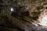
Glacier cave - Oberwölz | 2631/1 |
Oberwölz KG: Winklern location |
02/05/1932 | |

|
Schafferloch | 2763/4 |
Weißkirchen in Steiermark KG: Mühldorf location |
The cave entrance is at 734 m above sea level | 05/29/1905 |

|
Grotto and wind hole | 2763/2 and 2763/3 |
Judenburg KG: Oberweg location |
09/01/1982 | |

|
Pagan temple near Köflach | 2782/27 |
Köflach KG: Gradenberg location |
The Heidentempel is a cleft cave in the Zigöllerkogel with three openings at different altitudes. Traces of human processing (niches, inscriptions, etc.) can still be seen. In the same mountain there are several other caves (Luegloch; Geldloch; etc.) | 06/25/1931 |

|
Leitner cave | 2781/1 |
Salla KG: Scherzberg location |
The cave is traversed by water that came to light below in the Stiegljörg spring, which is now contained. The Leitner cave runs within a marble train that is surrounded by non-karstifying rocks. Total length of the cave: 600 m. The cave entrance is inside the Brunnstube of Stadtwerke Köflach. In the area the cave is only known under the name Stiegljörghöhle. Note: Coordinates in GIS inaccurate. |
01/30/1974 |

|
Fischbacher stalactite cave | 2842/2 |
Fischbach KG: Falkenstein location |
Note: The area in front of the cave is used as a clay pigeon shooting range (shooting direction towards the cave). |
December 22, 1971 |

|
Bärenhöhle-Schachenkogel | 2833/56 |
Gutenberg-Stenzengreith KG: Garrach location |
Note: The coordinates in the GIS are incorrect, show the Schachenbauer-Pumperskirchenhöhle |
05/08/1952 |

|
Yellow Grotto (stalactite cave Schachnerkogel) | 2833/57 |
Gutenberg-Stenzengreith KG: Garrach location |
Note: The cave is not listed as protected in the GIS. Protection under the Natural Caves Act. |
|

|
Gibsloch | 2833/13 |
Passail KG: Haufenreith location |
01/12/1972 | |

|
Klementhöhle (grotto) | 2833/21 |
Passail KG: Haufenreith location |
The Klementgrotte in the Weizklamm has two entrances and a total length of about 845 m. Your point furthest from the day is about 115 m as the crow flies from the two entrances. | 11/08/1968 |

|
Grasslhöhle | 2833/60 |
Naas KG: Dürnthal location |
03/09/1953 | |
|
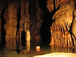
Hangover hole | 2833/59 |
Naas KG: Dürnthal location |
The Katerloch is the most stalactite cave in Austria. | 09/14/1959 |

|
Rablloch | 2834/8 |
Naas KG: Naas location |
December 17, 1968 | |

|
Seeriegelhöhle | 2843/1 |
Rettenegg KG: Rettenegg location |
06/07/1955 | |

|
Quarry cave | 2834/1 |
Thannhausen KG: Landscha location |
02/28/1933 | |
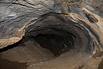
|
Blaubruch Cave (= Ludwig Hammer Cave) | 2832/3 |
Weinitzen KG: Weinitzen location |
Note: Protected by decision of June 8, 1989. |
06/08/1989 |

|
Stainzer stalactite cave | 2772/2 |
Stainz KG: trough location |
||

|
Wildemannloch and the area around the entrance | 2836/27 |
Peggau KG: Peggau location |
06/01/1988 | |
| Fairy tale cave on Gehartsbachsattel | 1742/17 |
Eisenerz (Styria) KG: Münichthal location |
12/09/1981 | ||
| Gehartsbachsattel water cave | 1742/21 |
Eisenerz (Styria) KG: Münichthal location |
12/09/1981 | ||

|
Ox bottom hole including entrance area | 2839/6 |
Fladnitz an der Teichalm KG: Fladnitz an der Teichalpe location |
07/10/1993 | |
| Kriemandl cave and surroundings of the entrance | 1622/8 |
Bad Mitterndorf KG: Krungl location |
12/13/1982 | ||
| Bear cave on the Karleck-Schneealpe | 1851/76 |
Neuberg an der Mürz KG: Krampen location |
02/15/1977 |
swell
- GIS Styria. Retrieved on August 22, 2015 (To make the caves visible: Flora & Fauna map → Protected natural areas → Select protected caves . The list of caves can be found via the search and csv export.).
Web links
Commons : Protected caves in Styria - collection of images, videos and audio files
Individual evidence
- ↑ Federal Act of June 26, 1928 for the Protection of Natural Caves (Natural Caves Act) , called on November 1, 2017, has been in effect as a state law since January 1, 1975, Federal Law Gazette No. 444/1974 .
- ↑ Annemarie Reiter: Small cave guide. Graz 1974, ISBN 3-7011-7041-X , p. 40.
- ↑ Jörg Fürnholzer: On the attempt to revise the excavations in the Repolust cave (cat. No. 2837/1) from 1947 to 1955. In: Die Höhle. 047, 1996, p. 45 ff ( PDF on ZOBODAT ).
- ↑ Archived copy ( Memento of the original from March 5, 2016 in the Internet Archive ) Info: The archive link was inserted automatically and has not yet been checked. Please check the original and archive link according to the instructions and then remove this notice. Page 81ff
- ^ Hubert Trimmel: The protective measures in the area of the Tanneben between Semmriach and Peggau . In: The cave . tape 23 , 1972, p. 47–58, here p. 58 ( PDF on ZOBODAT ).
- ↑ Archived copy ( Memento of the original from March 4, 2016 in the Internet Archive ) Info: The archive link was inserted automatically and has not yet been checked. Please check the original and archive link according to the instructions and then remove this notice.
- ^ A b Hubert Trimmel: The protective measures in the area of the Tanneben between Semmriach and Peggau . In: The cave . tape 23 , 1972, p. 47–58, here p. 56 ( PDF on ZOBODAT ).
- ^ A b Hubert Trimmel: Cave protection in Austria in 1974. In: The cave. 026, 1975, p. 16 ( PDF on ZOBODAT ).
- ↑ Hartmut Heidinger: The Styrian Krakau . In: Bergsteigerdörfer. Alpine history in a nutshell . 2013, p. 30–33 ( bergsteigerdoerfer.org [PDF; accessed March 3, 2020]).
- ↑ Franz Narobe: The Bishop hole in Preber (Styria) . In: Speleological Yearbook . tape 10-12 , 1929, pp. 79–85 ( PDF on ZOBODAT [accessed March 3, 2020]).
- ↑ Annemarie Reiter: Small cave guide. Graz 1974, ISBN 3-7011-7041-X , p. 61.
- ^ Hubert Trimmel: The Raabklamm (Styria) - nature reserve. In: The cave. 022, 1971, p. 76 ( PDF on ZOBODAT ).
- ↑ Harald Polt: The caves on the west bank of the Weizklamm. In: Communications of the State Association for Speleology in Styria. Volume 24. Graz 1995.
- ^ Hubert Trimmel: Cave protection in Austria in 1968. In: The cave. 020, 1969, p. 13 ( PDF on ZOBODAT ).
- ^ Hubert Trimmel: Karst, caves, nature and environmental protection. Blaubruchhöhle and Wildes Loch - two new natural monuments in Styria. In: The cave. 040, pp. 85-86 ( PDF on ZOBODAT ).