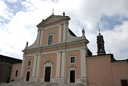
Medole
| Medole | ||
|---|---|---|

|
|
|
| Country | Italy | |
| region | Lombardy | |
| province | Mantua (MN) | |
| Local name | Médule | |
| Coordinates | 45 ° 20 ′ N , 10 ° 31 ′ E | |
| height | 62 m slm | |
| surface | 25.9 km² | |
| Residents | 4,128 (Dec. 31, 2019) | |
| Population density | 159 inhabitants / km² | |
| Post Code | 46046 | |
| prefix | 0376 | |
| ISTAT number | 020034 | |
| Popular name | Medolesi | |
| Website | Medole | |
Medole is a northern Italian municipality ( comune ) with 4128 inhabitants (as of December 31, 2019) in the province of Mantua in Lombardy . The municipality is located about 30 kilometers northwest of Mantua .
history
The parish church was decorated with paintings by Titian . The Annunciata Convent was established in the mid-15th century and has been closed since the 19th century. In 1859 the Battle of Medole took place. A clash between French and Habsburg troops in the Second Italian War of Independence with the victory of France.
traffic
The former Strada Statale 236 Goitese (now Provincial Road 17) leads through Medole from Mantua to Brescia .
Individual evidence
- ↑ Statistiche demografiche ISTAT. Monthly population statistics of the Istituto Nazionale di Statistica , as of December 31 of 2019.
Web links
Commons : Medole - collection of images, videos and audio files


